
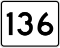
Route 136 is a 7.4-mile-long (11.9 km) numbered state highway in the U.S. state of Rhode Island. Its southern terminus is at Route 114 in Bristol, and...
3 KB (141 words) - 01:23, 11 March 2023
city and town in Rhode Island, except for New Shoreham (Block Island), has at least one numbered route. State highways in Rhode Island are signed with...
34 KB (179 words) - 21:33, 6 March 2024
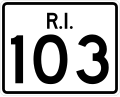
Route 103 is a numbered state highway running 11.8 miles (19.0 km) in Rhode Island, United States. It runs from Interstate 195 (I-195) in East Providence...
8 KB (566 words) - 22:35, 27 January 2024
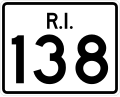
Route 138 is a numbered State Highway running 48.3 miles (77.7 km) in Rhode Island. It is the longest state numbered route in Rhode Island, and the second...
15 KB (828 words) - 01:28, 27 March 2024
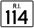
Route 114 is a 45.7-mile-long (73.5 km) numbered state highway in the U.S. state of Rhode Island. It connects the city of Newport to the city of Woonsocket...
22 KB (1,510 words) - 07:09, 10 February 2024

East Providence Expressway. I-195 provides a direct highway route to Cape Cod from Rhode Island and, via I-95, from New York and Connecticut as well. I-195...
36 KB (2,547 words) - 00:42, 27 April 2024

northeast in the vicinity of Rumstick Road along Route 114, Rhode Island Route 136 and Massachusetts Route 136 to interchange with Interstate 195 near Exit...
9 KB (914 words) - 20:40, 26 April 2024
Route 136 is a state highway in the U.S. state of Massachusetts. The highway runs 1.730 miles (2.784 km) from the Rhode Island state line in Swansea north...
3 KB (220 words) - 00:58, 19 March 2023
Route 136, or Highway 136, can refer to: National Route 136 (Argentina) Ontario Highway 136 (former) Prince Edward Island Route 136 Quebec Route 136 (Montreal)...
5 KB (368 words) - 23:32, 4 April 2024

across the states of Connecticut, Rhode Island, and Massachusetts. Route 199 was also incorporated into the new route, connecting with the New York state...
56 KB (4,005 words) - 23:40, 2 June 2024

the U.S. state of Rhode Island. As of the 2020 census, the population was 85,643. It is also one of the seven regions of Rhode Island. The county was created...
19 KB (1,536 words) - 15:10, 26 April 2024

Bristol: Metacom Avenue (RI Route 136).: 11 Bristol was a town of Massachusetts until the Crown transferred it to the Rhode Island Colony in 1747.: 11 The...
31 KB (2,603 words) - 23:26, 11 June 2024

Route 128 is a 3.1-mile-long (5.0 km) state highway in the U.S. state of Rhode Island. The highway links U.S. Route 6A (US 6A), US 6 and US 44. Route...
3 KB (136 words) - 01:19, 6 March 2023

county located in the U.S. state of Rhode Island. As of the 2020 census, the population was 129,839. Rhode Island counties have no governmental functions...
21 KB (1,483 words) - 19:46, 2 May 2024

(originally Montaup in Pokanoket language) is a small hill in Bristol, Rhode Island overlooking the part of Narragansett Bay known as Mount Hope Bay. It...
7 KB (684 words) - 19:43, 1 March 2024
249083°W / 41.614417; -71.249083 Narragansett Bay divides the state of Rhode Island into two parts. The term East Bay refers to communities on the east side...
5 KB (667 words) - 08:26, 6 March 2024

New England road marking system (redirect from New England Interstate Route 17)
Rhode Island. Route 1 immediately intersected the southern end of Route 1A on entering Rhode Island. Route 1A followed a shorter, more inland route between...
158 KB (6,445 words) - 17:10, 1 February 2024

U.S. Route 6 (US 6) in Massachusetts is a 117.952-mile-long (189.825 km) portion of the cross-country route connecting Providence, Rhode Island, to Fall...
31 KB (2,583 words) - 17:02, 17 May 2024

Clayville is located on Rhode Island Route 14 and 102. Route 14 leads east to Providence and west to Moosup, Connecticut, while Route 102 leads north to Woonsocket...
6 KB (272 words) - 04:45, 10 July 2023

Route 1A Route 18 Route 24 Route 79 Route 81 Route 88 Route 104 Route 105 Route 106 Route 118 Route 120 Route 123 Route 136 Route 138 Route 140 Route 152...
40 KB (2,771 words) - 08:06, 3 May 2024

Newport and Wickford Railroad and Steamboat Company (category Defunct Rhode Island railroads)
the first railroad to be built in southern Rhode Island, completed in 1837. The company planned to route their line directly through the coastal village...
14 KB (1,534 words) - 05:44, 10 June 2024

miles (179.55 km) in Connecticut, from the New York state line to the Rhode Island state line. I-95 from Greenwich to East Lyme is part of the Connecticut...
52 KB (4,477 words) - 00:44, 5 June 2024
List of highways numbered 403 (redirect from Route 403)
Route 403 Puerto Rico Highway 403 Rhode Island Route 403 South Carolina Highway 403 Virginia State Route 403 Washington State Route 403 This article includes...
2 KB (136 words) - 22:25, 4 April 2024
List of highways numbered 138 (redirect from Route 138)
Route 138 Oregon Route 138 Pennsylvania Route 138 Rhode Island Route 138 Rhode Island Route 138A Tennessee State Route 138 Texas State Highway 138 Texas State...
4 KB (272 words) - 23:00, 4 April 2024
US 6 shortly before crossing the Rhode Island state line. US 6 covers approximately 26.5 miles (42.6 km) in Rhode Island from Foster (western border with...
61 KB (6,447 words) - 00:11, 23 May 2024
(76 km) south of Boston, and 12 miles (19 km) southeast of Providence, Rhode Island. The population was 17,144 at the 2020 census. The villages of Hortonville...
18 KB (2,158 words) - 02:32, 5 June 2024
List of highways numbered 401 (redirect from Route 401)
Pennsylvania Route 401 Pennsylvania Route 401 Alternate Truck Puerto Rico Highway 401 Rhode Island Route 401 Virginia State Route 401 Washington State Route 401...
2 KB (147 words) - 22:55, 4 April 2024
List of highways numbered 402 (redirect from Route 402)
County Route 402 (Erie County, New York) North Carolina Highway 402 (former) Oregon Route 402 Pennsylvania Route 402 Puerto Rico Highway 402 Rhode Island Route 402...
2 KB (154 words) - 23:16, 4 April 2024

U.S. Route 1 (US 1) in the U.S. state of Connecticut is a major east–west U.S. Route along Long Island Sound. It has been replaced by Interstate 95 (I-95)...
22 KB (640 words) - 01:02, 5 June 2024

Nathanael Greene (category Continental Army officers from Rhode Island)
theater of the conflict. Born into a prosperous Quaker family in Warwick, Rhode Island, Greene became active in the colonial opposition to British revenue policies...
49 KB (5,836 words) - 20:05, 5 June 2024