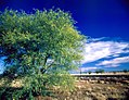
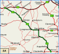
Richmond–Winton Road is a continuous 145 kilometres (90 mi) road route in the Richmond and Winton local government areas of Queensland, Australia. It...
8 KB (839 words) - 18:00, 25 July 2024

Flinders Highway, Queensland (redirect from Julia Creek–Kynuna Road)
Road Burdekin Falls Dam Road Aramac–Torrens Creek Road Hughenden–Muttaburra Road Richmond–Winton Road Julia Creek–Kynuna Road Julia Creek–Kynuna Road...
19 KB (1,271 words) - 00:30, 5 May 2024

Burnett Highway (redirect from Murgon–Barambah Road)
Kilkivan–Tansey Road Murgon–Gayndah Road Gayndah–Mount Perry Road Mundubbera–Durong Road Eidsvold–Theodore Road Wuruma Dam Road Monto–Mount Perry Road Gladstone–Monto...
15 KB (926 words) - 06:03, 27 April 2024

including Dutton River, Flinders River, Mount Sturgeon, Caledonia, Richmond, Corfield, Winton, Torrens, Tower Hill, Landsborough Creek, Lammermoor Station,...
125 KB (12,730 words) - 04:04, 1 September 2024
Connection Road Maroochydore Road Nambour–Bli Bli Road Yandina–Coolum Road Eumundi–Noosa Road Eumundi–Kenilworth Road Cooroy Connection Road Pomona Connection...
40 KB (3,348 words) - 15:45, 4 April 2024
Richmond–Croydon Road is a continuous 360 kilometres (220 mi) road route in the Richmond, Croydon and Etheridge local government areas of Queensland, Australia...
7 KB (768 words) - 18:00, 25 July 2024
with its tributary Dutton River. The Richmond–Croydon Road exits to the north-west, and the Richmond–Winton Road to the south-west. Jirandali (also known...
25 KB (2,107 words) - 08:05, 15 June 2024
Haigslea–Amberley Road Rosewood–Marburg Road Laidley–Plainland Road Forest Hill–Fernvale Road Gatton–Esk Road Gatton–Helidon Road Toowoomba Second Range...
23 KB (1,932 words) - 00:40, 22 January 2024
Crossing Road Kalbar Connection Road Boonah–Fassifern Road Lake Moogerah Road New England Highway Freestone Road Warwick–Yangan Road Warwick–Allora Road Warwick–Killarney...
22 KB (1,802 words) - 22:38, 9 February 2024

Outback Highway (category WikiProject Australian Roads articles with a junction list using templates)
Outback Highway or Outback Way is a series of roads and dirt tracks linking Laverton, Western Australia and Winton, Queensland. At 2,719 km (1,690 mi), it crosses...
9 KB (314 words) - 05:03, 11 February 2024
Landsborough Highway (category WikiProject Australian Roads articles with a junction list using templates)
Australia Road and 4WD Atlas (Map). Eight Mile Plains Queensland: Hema Maps. pp. 8–16/17. ISBN 978-1-86500-456-3. "Landsborough Highway (Longreach - Winton) -...
10 KB (542 words) - 11:07, 27 July 2023
Marlborough–Sarina Road is a state-controlled district road (number 512) rated as a local road of regional significance (LRRS). It runs from the Bruce...
18 KB (1,471 words) - 05:56, 19 December 2023
Bundaberg–Bargara Road is a state-controlled district road (number 174) in the Bundaberg region of Queensland, Australia. It is rated as a local road of regional...
11 KB (768 words) - 16:40, 25 July 2024
Landsborough Highway passes the south-western corner, near Kynuna. The Richmond–Winton Road runs through from north to south-east. In the 2016 census, Albion...
3 KB (165 words) - 16:28, 25 July 2024
Blackall–Jericho Road is a continuous 121-kilometre (75 mi) road route in the Blackall-Tambo and Barcaldine local government areas of Queensland, Australia...
10 KB (813 words) - 16:37, 25 July 2024

Bruce Highway (category WikiProject Australian Roads articles with a junction list using templates)
1986.[citation needed] It was previously known as the Great North Coast Road, being renamed as the Bruce Highway in 1934 after the state's Minister for...
103 KB (5,393 words) - 07:55, 6 August 2024
state-controlled roads intersect with section 25A: Camp Cable Road Beaudesert–Boonah Road Camp Cable Road is a state-controlled district road (number 2071)...
6 KB (516 words) - 02:20, 5 March 2024
22A: Kingaroy–Cooyar Road Oakey–Cooyar Road Pechey–Maclagan Road Esk–Hampton Road Murphys Creek Road Toowoomba Connection Road (former Warrego Highway)...
12 KB (1,052 words) - 01:05, 22 January 2024
Nambour–Bli Bli Road is a continuous 8.1-kilometre (5.0 mi) road route in the Sunshine Coast local government area of Queensland, Australia. It is signed...
11 KB (732 words) - 23:27, 8 May 2024
Roma–Condamine Road is a continuous 115-kilometre (71 mi) road route in the Maranoa and Western Downs local government areas of Queensland, Australia...
12 KB (1,042 words) - 03:48, 17 August 2024
state-controlled roads: Gladstone–Benaraby Road Boyne Island Road Gladstone Port Access Road Gladstone–Mount Larcom Road Boyne Island Road is a state-controlled...
3 KB (267 words) - 00:03, 5 March 2024
Roma–Taroom Road is a continuous 149-kilometre (93 mi) road route in the Maranoa, Western Downs and Banana local government areas of Queensland, Australia...
10 KB (800 words) - 03:35, 17 August 2024
Cooroy–Noosa Road is a continuous 12.5-kilometre (7.8 mi) road-route in the Noosa local government area of Queensland, Australia. It is signed as 'State...
10 KB (771 words) - 13:50, 12 August 2024
Hervey Range Developmental Road (alternate spellings: "Herveys", "Hervey's") is a continuous 125-kilometre (78 mi) road route in the Townsville and Charters...
10 KB (851 words) - 04:16, 24 August 2024
Douglas–Garbutt Road Garbutt–Upper Ross Road North Townsville Road North Ward Road Ross River Road Shaw Road South Townsville Road Townsville Connection Road Townsville...
29 KB (2,361 words) - 18:21, 25 July 2024
Gin Road is a state-controlled district road (number 176) in the Bundaberg region of Queensland, Australia. It runs from Bundaberg–Bargara Road (Quay...
13 KB (1,025 words) - 16:41, 25 July 2024
Yandina–Coolum Road is a continuous 18.5-kilometre (11.5 mi) road route in the Sunshine Coast local government area of Queensland, Australia. The route...
7 KB (488 words) - 23:33, 8 May 2024

Corfield, Queensland (category Shire of Winton)
The Richmond–Winton Road follows a section of the north-western boundary. The principal land use is cattle grazing. As the boundaries of Winton hug the...
11 KB (881 words) - 23:24, 13 July 2024
Atherton–Herberton–Longlands Gap Road is a continuous 33.5-kilometre (20.8 mi) road route in the Tablelands local government area of Queensland, Australia...
8 KB (690 words) - 17:02, 5 August 2024
Bundaberg–Port Road (known as Burnett Heads Road) is a state-controlled district road (number 175) in the Bundaberg region of Queensland, Australia. It...
12 KB (828 words) - 16:41, 25 July 2024