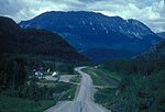
The Liard River of the North American boreal forest flows through Yukon, British Columbia and the Northwest Territories, Canada. Rising in the Saint Cyr...
16 KB (1,829 words) - 09:33, 1 November 2023
Liard River Hot Springs Provincial Park is a provincial park in British Columbia, Canada. It is home to the second largest natural hot springs in Canada...
5 KB (507 words) - 18:51, 17 October 2024
British Columbia community of Liard River, is named after him., as is the Robert Campbell Highway, Yukon and the Robert Campbell Bridge which connects...
2 KB (253 words) - 10:32, 17 July 2022
successor regional districts: Comox Valley and Strathcona. The Peace River–Liard Regional District was created October 31, 1967, when the regional district...
15 KB (928 words) - 02:08, 26 November 2023
left) into the Ourthe. View on the Ourthe Clélie Lamberty painted by Robert Liard, 1977 Tous les pouvoirs émanent de la Nation - All powers come from within...
12 KB (1,070 words) - 20:07, 25 August 2024
climate. Notable rivers include the Yukon, Pelly, Stewart, Peel, White, Liard, and Tatshenshini. The territory is named after the Yukon River, the longest...
64 KB (5,257 words) - 18:30, 22 October 2024
Liard River Corridor Provincial Park and Protected Area is a provincial park in British Columbia, Canada. Part of the park is in the larger Muskwa-Kechika...
2 KB (59 words) - 18:49, 17 October 2024
localities as of February 2012. Two of these localities, Tagish and Upper Liard, are designated as census subdivisions by Statistics Canada, though are...
11 KB (1,133 words) - 21:24, 30 April 2024
the end of the 19th century. Watson Lake is near the Liard River, at the junction of the Robert Campbell Highway and the Alaska Highway. The Stewart–Cassiar...
24 KB (1,146 words) - 13:19, 18 October 2024
The Cremation of Sam McGee (category Works by Robert W. Service)
However, in 1930, McGee returned to the Yukon to try prospecting along the Liard River, but met with no success. He did however return with an urn that he...
10 KB (1,126 words) - 00:56, 28 October 2024
British Columbia, the Northwest Territories and Yukon between the upper Liard River and the 64th parallel north latitude. While these native groups do...
3 KB (323 words) - 14:36, 26 September 2024
Frances River (Yukon) (category Liard Country)
The Frances River is a left tributary of the Liard River in southern Yukon. The Frances River forms the drain of Frances Lake. Flowing south, it passes...
2 KB (177 words) - 18:39, 11 August 2024
University of Paris, which came into existence in 1896 after the Louis Liard law disbanded Napoleon's University of France system. The word "university"...
168 KB (6,396 words) - 15:19, 21 October 2024
South Nahanni River (category Tributaries of the Liard River)
The South Nahanni River is a major tributary of the Liard River, located roughly 500 km (310 mi) west of Yellowknife in the Northwest Territories of Canada...
16 KB (1,680 words) - 18:34, 15 April 2023
survey between Lake Temiscamingue and Hudson Bay. 1891—Examination between Liard and Peace Rivers. 1892—Subdivision and re-surveys in Prince Albert District...
8 KB (521 words) - 22:57, 17 February 2024
Yukon River at Fort Selkirk. The southern Tintina Trench is drained by the Liard River which first flows south-eastward, then eastward and finally merges...
3 KB (365 words) - 21:18, 15 September 2024
as the northern border of the Rocky Mountains is considered to be the Liard River far to the south in the province of British Columbia. While the range...
18 KB (2,116 words) - 04:24, 1 November 2024
(2011) - Shinsaku Takasugi 2nd Super Robot Wars Z: Hakai Hen (2011) - Aim Liard Fairy Tail Gekitotsu! Kardia Daiseidou (2011) - Elfman Strauss Storm Lover:...
72 KB (3,099 words) - 22:49, 30 October 2024
Canada. The electoral district historically covered the communities of, Fort Liard, Fort Simpson, Fort Wrigley, Fort Norman, Fort Franklin, Norman Wells, Fort...
865 bytes (62 words) - 22:51, 4 August 2023
medieval remains. The building was listed as a monument in 1967. Louis Liard Lycée – This secondary school for boys was built in the third quarter of...
30 KB (2,483 words) - 10:27, 23 October 2024
Dene") in the Northwest Territories: Acho Dene Koe First Nation – Fort Liard (Ahcho Koe or Ahcho Kue) Deh Gáh Got'ı̨ę First Nation – Fort Providence...
11 KB (1,111 words) - 18:12, 17 October 2024
amount of alcohol is limited. These are Deline, Dettah, Fort Good Hope, Fort Liard, Fort McPherson, Paulatuk, Trout Lake, Tuktoyaktuk, Tulita and Ulukhaktok...
51 KB (5,666 words) - 15:29, 19 October 2024
Indigenous peoples and newcomers in the Yukon area (for example, in around Liard River and in the Mackenzie River district) in the 19th century. Broken Slavey...
8 KB (906 words) - 22:42, 4 October 2024
Watson Lake 976.4 606.7 Hwy 4 north (Robert Campbell Highway) – Ross River, Faro Upper Liard 987.6 613.7 Crosses the Liard River 997.6 619.9 Hwy 37 south...
49 KB (4,661 words) - 18:43, 22 October 2024
drainage to the Pacific Ocean, via the Stikine, and the Arctic Ocean, via the Liard and Mackenzie Rivers, this is part of the Continental Divide. The town has...
18 KB (692 words) - 05:48, 23 May 2024
63–70. doi:10.1016/j.geobios.2019.04.001. Cuny, Gilles; Liard, Romain; Deesri, Uthumporn; Liard, Tida; Khamha, Suchada; Suteethorn, Varavudh (September...
5 KB (456 words) - 13:23, 24 October 2024
Toad River, British Columbia (category Liard Country)
Company employees using the Liard River to reach the Northern Interior of British Columbia. It is likely a name given by Robert Campbell on his trips up...
7 KB (468 words) - 18:06, 28 May 2024
Peace River and then continuing on overland to the Klondike, crossing the Liard River en route. To encourage travel via Edmonton, the government hired T...
121 KB (16,100 words) - 11:23, 28 October 2024
brown creepers in the Northwest Territories were detected in 2008, in the Liard Valley, which may be a result of northern range expansion. As a migratory...
13 KB (1,460 words) - 20:47, 30 October 2024
Highway 37 and terminating at a junction with the Alaska Highway near Upper Liard just 3.4 km (2.1 mi) later. According to the British Columbia Ministry of...
11 KB (826 words) - 03:04, 15 August 2024


