Robert Peel Inlet 65°09′N 066°56′W / 65.150°N 66.933°W / 65.150; -66.933 (Robert Peel Inlet) is a body of water in Nunavut's Qikiqtaaluk Region. It...
697 bytes (69 words) - 19:16, 8 April 2021
Peel Hotels Bobby Peel (1857–1941), Yorkshire and England cricketer Robert Peele (engineer) (1858–1942), American mining engineer Robert Peel Inlet,...
1 KB (175 words) - 21:18, 1 September 2024
between Brown Inlet and Ikpit Bay. It rises approximately 30 m (98 ft) above sea level. Nuvujen Island lies to its north. Robert Peel Inlet is due south...
2 KB (91 words) - 08:12, 31 July 2023
the western shore of Cumberland Sound, between Brown Inlet to the northwest and Robert Peel Inlet to the southeast. Aupaluktut Island lies to its south...
3 KB (182 words) - 08:31, 2 October 2023
Qikiqtaaluk Region. It lies in Cumberland Sound, at the mouth of Robert Peel Inlet. Shakshukowshee Island lies along its west side. "Shakshukuk Island...
2 KB (60 words) - 08:23, 2 October 2023
Qikiqtaaluk Region. It lies in Cumberland Sound, across the mouth of Robert Peel Inlet. Shakshukuk Island lies north. "Kangigutsak Island, Nunavut, Canada"...
2 KB (58 words) - 08:25, 2 October 2023
It lies in Cumberland Sound, approximately 15.4 km (9.6 mi) from Robert Peel Inlet. "Maktaktujanak Island, Nunavut, Canada". travelingluck.com. Retrieved...
2 KB (73 words) - 18:21, 16 November 2023
The uninhabited island lies in Cumberland Sound, at the mouth of Robert Peel Inlet. Shakshukuk Island lies along its east side. "Shakshukowshee Island...
2 KB (70 words) - 13:45, 13 September 2023
mouth of Chidliak Bay, approximately 14.4 km (8.9 mi) southeast of Robert Peel Inlet Nimigen Island lies to its west. "Utsusivik Island, Nunavut, Canada"...
2 KB (79 words) - 08:27, 2 October 2023
Region. It lies in Cumberland Sound between Ikpit Bay to the north and Robert Peel Inlet approximately 18.6 km (11.6 mi) to the south. The former community...
2 KB (131 words) - 17:28, 11 September 2023
lies in Cumberland Sound, approximately 10.5 km (6.5 mi) east of Robert Peel Inlet To its east is Utsusivik Island; south is Chidliak Bay. In the mid...
3 KB (160 words) - 08:27, 2 October 2023

Milne Inlet (72°15′N 080°30′W / 72.250°N 80.500°W / 72.250; -80.500 (Mine Inlet)) is a small, shallow arm of Eclipse Sound which, along with Navy...
9 KB (874 words) - 01:57, 26 June 2022

Pond Inlet (Inuktitut: Mittimatalik, lit. 'the place where Mittima is buried') is a small, predominantly Inuit community in the Qikiqtaaluk Region of...
82 KB (8,683 words) - 18:10, 24 August 2024

Bathurst Inlet, officially Kiluhiqtuq, is a deep inlet located along the northern coast of the Canadian mainland, at the east end of Coronation Gulf,...
9 KB (768 words) - 02:56, 3 September 2024

Lake Mount Craig (Baldy) from East Inlet meadow List of peaks in Rocky Mountain National Park Mountains portal Robert M. Ormes (2000), Guide to the Colorado...
5 KB (382 words) - 17:00, 29 June 2023

Chantrey Inlet (Tariunnuaq) is a bay on the Arctic coast of Canada. It marks the southeast "corner" where the generally east–west coast turns sharply...
3 KB (289 words) - 18:26, 28 January 2023
Young Inlet is an Arctic waterway in Qikiqtaaluk Region, Nunavut, Canada. It is a natural bay in Sir William Parker Strait by northeastern Bathurst Island...
2 KB (103 words) - 22:51, 2 September 2024

Alexander Island (redirect from Brahms Inlet)
Point and Mount Tyrrell. Brahms Inlet (71°28′S 73°41′W / 71.467°S 73.683°W / -71.467; -73.683) is an ice-filled inlet, 25 nautical miles (46 km) long...
17 KB (1,985 words) - 17:22, 29 July 2024

Chesterfield Inlet (Inuit: Igluligaarjuk) is an inlet in Kivalliq Region, Nunavut, Canada. It is an arm of northwestern Hudson Bay, and the end point of...
2 KB (136 words) - 13:44, 13 June 2023
Pell Inlet is a waterway in the Qikiqtaaluk Region of Nunavut, Canada. It separates Alexander Island (to the north) from Bathurst Island (to the south)...
538 bytes (67 words) - 01:55, 26 May 2021

Prince Regent Inlet (73°00′N 090°30′W / 73.000°N 90.500°W / 73.000; -90.500 (Prince Regent Inlet)) is a body of water in Nunavut, Canada between the...
2 KB (209 words) - 14:41, 27 August 2023
Admiralty Inlet is a bay in the Qikiqtaaluk Region of Nunavut, Canada. It extends southerly from Lancaster Sound along the western shore of Baffin Island's...
5 KB (279 words) - 16:04, 10 September 2024
Qavarusiqtuuq (redirect from Balcom Inlet)
Qavarusiqtuuq (ᖃᕙᕈᓯᖅᑑᖅ) formerly Balcom Inlet is a body of water in Nunavut's Qikiqtaaluk Region. It lies in western Hudson Strait, forming a wedge into...
866 bytes (45 words) - 08:21, 1 June 2020
Scott Inlet is a body of water in the Qikiqtaaluk Region of Nunavut, Canada. It is an arm of Baffin Bay. Scott Island lies in its middle. At its south...
2 KB (189 words) - 15:19, 2 August 2022
Kangiqtualujjuaq (redirect from Barrier Inlet)
the inlet. Shaftesbury Inlet is to the northwest, while Qavarusiqtuuq is to the southeast Kangiqtualujjuaq Kangiqtualujjuaq (Formerly Barrier Inlet) v...
1 KB (66 words) - 08:35, 1 June 2020
Kangiqturjuaq (redirect from Crooks Inlet)
Kangiqturjuaq (Inuktitut syllabics: ᑲᖏᖅᑐᕐᔪᐊᖅ) formerly Crooks Inlet is a body of water in Nunavut's Qikiqtaaluk Region. It lies in western Hudson Strait...
911 bytes (39 words) - 07:32, 9 February 2023
in the eastern high Arctic. Like Stratton Inlet, Burnett Inlet, Hobhouse Inlet, and Cuming Inlet, Powell Inlet is situated between Maxwell Bay and Croker...
1,002 bytes (106 words) - 22:09, 27 March 2023
The Erskine Inlet (76°2′N 102°05′W / 76.033°N 102.083°W / 76.033; -102.083 (Erskine Inlet)) is a natural waterway through the central Canadian Arctic...
682 bytes (62 words) - 20:05, 3 November 2020
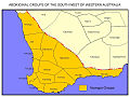
HMS Sulphur to explore the mouths of the Peel Inlet, the Serpentine and Murray Rivers, and the Leschenault Inlet. The Pindjarup killed one of the exploration...
11 KB (1,358 words) - 09:02, 6 August 2024
Jackson Inlet (73°18′N 088°45′W / 73.300°N 88.750°W / 73.300; -88.750 (Jackson Inlet)) is a body of water in Nunavut's Qikiqtaaluk Region. It lies...
1 KB (133 words) - 14:22, 13 December 2020