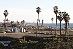
The San Gabriel River Trail (also known as SGRT) is a 28-mile (45 km) bike path along the San Gabriel River through El Dorado Regional Park and onto street...
6 KB (552 words) - 21:44, 20 August 2022
Santa Fe Dam Recreation Area (category San Gabriel River (California))
Regional Park in Devore, California. The San Gabriel River Bike Trail runs through the recreation area. The bike path traces the rim of the dam around to...
5 KB (490 words) - 20:55, 13 November 2024
Beach. The 4-mile-long (6.4 km) path connects with the San Gabriel River Bike Trail. Expo Bike Path – runs parallel to the E Line for ~12 miles, from...
37 KB (3,698 words) - 16:15, 15 March 2024
The San Gabriel River is a mostly-urban waterway flowing 58 miles (93 km) southward through Los Angeles and Orange Counties, California, in the United...
107 KB (13,359 words) - 03:34, 11 September 2024
A paved parcourse trail is available at Rynerson Park in Lakewood on Studabaker Road parallel to the San Gabriel River Bike Trail. This parcourse has...
19 KB (2,169 words) - 11:31, 5 September 2024
creating the Los Angeles River Bikeway. CicLAvia Shoreline Pedestrian Bikepath San Gabriel River Bike Trail Los Angeles River bicycle path — for all sections...
5 KB (329 words) - 10:43, 29 May 2024
comprehensive high school of PUSD is Paramount High School. The San Gabriel River Bike Trail is adjacent to Rynerson Park. Los Cerritos Community News serves...
28 KB (2,463 words) - 20:33, 30 September 2024
Shoreline Pedestrian Bikepath (redirect from Shoreline Aquatic Park Bike Trail.)
the Shoreline Aquatic Park Bike Trail. San Gabriel River Bike Trail, a 28-mile (45 km) bikeway along the San Gabriel River through El Dorado Regional...
4 KB (371 words) - 11:18, 15 August 2024
San Fernando Valley Mission Bay bike path Rio Hondo bicycle path San Diego Creek bicycle path San Gabriel River Bike Trail San Luis Rey River bike path...
51 KB (4,141 words) - 15:44, 21 October 2024
Rio Hondo (California) (redirect from Hondo River (California))
surround much of the river, and its bike paths are very popular. The river passes through the location of the Battle of Rio San Gabriel, fought on January...
12 KB (1,078 words) - 06:09, 14 August 2024
in which the San Gabriel Wilderness is now located. Permits are not required to enter the San Gabriel wilderness. The following trails provide access:...
6 KB (596 words) - 00:23, 1 November 2021
connects with the San Gabriel River Bike Trail at various locations. Both the Coyote Creek Bicycle Path and the San Gabriel River Bicycle Path cross...
9 KB (918 words) - 18:49, 17 August 2024
Rio Hondo ("deep river") now serves as a distributary for the San Gabriel River to the east via the Whittier Narrows Reservoir. The river then crosses under...
79 KB (8,016 words) - 18:34, 17 November 2024
The San Gabriel Mountains Trailbuilders (SGMTBs) is a 501(c)(3) non-profit volunteer organization which performs hiking and nature trail building and maintenance...
14 KB (2,346 words) - 16:44, 19 February 2024
Alamitos Energy Center Units 1-4 as seen from San Gabriel River Bike Trail in March 2017. Official name Alamitos Energy Center Country United States Location...
9 KB (612 words) - 04:25, 7 September 2022
bordered on the north by the eastern San Gabriel Mountains and the San Bernardino Mountains; on the east by the San Jacinto Mountains; on the south by the...
24 KB (2,240 words) - 20:14, 25 October 2024
Chantry Flat (category San Gabriel Mountains)
starting point for several historic trails of the San Gabriel Mountains, including the 28.5-mile (45.9 km) Gabrielino Trail. The US Forest Service estimates...
8 KB (1,110 words) - 17:29, 1 March 2024
Crystal Lake Recreation Area (category San Gabriel Mountains)
in the San Gabriel Mountains of Southern California, administered by the San Gabriel Mountains National Monument (formally the San Gabriel River Ranger...
30 KB (4,650 words) - 07:00, 1 November 2024
Ballona Creek Bike Path is one of several southern California bike routes (including the Rio Hondo Bike Path and the Santa Ana River Trail) that are immediately...
57 KB (4,265 words) - 15:08, 10 November 2024
the San Gabriel River in central Texas in the United States. Lake Georgetown is a U.S. Army Corps of Engineers reservoir formed on the San Gabriel by the...
4 KB (449 words) - 14:28, 26 March 2024
United States. It lies along the Santa Clara River between the Sierra Pelona Mountains and the San Gabriel Mountains. It is the most populous of Santa...
13 KB (1,247 words) - 20:44, 13 November 2024
transportation trails throughout the city. The major trails in the network include: Coyote Creek Trail Guadalupe River Trail Los Gatos Creek Trail Los Alamitos...
204 KB (17,817 words) - 03:20, 21 November 2024
Verdugo Mountains (category Geography of the San Fernando Valley)
in Los Angeles County, California. Located just south of the western San Gabriel Mountains, the Verdugo Mountains region incorporates the cities of Burbank...
32 KB (3,780 words) - 21:53, 1 February 2024
Pacoima Wash (category San Gabriel Mountains)
in the western San Gabriel Mountains of the Angeles National Forest and proceeds south in a free-flowing stream alongside Pacoima Trail Road. Below the...
13 KB (1,297 words) - 01:25, 15 September 2024
Chino Hills State Park (category Parks in San Bernardino County, California)
or mountain bike on trails through valleys and along ridge tops through woodlands, sage scrub and grasslands. 60 miles (100 km) of trails and fire roads...
8 KB (827 words) - 15:20, 19 June 2024
Rio Hondo bicycle path (redirect from Upper Rio Hondo Bike Trail)
The Rio Hondo Bike Path is a bicycle path that parallels the Rio Hondo (creek) through the San Gabriel Valley, in eastern Los Angeles County, California...
3 KB (269 words) - 03:51, 12 August 2023
Duarte bicycle path (category Bike paths in Los Angeles)
Monrovia-Glendora line closed in 1951. From the end of the trail it is possible to continue on the San Gabriel River Bicycle path via Royal Oaks Drive (East) to Encanto...
3 KB (359 words) - 04:12, 19 June 2024
El Escorpión Park (category Parks in the San Fernando Valley)
Mountains, Simi Hills, Santa Susana Mountains, San Gabriel Mountains, and the San Fernando Valley. A trail leads northward toward Bell Creek, the community...
10 KB (1,013 words) - 22:28, 22 September 2024
riding, biking, camping, scenic driving, water sports, and other activities. The National Trails System consists of 11 national scenic trails, 21 national...
60 KB (2,721 words) - 20:04, 14 July 2024
beach to surf, swim, and picnic. This is the beginning of the Omer Rains Bike Trail system that leads to other nearby beaches. Several special events take...
3 KB (259 words) - 06:15, 17 August 2024


