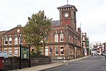
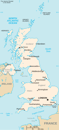
Shadingfield is a village and civil parish in the East Suffolk district of the English county of Suffolk. It is located around 4 miles (6.4 km) south of...
7 KB (529 words) - 12:28, 31 August 2024
Titsal Wood, Shadingfield is a 14.7-hectare (36-acre) biological Site of Special Scientific Interest south-west of Shadingfield in Suffolk. This ancient...
2 KB (145 words) - 12:28, 31 August 2024
Willingham St Mary follows before the route reaches Shadingfield where it passes the Shadingfield Fox public house, the village hall and a water tower...
17 KB (1,861 words) - 17:54, 16 April 2022
road cuts through the western section of the parish where it joins with Shadingfield. Sections of the Sotterley estate are included within its western section...
10 KB (880 words) - 12:04, 20 October 2024
south-east of Beccles and 1.5 miles (2 km) east of Willingham St Mary and Shadingfield. The parish is primarily agricultural with a dispersed population of...
16 KB (1,565 words) - 20:32, 14 October 2024
Santon Downham, Sapiston, Saxmundham, Saxtead, Saxtead Green, Semer, Shadingfield, Shelland, Shelley, Shimpling, Shimpling Street, Shingle Street, Shipmeadow...
13 KB (852 words) - 10:15, 9 October 2024
(Easton Bavents) Ringsfield Rumburgh Rushmere Rushmere St Andrew Saxtead Shadingfield Shipmeadow Shottisham Sibton Snape Somerleyton, Ashby and Herringfleet...
16 KB (831 words) - 10:46, 21 July 2024
Sotterley, Uggeshall, Sotherton, Westhall, Ilketshall St Andrew and Shadingfield. At the 2011 census the population of the parish was 427, down from a...
4 KB (275 words) - 20:32, 14 October 2024
Cove Oulton Oulton Broad Redisham Reydon Ringsfield Rumburgh Rushmere Shadingfield Shipmeadow Somerleyton, Ashby and Herringfleet Sotherton Sotterley South...
8 KB (385 words) - 22:22, 24 October 2024
Street. The parish council operates to administer jointly the parishes of Shadingfield, Willingham St Mary, Sotterley and Ellough. The village was the site...
10 KB (908 words) - 20:32, 14 October 2024
location. It borders Ilketshall St Andrew, Westhall, Brampton with Stoven, Shadingfield, Weston and Ringsfield. The village is on the eastern border of the parish...
4 KB (287 words) - 20:28, 14 October 2024
Margaret 2093 Mettingham 1706 North Cove 1082 Redisham 733 Ringsfield 1700 Shadingfield 1370 Shipmeadow 800 Sotterley 1594 South Elmham, All Saints 1150 South...
5 KB (534 words) - 16:17, 21 July 2024
Lawrence, St Margaret), Mettingham, North Cove, Redisham, Ringsfield, Shadingfield, Shipmeadow, Sotterley, South Elmham (All Saints and St Nicholas, St...
4 KB (234 words) - 21:19, 1 June 2023
Ilketshall St Margaret, Mettingham, North Cove, Redisham, Ringsfield, Shadingfield, Shipmeadow, Sotterley, St Cross South Elmham, St James South Elmham...
255 KB (984 words) - 21:56, 9 October 2024
immediately to the east of Brampton, Uggeshall to the south-east and Shadingfield to the north. The village is served by Brampton railway station, a request...
5 KB (446 words) - 20:31, 14 October 2024
Neighbouring parishes include Ellough, Ringsfield, Willingham St Mary and Shadingfield. The village is largely dispersed with a population of around 230. The...
8 KB (720 words) - 20:27, 14 October 2024
Brampton, Ellough and Weston, Ilketshall St Andrew, Redisham, Ringsfield, Shadingfield, Sotterley with Willingham, Stoven, and Westhall". www.crockford.org...
87 KB (3,130 words) - 13:14, 9 October 2024
and Hollesley Heaths Thetford Heaths Thorpe Morieux Woods Titsal Wood, Shadingfield Trundley and Wadgell's Wood, Great Thurlow Tunstall Common Wangford Warren...
2 KB (152 words) - 23:53, 29 October 2022
Lawrence & St Margaret), Mettingham, North Cove, Redisham, Ringsfield, Shadingfield, Shipmeadow, Sotterley, South Elmham (All Saints and St Nicholas, St...
4 KB (288 words) - 21:19, 1 June 2023
Demolished March 1907[69] Windmill World Shadingfield TM 484 848 Post 1764 1764 Demolished c. 1905 Shadingfield TM 411 844 Smock c. 1840 Demolished c. 1938...
106 KB (585 words) - 10:16, 9 October 2024
Waineford Deanery to Willingham St Mary, Redisham, Ringsfield, Barsham, Shadingfield and Beccles, continuing also into Lothingland and across the Waveney...
52 KB (6,537 words) - 06:07, 23 July 2024
Michael and All Angels) 1032082 More images Church of St John the Baptist Shadingfield Church 13th century 1 September 1953 TM4348583797 52°23′53″N 1°34′39″E...
57 KB (2,238 words) - 12:39, 3 August 2024
Suffolk Coastal Saxtead 335 4.89 Blyth Rural District Suffolk Coastal Shadingfield 178 5.67 Wainford Rural District Waveney (East Suffolk) Shelland Gipping...
89 KB (5,206 words) - 10:15, 9 October 2024
View: Titsal Wood, Shadingfield". Sites of Special Scientific Interest. Natural England. Retrieved 14 June 2017. "Titsal Wood, Shadingfield citation" (PDF)...
318 KB (9,704 words) - 20:40, 4 April 2024
427091; 1.664725 (Rushmere Hall) 1284310 More images Hill Farmhouse Shadingfield Farmhouse Early-Mid 16th century 1 September 1953 TM4346883516 52°23′44″N...
28 KB (109 words) - 13:29, 13 January 2024
Shadforth Durham 54°45′N 1°28′W / 54.75°N 01.47°W / 54.75; -01.47 NZ3440 Shadingfield Suffolk 52°24′N 1°34′E / 52.40°N 01.57°E / 52.40; 01.57 TM4384 Shadoxhurst...
108 KB (26 words) - 19:08, 31 October 2024


