
South Dakota Highway 89 (SD 89) is a 34.5-mile (55.5 km) state highway in Fall River and Custer counties in South Dakota, United States, that travels from...
5 KB (298 words) - 04:59, 18 January 2025

South Dakota Highway 87 (SD 87) is a 37.894-mile-long (60.984 km) state highway in the southwestern part of the U.S. state of South Dakota. It travels...
9 KB (720 words) - 04:59, 18 January 2025

North Dakota Highway 89 (ND 89) is a 1.960-mile-long (3.154 km) north–south state highway in the U.S. state of North Dakota. ND 89's southern terminus...
2 KB (111 words) - 06:06, 17 January 2025

Highway 16 U.S. Highway 385 U.S. Highway 16A South Dakota Highway 36 South Dakota Highway 40 South Dakota Highway 79 South Dakota Highway 87 South Dakota...
14 KB (989 words) - 14:45, 30 December 2024
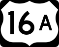
U.S. Route 16A (redirect from U.S. Route 16 Alternate (South Dakota))
the U.S. state of South Dakota. The highway's western terminus is an intersection with US 16, US 385, and South Dakota Highway 89 (SD 89) in Custer. The...
6 KB (433 words) - 02:42, 4 November 2024
The following highways are numbered 89: Manitoba Highway 89 Highway 89 (Ontario) EO89 road Highway 89 (Israel) Interstate 89 Interstate 89 (North Carolina)...
4 KB (349 words) - 16:18, 27 August 2024

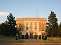
Pierre (/pɪər/ PEER) is the state capital of the U.S. state of South Dakota and the county seat of Hughes County. The population was 14,091 at the 2020...
30 KB (2,236 words) - 13:40, 21 January 2025

South Dakota's state highways were assigned in a numbering pattern that followed that of the U.S. Highways followed upon their inception. East–west highways...
39 KB (114 words) - 16:26, 25 January 2025

Watertown is a city in and the county seat of Codington County, South Dakota, United States. Watertown is home to the Redlin Art Center, which houses many...
32 KB (2,115 words) - 19:35, 27 January 2025

South Dakota, United States. It became a city in 1889. The population was 15,411 at the 2020 census, making it the 7th most populous city in South Dakota...
54 KB (4,866 words) - 04:26, 3 January 2025

South Dakota Highway 47 (SD 47) is a state route that runs north to south across the central portion of South Dakota. It begins at an unnumbered highway...
9 KB (466 words) - 04:58, 18 January 2025

Highway 83 U.S. Highway 183 South Dakota Highway 47 South Dakota Highway 49 South Dakota Highway 53 South Dakota Highway 273 South Dakota Highway 1806...
15 KB (1,078 words) - 21:27, 7 January 2025
counties to observe Mountain Time. U.S. Highway 212 South Dakota Highway 20 South Dakota Highway 63 South Dakota Highway 65 Corson County – north Walworth County...
14 KB (1,041 words) - 21:15, 23 November 2024

Beadle County, South Dakota, United States. The population was 14,263 at the 2020 census, making it the 8th most populous city in South Dakota. The first...
32 KB (2,709 words) - 16:45, 26 January 2025

city in and the county seat of Brookings County, South Dakota, United States. Brookings is South Dakota's fourth most populous city, with a population of...
29 KB (2,306 words) - 01:04, 23 August 2024

Milwaukee, Wisconsin. In the state of South Dakota, US 18 runs from the Wyoming border east to the Iowa border. The highway runs parallel to the state's southern...
12 KB (279 words) - 02:05, 6 May 2024
Aberdeen (Lakota: Ablíla) is a city in and the county seat of Brown County, South Dakota, United States, located approximately 125 miles (201 km) northeast of...
53 KB (4,997 words) - 00:40, 31 January 2025

U.S. Highway 12 U.S. Highway 281 South Dakota Highway 10 South Dakota Highway 37 Dickey County, North Dakota - north Sargent County, North Dakota - northeast...
16 KB (1,073 words) - 22:15, 23 November 2024

is water. U.S. Highway 212 U.S. Highway 281 South Dakota Highway 20 South Dakota Highway 26 South Dakota Highway 28 South Dakota Highway 37 Fisher Grove...
13 KB (856 words) - 22:35, 23 November 2024

water. U.S. Highway 18 U.S. Highway 83 South Dakota Highway 63 Mellette County - north Tripp County - east Cherry County, Nebraska - south (western half...
14 KB (1,083 words) - 21:24, 23 November 2024
South Dakota (/dəˈkoʊtə/ ; Sioux: Dakȟóta itókaga, pronounced [daˈkˣota iˈtokaga]) is a landlocked state in the North Central region of the United States...
158 KB (13,407 words) - 03:11, 7 February 2025

Highway 18 U.S. Highway 281 South Dakota Highway 43 South Dakota Highway 44 South Dakota Highway 47 South Dakota Highway 251 South Dakota Highway 1806...
15 KB (1,032 words) - 21:45, 23 November 2024

12 U.S. Route 81 South Dakota Highway 15 South Dakota Highway 20 South Dakota Highway 109 South Dakota Highway 123 South Dakota Highway 158 Roberts County—north...
15 KB (1,009 words) - 22:11, 23 November 2024

square miles (16 km2) (0.5%) is water. U.S. Highway 14 U.S. Highway 281 South Dakota Highway 28 South Dakota Highway 37 Spink County - north Clark County -...
15 KB (1,137 words) - 22:34, 23 November 2024
second-smallest county in South Dakota by area. U.S. Highway 18 U.S. Highway 281 South Dakota Highway 44 South Dakota Highway 50 Aurora County - north...
12 KB (805 words) - 22:27, 23 November 2024

Special routes of U.S. Route 16 (redirect from South Dakota Highway 16B)
the U.S. state of South Dakota. The highway's western terminus is an intersection with US 16, US 385, and South Dakota Highway 89 (SD 89) in Custer. The...
7 KB (584 words) - 01:19, 28 February 2024

Gary is a city in Deuel County, South Dakota, United States. The population was 240 at the 2020 census. South Dakota Highway 101 serves as the main route...
12 KB (867 words) - 12:09, 21 August 2023

Nebraska - southwest Yankton County - west South Dakota Highway 19 South Dakota Highway 46 South Dakota Highway 50 Missouri National Recreational River (part)...
17 KB (1,233 words) - 21:59, 23 November 2024

bordered on its eastern side by South Dakota State Highway 19. Its northern side is bordered by South Dakota State Highway 44. Parker is located approximately...
13 KB (1,163 words) - 02:47, 4 December 2024

and Highway 115, neither highway passes through the city. Access to both highways is via east–west 250th Street. Nils Boe, Governor of South Dakota from...
14 KB (1,068 words) - 04:54, 5 December 2024