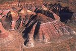
Study Butte (/ˈstjuːdi ˌbjuːt/ STEW-dee BEWT) is a census-designated place (CDP) in Brewster County, Texas, United States. The population was 200 at the...
15 KB (691 words) - 00:34, 26 October 2024
Study Butte-Terlingua was a census-designated place (CDP) in Brewster County, Texas, United States. The population was 267 at the 2000 census. For the...
13 KB (853 words) - 15:46, 20 September 2024
southwestern Brewster County, Texas, United States. It is located near the Rio Grande and the villages of Lajitas and Study Butte, Texas, as well as the Mexican...
28 KB (2,883 words) - 00:40, 26 October 2024
2,865 feet (873 m) Study Butte Coordinates: 29°19′43″N 103°33′11″W / 29.32861°N 103.55306°W / 29.32861; -103.55306 (Study Butte) Elevation: 2,563 feet...
42 KB (3,582 words) - 18:41, 5 January 2025
Farm to Market Road 170 (redirect from Farm to Market Road 170 (Texas))
several smaller communities and former settlements to State Highway 118 in Study Butte near Big Bend National Park. The road also passes through the southern...
15 KB (1,880 words) - 17:44, 23 October 2024
Elephant Butte Dam or Elephant Butte Dike, originally Engle Dam, is a concrete gravity dam on the Rio Grande near Truth or Consequences, New Mexico, in...
16 KB (1,609 words) - 19:08, 8 October 2024
highway in the U.S. state of Texas that runs from Big Bend National Park north to Kent and passes through the towns of Study Butte, Alpine, and Fort Davis...
21 KB (2,134 words) - 02:25, 18 August 2024
the Interior. Retrieved November 16, 2024. Bee Mountain, Study Butte, Brewster County, Texas, USA, Mindat.org, Retrieved 2024-11-16. Droddy, Marvin Jr...
5 KB (351 words) - 09:50, 5 January 2025
Hill in Prescott Valley and Pilot Knob in Austin, Texas. The 114.22-acre (46.22-hectare) Pilot Butte State Scenic Viewpoint, presented as a gift to the...
18 KB (1,836 words) - 08:45, 6 September 2024
Big Bend High School (category Schools in Brewster County, Texas)
K-12 school located in unincorporated Brewster County, Texas (USA), adjacent to the Study Butte census-designated place, and with a Terlingua postal address...
12 KB (913 words) - 01:07, 23 December 2024
Trans-Pecos (redirect from Far West Texas)
the junction of Interstates 10 and 20 near Kent and continues south to Study Butte at the entrance of Big Bend National Park. The Trans-Pecos region contains...
17 KB (1,158 words) - 21:46, 1 January 2025
LeChee Rock Monument Valley Camel Butte Cly Butte Elephant Butte Gray Whiskers Hunts Mesa Merrick Butte Mitchell Butte The Mitten Buttes North Window Rain...
23 KB (1,607 words) - 20:33, 4 January 2025
Cerro Castellan (category Mountains of Texas)
village of Castolon took its name from the nearby butte. List of mountain peaks of Texas Geography of Texas West aspect West aspect East aspect West aspect...
5 KB (425 words) - 09:53, 5 January 2025
Frank Little (unionist) (category People from Butte, Montana)
known as Frank Little, was an American labor leader who was murdered in Butte, Montana. No one was apprehended or prosecuted for Little's murder. He joined...
20 KB (2,725 words) - 22:27, 13 August 2024
Meteor Crater (redirect from Coon Butte)
crater was given several early names, including "Coon Mountain", "Coon Butte", "Crater Mountain", "Meteor Mountain," and "Meteor Crater." Daniel M. Barringer...
41 KB (4,327 words) - 04:16, 28 November 2024
Chisos Mountains (category Landforms of Brewster County, Texas)
1930s), and surrounded by the Chihuahuan Desert. The nearby towns include Study Butte, Terlingua, Fort Stockton, 135 miles north, Alpine, 105 mi (169 km) northwest...
11 KB (778 words) - 06:06, 7 November 2024
Terlingua Common School District (category School districts in Brewster County, Texas)
Brewster County, in the U.S. state of Texas. Its only school, Big Bend High School, is located adjacent to the Study Butte census-designated place, and with...
7 KB (625 words) - 01:56, 8 January 2025
reported only twenty-five residents, the majority of those living in Study Butte and Terlingua. In 1889, it and neighboring Buchel County were attached...
2 KB (163 words) - 22:21, 26 November 2024
Anthony Francis Lucas (category Texas Oil Boom people)
Anse la Butte, having by then become an expert on salt domes.: 57–60 In 1899, Lucas visited the Sour Spring Mound south of Beaumont, Texas, with Pattillo...
12 KB (1,322 words) - 20:40, 16 June 2024
Dallas Fort Worth International Airport (redirect from DFW Airport, Texas)
serving the Dallas–Fort Worth metroplex and the North Texas region, in the U.S. state of Texas. It is the largest hub for American Airlines, which is...
120 KB (7,745 words) - 00:34, 9 January 2025
South Point (97.5%) Sparks (99.1%) Spring Garden-Terra Verde (97.11%) Study Butte-Terlingua (51.69%) Taft Southwest (95.5%) Tierra Bonita (95.7%) Tierra...
17 KB (1,350 words) - 03:35, 20 September 2024
census-designated places. List of cities in Texas List of cities in Texas by population "Adkins, TX". Handbook of Texas. Texas State Historical Association. Retrieved...
129 KB (179 words) - 03:36, 22 November 2024
The Elephant Butte Historic District, a historic district in the Elephant Butte, New Mexico, was listed on the National Register of Historic Places in...
5 KB (578 words) - 05:25, 6 August 2023
electric power companies, newspapers, railroads (trolley lines around Butte and the San Pedro, Los Angeles and Salt Lake Railroad from Salt Lake City...
22 KB (2,304 words) - 08:02, 21 December 2024
Chinle Formation (redirect from Monitor Butte Member)
from the Monitor Butte Member, which has more evaporite deposits and fewer red sandy layers. The drab mudstone of the Monitor Butte and Cameron members...
48 KB (4,789 words) - 22:43, 7 December 2024
List of the United States communities where English is not the majority language spoken at home (section Texas)
Springlake 91 Town 91 Spanish 54.9 45.1 Stowell 1,960 CDP 1,917 English 49 49 Study Butte 178 CDP 178 Spanish 79.2 20.8 Sullivan City 3,917 City 3,537 Spanish...
154 KB (126 words) - 15:44, 29 July 2024
planes crashed at Grey Butte Airfield during this time. Training ended on October 12, 1945. In 1948 the Army closed the Grey Butte Auxiliary Airfield and...
21 KB (2,682 words) - 09:10, 11 February 2024
Boomtown (category Urban studies and planning terminology)
Bodie, California Borger, Texas Buffalo, New York, shipping via Erie Canal, steel production, 1825–1890 Burkburnett, Texas Butte, Montana, copper and other...
19 KB (2,091 words) - 14:18, 9 January 2025
Park. Panther Junction is located approximately twenty miles east of Study Butte. The elevation for the community is 3,720 feet (1,130 m) above sea level...
9 KB (293 words) - 00:14, 4 July 2024
the frame narrative, it is revealed that Rory was found on the top of a butte and brought to the university to be studied under Spratling's supervision...
24 KB (3,005 words) - 10:20, 7 January 2025


