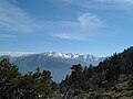
Summit Valley is a valley along SR 138 in the San Bernardino Mountains, east of Cajon Pass within San Bernardino County, California. Its mouth lies at...
1 KB (149 words) - 10:31, 13 June 2023

San Bernardino (/ˌsæn ˌbɜːrnəˈdiːnoʊ/ SAN BUR-nə-DEE-noh) is a city in and the county seat of San Bernardino County, California, United States. Located...
79 KB (7,018 words) - 11:54, 7 April 2025

San Bernardino County (/sæn ˌbɜːrnəˈdiːnoʊ/ SAN BUR-nə-DEE-noh), officially the County of San Bernardino and sometimes abbreviated as S.B. County, is...
130 KB (6,916 words) - 20:06, 3 April 2025
north and northeast of San Bernardino and spanning two California counties, the range tops out at 11,503 feet (3,506 m) at San Gorgonio Mountain – the tallest...
43 KB (4,661 words) - 12:37, 19 March 2025

The San Bernardino County Sheriff-Coroner's Department (SBSD) serves San Bernardino County, California, which is geographically the largest county in the...
35 KB (3,471 words) - 05:58, 23 March 2025
Summit Valley may refer to: Summit Valley (Los Angeles County, California), a valley south of Woodland Hills[citation needed] Summit Valley (San Bernardino...
416 bytes (77 words) - 13:41, 24 February 2015

city in San Bernardino County, California, located in the San Bernardino Mountains along the south shore of Big Bear Lake, and surrounded by the San Bernardino...
35 KB (3,246 words) - 23:23, 7 April 2025

the U.S. state of California. It serves as a primary route into the San Bernardino Mountains, both from the Riverside–San Bernardino metropolitan area...
17 KB (1,532 words) - 03:33, 5 March 2025

Riverside, San Bernardino, Kern, Ventura, Santa Barbara, San Luis Obispo, and Imperial counties. Although geographically smaller than Northern California in land...
81 KB (6,663 words) - 22:26, 1 April 2025

the Victor Valley of the Mojave Desert, within San Bernardino County, California. Oak Hills is in the Mojave Desert north of the Cajon Summit of Cajon Pass...
8 KB (684 words) - 18:40, 4 October 2024
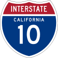
Interstate Highway in the U.S. state of California, connecting San Bernardino, Riverside, and San Diego Counties. The route consists of the southernmost...
62 KB (4,441 words) - 01:41, 30 March 2025

community in San Bernardino County, California, United States along the east shore of Big Bear Lake and surrounded by the San Bernardino National Forest...
23 KB (2,451 words) - 23:26, 7 April 2025

Riverside County is included in the Riverside–San Bernardino–Ontario Metropolitan Statistical Area, also known as the Inland Empire. The county is also...
139 KB (6,001 words) - 20:50, 11 April 2025

Snow Summit is a ski resort that was established in 1952 and is in the San Bernardino Mountains in Southern California. It is located by Big Bear Lake...
8 KB (565 words) - 04:41, 25 February 2025

state highway in the U.S. state of California that runs entirely in San Bernardino County, mostly in the San Bernardino National Forest. Its west end is...
8 KB (966 words) - 03:33, 5 March 2025

census-designated place in San Bernardino County, California, in the Victor Valley of the Mojave Desert, north of the San Gabriel Mountains. The population...
14 KB (1,422 words) - 15:11, 24 December 2024

community in the San Gabriel Mountains located in San Bernardino County and Los Angeles County in Southern California, with the county line running through...
10 KB (936 words) - 05:12, 12 January 2025
with summit and elevation of 3,897 feet (1,188 m), in the Mojave Desert of Southern California. It is located north of Apple Valley, in San Bernardino County...
1 KB (60 words) - 05:24, 7 July 2023
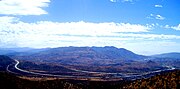
Cajon Pass (redirect from Cajon Summit)
between the San Bernardino Mountains to the east and the San Gabriel Mountains to the west in Southern California. Created by the movements of the San Andreas...
25 KB (2,894 words) - 04:22, 2 February 2025

Fontana is a city in San Bernardino County, California, United States. Founded by Azariel Blanchard Miller in 1913, it remained essentially rural until...
73 KB (5,915 words) - 22:50, 10 April 2025

Highway in the state of California that ran from the west in Santa Monica on the Pacific Ocean through Los Angeles and San Bernardino to Needles at the Arizona...
25 KB (1,939 words) - 20:46, 1 April 2025

is in San Bernardino County. Indicates that the postmile represents the distance along SR 18 rather than SR 38. California Roads portal California Department...
11 KB (1,268 words) - 03:39, 5 March 2025

San Diego, Riverside, and San Bernardino. The highway serves as a connection to the Greater Los Angeles area for the communities of the Owens Valley,...
58 KB (4,815 words) - 00:01, 27 March 2025
is the second-largest county by area in California, after San Bernardino County. Almost half of that area is within Death Valley National Park. However...
66 KB (3,704 words) - 11:36, 28 February 2025
San Bernardino, and Palm Springs before crossing into the state of Arizona. In the Greater Los Angeles area, it is known as the Santa Monica and San Bernardino...
73 KB (4,675 words) - 01:26, 30 March 2025
Bobcat Hills is a summit in the Lanfair Valley of San Bernardino County, California. U.S. Geological Survey Geographic Names Information System: Bobcat...
382 bytes (45 words) - 03:41, 27 January 2025

The San Gorgonio Pass, or Banning Pass, is a 2,600 ft (790 m) elevation gap on the rim of the Great Basin between the San Bernardino Mountains to the north...
9 KB (921 words) - 06:53, 17 January 2025

Gabriel Mountains on the border of Los Angeles and San Bernardino counties of California. Lying within the San Gabriel Mountains National Monument and Angeles...
38 KB (4,552 words) - 18:38, 23 February 2025

state highway in the U.S. state of California that runs across the Coast Ranges, the southern San Joaquin Valley, the Tehachapi Mountains, which border...
35 KB (2,338 words) - 22:39, 18 February 2025

Riverside County, California, United States, located at the summit of the San Gorgonio Pass, between the San Bernardino Mountains and Mount San Gorgonio...
41 KB (3,479 words) - 23:26, 7 April 2025