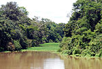
The Tapauá State Forest (Portuguese: Floresta Estadual Tapauá) is a state forest in the state of Amazonas, Brazil. The Tapauá State Forest is divided between...
4 KB (357 words) - 14:51, 8 January 2024
Tapauá is a municipality located in the Brazilian state of Amazonas. Its population was 17,015 (2020) and its area is 89,324 km2, making it the third...
4 KB (239 words) - 20:32, 19 August 2024
Ipixuna River (Purus River tributary) (category Rivers of Amazonas (Brazilian state))
hectares (2,178,740 acres) Tapauá State Forest, created in 2009, before joining the Purus river from the right at Tapauá. The river flows through the...
3 KB (176 words) - 10:51, 24 January 2023
The Tapauá River (Portuguese: Rio Tapauá) is a river of Amazonas state in north-western Brazil. It is a left tributary of the Purus River. The river flows...
4 KB (154 words) - 01:33, 25 September 2024
municipalities of Tapauá (6.65%) and Canutama (93.35%) in the state of Amazonas. It has an area of 150,588 hectares (372,110 acres). The state forest lies on the...
4 KB (372 words) - 14:40, 8 January 2024
flood each year. Major rivers include the Jutaí, mid-lower Juruá, Tefé, Tapauá and mid-lower Purus rivers. The sediments of the low Amazon basin were formed...
10 KB (1,080 words) - 21:20, 16 March 2024
Canutama (category Municipalities in Amazonas (Brazilian state))
in 2009. It contains 2% of the 881,704 hectares (2,178,740 acres) Tapauá State Forest, also created in 2009. During its beginning, it received some denominations:...
4 KB (257 words) - 20:31, 19 August 2024
BR-319 (Brazil highway) (category Transport in Amazonas (Brazilian state))
Extractive Reserve, Canutama State Forest, Tapauá State Forest and Matupiri State Park. In December 2012 the Amazonas state government allocated more than...
25 KB (2,860 words) - 04:12, 26 September 2024
potential threats to it. One population, however, occurs in the Tapauá State Forest, representing a refuge. Ferrão, Miquéias; Moravec, Jirí; Fraga, Rafael...
6 KB (608 words) - 02:01, 16 April 2024
A state forest (Portuguese: Floresta Estadual, FES) in Brazil is a type of sustainable use protected area managed at the state level. The primary purpose...
8 KB (439 words) - 15:42, 29 March 2021
Purus River (category Rivers of Acre (state))
the river flow through the Purus várzea ecoregion. In the municipality of Tapauá, Amazonas, the river flows through the 233,864 hectares (577,890 acres)...
14 KB (923 words) - 18:28, 20 April 2024
Igapó-Açu Sustainable Development Reserve (category Protected areas of Amazonas (Brazilian state))
Extractive Reserve, Canutama State Forest, Tapauá State Forest and Matupiri State Park. In December 2012 the Amazonas state government allocated more than...
5 KB (451 words) - 03:38, 21 October 2024
Venezuela). State Park Ecological Serra do Acará. State Reserve Ecological of Nhamundá. Amazon Jungle Hikes & Canopy Tours Adolfo Ducke Forest Reserve Mamirauá...
62 KB (6,476 words) - 20:12, 10 October 2024
Canutama Extractive Reserve (category Protected areas of Amazonas (Brazilian state))
Extractive Reserve, Canutama State Forest, Tapauá State Forest and Matupiri State Park. In December 2012 the Amazonas state government allocated more than...
5 KB (419 words) - 00:37, 5 September 2024
Matupiri Sustainable Development Reserve (category Protected areas of Amazonas (Brazilian state))
Extractive Reserve, Canutama State Forest, Tapauá State Forest, and Matupiri State Park. In December 2012 the Amazonas state government allocated more than...
5 KB (433 words) - 03:20, 29 February 2024
The Balata-Tufari National Forest covers parts of the municipalities of Canutama (90.85%) and Tapauá (9.15%) in the state of Amazonas. It has an area...
6 KB (548 words) - 11:15, 23 September 2023
Piagaçu-Purus Sustainable Development Reserve (category Protected areas of Amazonas (Brazilian state))
reserve in the state of Amazonas, Brazil. The Piagaçu-Purus Sustainable Development Reserve (RDS) is divided between the municipalities of Tapauá (30.35%),...
6 KB (601 words) - 11:55, 31 May 2022
Rio Amapá Sustainable Development Reserve (category Protected areas of Amazonas (Brazilian state))
Extractive Reserve, Canutama State Forest, Tapauá State Forest and Matupiri State Park. In December 2012 the Amazonas state government allocated more than...
8 KB (864 words) - 03:37, 29 February 2024
Rio Preto da Eva (category Municipalities in Amazonas (Brazilian state))
The municipality contains the 27,342 hectares (67,560 acres) Rio Urubu State Forest, created in 2003. IBGE 2020 IBGE - [1] ARIE Proj. Dinâmica B. de Fragmentos...
3 KB (110 words) - 03:12, 19 August 2024
Humaitá, Amazonas (category Municipalities in Amazonas (Brazilian state))
vegetation in the Amazon rainforest. It also contains the Humaitá National Forest, a 473,155 hectares (1,169,190 acres) sustainable use conservation unit...
5 KB (193 words) - 20:30, 19 August 2024
Maués (category Municipalities in Amazonas (Brazilian state))
Amazônia National Park, Juruena National Park, Pau-Rosa National Forest, Maués State Forest and Andirá Marau Indigenous Territory. It is thought that the...
6 KB (441 words) - 03:09, 19 August 2024
Santa Isabel do Rio Negro (category Municipalities in Amazonas (Brazilian state))
restricted access. The municipality also contains part of the Amazonas National Forest. The city is served by Tapuruquara Airport. IBGE 2020 IBGE - [1] Unidade...
3 KB (161 words) - 16:01, 19 August 2024
Juruá, Amazonas (category Municipalities in Amazonas (Brazilian state))
created in 2001. The municipality contains about 12% of the Tefé National Forest, created in 1989. IBGE 2020 IBGE - "Archived copy". Archived from the original...
3 KB (109 words) - 20:28, 19 August 2024
Manaus (category Municipalities in Amazonas (Brazilian state))
at the beginning of the century as Heart of the Amazon and City of the Forest. Currently, its main economic engine is the Industrial Park of Manaus, a...
86 KB (8,198 words) - 16:57, 20 October 2024
Novo Aripuanã (category Municipalities in Amazonas (Brazilian state))
conservation units. It contains the 83,381 hectares (206,040 acres) Manicoré State Forest, a sustainable use conservation unit created in 2005. It contains 39%...
7 KB (588 words) - 20:31, 19 August 2024
Itacoatiara, Amazonas (category Municipalities in Amazonas (Brazilian state))
Itacoatiara is a municipality in the central eastern portion of state of Amazonas, inland northern Brazil. Its population was 102,701 (2020) and its area...
14 KB (847 words) - 02:30, 20 September 2024
Manaquiri (category Municipalities in Amazonas (Brazilian state))
Brazilian state of Amazonas. Its population was 33,049 (2020) and its area is 3,976 km2. Manaquiri is located in a portion of the southern Várzea forest of the...
3 KB (94 words) - 03:07, 19 August 2024
Carauari (category Municipalities in Amazonas (Brazilian state))
town is in the Juruá-Purus moist forests ecoregion. The municipality contains about 5% of the Tefé National Forest, created in 1989. The municipality...
5 KB (173 words) - 16:07, 19 August 2024
Boca do Acre (category Municipalities in Amazonas (Brazilian state))
holds 92% of the 311,000 hectares (770,000 acres) Mapiá-Inauini National Forest, created in 1989. It also contains the 133,637 hectares (330,220 acres)...
3 KB (110 words) - 20:28, 19 August 2024
Barcelos, Amazonas (category Municipalities in Amazonas (Brazilian state))
Sustainable Development Reserve. It also contains part of the Amazonas National Forest. It contains the 833,352 hectares (2,059,260 acres) Rio Unini Extractive...
14 KB (714 words) - 03:35, 13 October 2024


