
State Route 438 (SR 438) is a 41.0 miles (66.0 km) long east-west state highway in extreme western Middle Tennessee. Mousetail Landing State Park is located...
4 KB (318 words) - 07:41, 22 June 2023
Tennessee state routes do not follow a systematic numbering system unlike the U.S. Highway System and some other states' highway systems. The routes are...
174 KB (349 words) - 06:30, 3 July 2024

U.S. Route 70 (US 70) enters the state of Tennessee from Arkansas via the Memphis & Arkansas Bridge in Memphis, and runs west to east across 21 counties...
45 KB (1,093 words) - 12:41, 7 August 2024

State Route 100 (SR 100) is a west–east state highway in both West Tennessee and Middle Tennessee that connects Whiteville with Nashville. It is 158.31 mi...
13 KB (685 words) - 23:50, 14 June 2024

route is Tennessee State Route 13, connecting with Interstate 40 9 miles (14 km) north of Lobelville in Humphreys County. Tennessee State Route 438 transits...
136 KB (13,379 words) - 23:26, 7 August 2024

Route 421 (also U.S. Highway 421, US 421) is a diagonal northwest–southeast United States Numbered Highway in the states of North Carolina, Tennessee...
17 KB (1,687 words) - 11:31, 9 August 2024
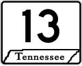
the Kentucky border in Montgomery County. The entire route is located in western Middle Tennessee. For the majority of its length, SR 13 is designated...
15 KB (766 words) - 00:23, 24 March 2024

bridge over the Tennessee River and entering Perry County. The highway has an intersection SR 438 just south of Mousetail Landing State Park before passing...
20 KB (1,387 words) - 08:28, 5 February 2024
unincorporated community in Perry County, Tennessee, United States. Spring Creek is located on Tennessee State Route 438 7.7 miles (12.4 km) east of Parsons...
3 KB (75 words) - 05:59, 29 July 2023
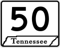
State Route 50 (SR 50) is a west–to–east highway in Middle Tennessee. The road begins near Only and ends in Altamont. The current length is 161.3 miles...
21 KB (1,364 words) - 08:49, 11 August 2023

and U.S. Route 412 approximately 13 miles (21 km) south in Linden. State Route 438 also passes through the southern part of Lobelville. As of the 2020...
15 KB (952 words) - 15:40, 26 March 2024

portal U.S. Roads portal List of state routes in Tennessee KML file (edit • help) Template:Attached KML/Tennessee State Route 437 KML is not from Wikidata...
3 KB (198 words) - 01:06, 31 July 2023

south. Tennessee State Route 108, connects the town to Viola and McMinnville to the northwest and Whitwell to the southeast. Tennessee State Route 50 connects...
14 KB (1,121 words) - 20:17, 8 March 2024

List of Kentucky supplemental roads and rural secondary highways (400–499) (redirect from Kentucky Route 438)
through Adolphus to the Tennessee state line, KY 482 turns onto the old road and follows it and Little Trammel Creek north to the route's eastern terminus at...
131 KB (12,134 words) - 17:05, 29 April 2024

U.S. Route 127 (US 127) in Kentucky runs 207.7 miles (334.3 km) from the Tennessee state line in rural Clinton County to the Ohio state line in Cincinnati...
32 KB (625 words) - 22:27, 4 August 2024

town to Etowah to the north and Tennga, Georgia to the south, and Tennessee State Route 314, which connects Benton to Parksville, Cherokee National Forest...
13 KB (1,102 words) - 01:04, 6 May 2024

Interstate 75 (redirect from Interstate Route 75)
Interstates that end in 5, it is a major cross-country, north–south route, traveling from State Road 826 (SR 826, Palmetto Expressway) and SR 924 (Gratigny Parkway)...
33 KB (3,082 words) - 00:58, 5 August 2024

most populous city in the U.S. state of Tennessee and the county seat of Davidson County. Located in Middle Tennessee, it had a population of 689,447...
241 KB (20,727 words) - 23:24, 10 August 2024

Interstate 59 (redirect from Georgia State Route 406)
Chattanooga, Tennessee, running closely parallel to the older U.S. Route 11 (US 11) corridor for the entire distance. Approximately one-third of the route, spanning...
35 KB (1,364 words) - 14:53, 10 August 2024

ignores US 74 along its route, even ignoring it at their intersection, showing instead the US 64 Bypass. From the Tennessee state line, US 74 traverses...
79 KB (5,551 words) - 11:51, 5 August 2024

In Tennessee, U.S. Route 412 (US 412) stretches for 181.93 miles (292.79 km) through the farmland of West Tennessee and the hills of Middle Tennessee, starting...
24 KB (1,461 words) - 20:24, 8 August 2024

with I-40 south of Tennessee State University and heads directly south. It immediately crosses a CSX railroad mainline and U.S. Route 70 (US 70, Charlotte...
30 KB (2,841 words) - 22:05, 4 August 2024

Highway Association (1911). "Route of Memphis-Nashville-Bristol Highway, Tennessee's First State Road". Nashville: Tennessee State Library and Archives. OCLC 957558404...
259 KB (19,441 words) - 00:55, 5 August 2024
List of highways numbered 1 (redirect from State Route 1)
Route 1A, Alternate route of U.S. Route 1 Tennessee State Route 1 Texas State Highway 1 (former) Texas State Highway Loop 1 Texas State Highway NASA Road...
20 KB (1,281 words) - 01:39, 5 August 2024

The State Route System in Alabama uses the standard numbering convention: odd numbers signify a north–south state route, and even numbers signify an east–west...
113 KB (297 words) - 05:35, 25 July 2024

Tennessee, United States. Its elevation is 407 feet (124 m). It lies along State Route 438, approximately halfway between Mousetail Landing State Park...
4 KB (90 words) - 00:12, 14 March 2024

Donelson is a neighborhood of Nashville, Tennessee, about 6 mi (10 km) east of downtown Nashville along U.S. Route 70. It is named in honor of John Donelson...
9 KB (1,144 words) - 14:37, 28 March 2024

State Route 16 is a primary state highway in the southwest part of the U.S. state of Virginia. It runs from the North Carolina border at North Carolina...
21 KB (2,103 words) - 05:28, 30 January 2024

and census-designated place (CDP) in Morgan County, Tennessee, United States, located on State Route 116. Its population was 459 at the 2020 census. Petros...
4 KB (159 words) - 09:29, 24 April 2024
List of highways numbered 66 (redirect from State Route 66)
Highway 66 Tennessee State Route 66 Texas State Highway 66 (no connection to Texas portion of US 66) Texas State Highway Loop 66 (former) Texas State Highway...
7 KB (539 words) - 22:51, 7 August 2024