
Tinkisso is a village in the Dinguiraye Prefecture of Guinea. The Tinkisso River and dam is important to the local economy. The economy is based on mining...
4 KB (41 words) - 00:13, 10 November 2020

The Tinkisso River is a river in Guinea in west Africa. The river is sourced near Dalaba in the Fouta Djallon mountain range, north of Mamou and snakes...
1 KB (125 words) - 10:51, 3 December 2021
Tinkisso Falls is a waterfall on the Tinkisso River located near Dabola in central Guinea. The falls are 70 m (230 ft) wide and 45 m (148 ft) high. The...
2 KB (119 words) - 15:03, 19 January 2024

grew around the railway line from Conakry to Kankan and is known for the Tinkisso Falls and for its important dam. While the main line is metre gauge, the...
5 KB (155 words) - 05:52, 22 January 2023

Placer gold is mined here. North and northwest of Siguiri, and along the Tinkisso River, is the Bouré region. This region replaced Bambouk as a major gold...
11 KB (302 words) - 21:51, 4 August 2024

rainfall, and is the headwaters of four major rivers and other medium ones: Tinkisso River (major upriver tributary of the Niger) Gambia River Senegal River...
17 KB (2,011 words) - 08:53, 15 July 2024
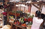
Farmers cooperative in Tinkisso, Dinguiraye...
4 KB (76 words) - 09:08, 5 July 2024

550 cu ft/s) Basin features River system Niger River Tributaries • left Tinkisso, Sokoto, Kaduna, Gurara, Benue, Anambra • right Niandan, Milo, Sankarani...
49 KB (3,394 words) - 18:42, 18 August 2024
Classified Forest Botokoly Classified Forest Boula Classified Forest Chutes de Tinkisso Classified Forest Colline-Macenta Classified Forest Counsignaki Classified...
4 KB (453 words) - 03:07, 8 March 2022

fighting for control of the Bouré gold producing area around Siguiri and the Tinkisso River. Instead Caillié left the town heading east in the direction of Minignan...
17 KB (1,260 words) - 13:23, 1 September 2024
586,000 Niger-Tinkisso 400,600 990,000 Rio Kapatchez 20,000 49,000 Rio Pongo 30,000 74,000 Sankarani-Fié 1,015,200 2,509,000 Tinkisso 896,000 2,210,000...
242 KB (220 words) - 03:54, 22 August 2024
Nile Falls Boti Falls Kintampo Falls Tagbo Falls Wli Falls Akaa falls Tinkisso Falls Karuru Falls Thomson's Falls Maletsunyane Falls – 192 m (630 ft)...
66 KB (5,476 words) - 00:09, 3 August 2024
River Ouassoulou River (Bale River) Dion River Gbanhala River Fié River Tinkisso River Bouka River Milo River Baoulé River Niandan River Kouya River Mafou...
2 KB (168 words) - 13:54, 15 December 2023

at the point they converge into the Niger. Alibori River Sirba River Tinkisso River Milo River Niandan River Sankarani River Bani River Mekrou River...
1 KB (80 words) - 01:23, 11 April 2022

the Falémé River to the west, the Bakhoy to the east and the Niger and Tinkisso to the south. The 1413 portolan chart of Mecia de Viladestes gives perhaps...
47 KB (5,783 words) - 02:42, 4 September 2024

people. Bissikrima is located at the geographical centre of Guinea on the Tinkisso River, one of the tributaries of the Niger on which there is a hydro-electric...
6 KB (191 words) - 20:08, 6 July 2024

(Panthera leo) returned to the protected area, probably migrating from the Tinkisso River region. There is a large trade in hunted animals from the park. At...
5 KB (564 words) - 19:26, 16 June 2024

fighting for control of the Bouré gold producing area around Siguiri and the Tinkisso River. Instead Caillié left the town heading east in the direction of Minignan...
32 KB (3,821 words) - 09:05, 21 August 2024
4504°W / 11.0483; -12.4504 Koulou 3.5 Tinkisso 10°43′41″N 11°10′06″W / 10.7281°N 11.1684°W / 10.7281; -11.1684 Tinkisso 1.65 Kaleta Kaleta 10°27′51″N 13°16′52″W...
8 KB (249 words) - 21:12, 13 December 2023

Niger, and its tributaries, the Sankarani, the Niandan, the Milo and the Tinkisso, rise in Guinea Highlands and the Fouta Djallon nearly 750 km (470 mi)...
32 KB (3,674 words) - 17:40, 23 June 2024