
Toolangi State Forest Melbourne Canberra The Toolangi State Forest region in southern Australia extends from Mount Monda in the south up to Murrindindi...
23 KB (2,610 words) - 13:14, 20 April 2024
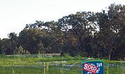
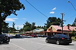
Toolangi is a locality in Victoria, Australia. At the 2021 census, Toolangi had a population of 366. It is situated on the edge of the Toolangi State...
11 KB (848 words) - 01:39, 25 August 2024

The Toolangi Forest Discovery Centre (TFDC) is a forest education hub in Toolangi, Victoria, Australia. It was opened by the Victorian Minister for Natural...
10 KB (1,178 words) - 02:45, 13 August 2024

Karri forest near Cascades at Pemberton, Western Australia Hopetoun Falls, beech forest, near Great Otway National Park, Victoria. Toolangi State Forest near...
16 KB (507 words) - 09:07, 27 February 2024

Central Highlands (Victoria) (category Forests of Victoria (state))
carbon dense forest is found in the Central Highlands of Victoria. Logging is proceeding in very significant regions of the Toolangi State Forest, including...
6 KB (412 words) - 04:27, 7 May 2024

Cathedral Range State Park and Toolangi State Forest. A Report produced by the Nous Group found that the establishment of the Great Forest National Park...
5 KB (503 words) - 00:36, 23 September 2024

Leadbeater's possum (category Mammals of Victoria (state))
clear-felling also approved by VicForests in the few remaining unburnt areas, such as the Kalatha Creek area of Toolangi State Forest in 2010, a move opposed by...
37 KB (3,632 words) - 02:44, 11 August 2024
Native Forests Clearcutting Conservation in Australia Illegal logging in Australia Logging in the Toolangi State Forest Logging in the Wielangta Forest Woodchipping...
26 KB (2,675 words) - 04:20, 29 February 2024
Toolangi State Forest excursions, with the endorsement of the Department of Sustainability and Environment after the closure of the Toolangi Forest Discovery...
8 KB (1,150 words) - 23:35, 14 June 2024
Duke of Poland Tanglefoot walking tracks, walking tracks in the Toolangi State Forest Camp Tanglefoot, a 1999 film Tanglefoot Trail, a rail trail in Mississippi...
783 bytes (123 words) - 18:36, 27 May 2020
regenerating forest covered 131,614,800 hectares (ha) and planted forest covered 2,390,300 hectares (ha). Of the naturally regenerating forest 0% was reported...
91 KB (8,386 words) - 16:43, 3 October 2024

Castella, Victoria (category Towns in Victoria (state))
quarries was used to dump the drillings from a tunnel under the Toolangi State Forest. This tunnel is part of the Sugarloaf Pipeline, carrying freshwater...
3 KB (168 words) - 05:02, 16 July 2024

North–South Pipeline (category Water resource management in Victoria (state))
pipeline's route cuts through parts of the Kinglake National Park and Toolangi State Forest. The North–South Pipeline has been criticised by environmental groups...
21 KB (2,151 words) - 09:36, 3 September 2024
The Forests Commission Victoria (FCV) was the main government authority responsible for management and protection of State forests in Victoria, Australia...
186 KB (21,602 words) - 02:00, 4 September 2024

Persoonia arborea (category Flora of Victoria (state))
Trobe and Yarra Rivers". Tree geebung occurs in high rainfall mountain ash forest to the north-east of Melbourne at altitudes of 450–1,200 m (1,480–3,940 ft)...
4 KB (404 words) - 00:50, 7 May 2023

old growth native forests was challenged by environmentalists, including through the use of nonviolent direct action. By 2016, the state of Victoria had...
7 KB (639 words) - 21:50, 25 December 2023

Billardiera macrantha (category Flora of Victoria (state))
Melbourne and isolated places further west, and in Tasmania. Habit near Toolangi Fruit near Yarra Junction "Billardiera macrantha". Australian Plant Census...
5 KB (493 words) - 19:01, 26 May 2024

Black Friday bushfires (category Bushfires in Victoria (state))
Melbourne in the Yarra Ranges east of Melbourne, affecting towns including Toolangi, Warburton and Thomson Valley. The alpine towns of Bright, Cudgewa and...
22 KB (2,663 words) - 08:05, 14 August 2024

Nerong Ourimbah Pilliga Pokolbin Riamukka Tallaganda Tamban Tillarook Toolangi Tuggolo Wang Wauk Weecurra Wingello Wombat Woomargama Wyong Yadboro Yalwal...
56 KB (1,989 words) - 06:17, 5 June 2024
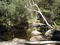
Murrindindi River (category Victoria (state) river stubs)
through the Murrindindi River Scenic Reserve between the Toolangi and Black Range State Forests. The river is joined by five minor tributaries, passing...
5 KB (263 words) - 14:30, 2 February 2023
Central regions of the Australian state of Victoria. The Yea River rises in the Toolangi State Forest north-east of Toolangi and northwest of Mount Tanglefoot...
6 KB (344 words) - 23:52, 2 February 2023
Kinglake, Victoria (category Towns in Victoria (state))
affected during the Black Saturday bushfires in 2009. Kinglake, comprising forest, farmland, a national park and a township, is located 57 km (35 mi) north...
13 KB (1,224 words) - 13:41, 28 July 2024

Narbethong, Victoria (category Towns in Victoria (state))
media related to Narbethong, Victoria. "Narbethong climate – site name: TOOLANGI (MOUNT ST LEONARD DPI)". Bureau of Meteorology. Australian Government....
7 KB (608 words) - 07:44, 16 July 2024
List of Melbourne suburbs (category Geography of Victoria (state))
South Steels Creek 3775 Tarrawarra 3775 The Patch 3792 Three Bridges 3797 Toolangi 3777 (shared with Shire of Murrindindi) Toorongo 3833 (shared with Shire...
48 KB (3,656 words) - 18:14, 6 October 2024
Melba Highway (category Highways in Victoria (state))
junction that links the highway with the nearby towns of Kinglake and Toolangi, a former home of Australian author C. J. Dennis. It continues south and...
11 KB (781 words) - 02:41, 1 July 2024

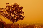
Black Saturday bushfires (category Forests of Victoria (state))
Dixons Creek, Chum Creek, Toolangi, Hazeldene, Broadford and Flowerdale. The area became the worst-impacted in the state, with a total of 120 deaths...
158 KB (13,341 words) - 01:02, 23 June 2024

Dandenong". Bureau of Meteorology. Retrieved 25 August 2024. "Sun hours from Toolangi". Bureau of Meteorology. Retrieved 25 August 2024. "2016 Census QuickStats:...
23 KB (1,905 words) - 03:33, 15 September 2024
fires burned to the urban fringe of Melbourne, affecting towns including Toolangi, Warburton and Thomson Valley. In the Victorian Alps, the towns of Bright...
98 KB (10,725 words) - 00:34, 1 October 2024

Aerial firefighting and forestry in southern Australia (category Bushfires in Victoria (state))
reconnaissance aircraft were grounded with the result that a fire near Toolangi reached a considerable size before being detected. Aerial photography can...
98 KB (11,678 words) - 10:18, 4 August 2023

Pomaderris vacciniifolia (category Flora of Victoria (state))
significant remaining wild population of the round-leaf pomaderris is at Toolangi, about 70 km (43 mi) north east of Melbourne. Factors in the decline of...
5 KB (520 words) - 14:44, 6 August 2023