Turka (Russian: Турка; Buryat: Түрхэнэ, Türkhene) is a rural locality (a selo) in Pribaykalsky District, Republic of Buryatia, Russia. The population...
2 KB (97 words) - 20:30, 9 October 2022
Poland) Turka, Gmina Ostrów Mazowiecka, in Masovian Voivodeship (central Poland) Turka, Republic of Buryatia, a rural locality in Russia Turka, Ukraine...
875 bytes (155 words) - 13:50, 11 January 2024
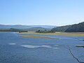
The Turka (Russian: Турка) is a river in the Republic of Buryatia, Russian Federation. It is one of the rivers flowing into Lake Baikal, and is 272 kilometres...
3 KB (196 words) - 15:39, 9 June 2020

The Republic of Buryatia (Russian: Респу́блика Буря́тия) is a federal subject of Russia (a republic) which, according to the IMF, was an emerging economy...
16 KB (1,865 words) - 16:08, 9 June 2024
Pribaykalsky District, Republic of Buryatia, Russia. The population was 142 as of 2010. There are 4 streets. Istok is located 110 km northeast of Turuntayevo (the...
2 KB (66 words) - 10:50, 3 November 2021
Kotokel (category Buryatia geography stubs)
District, Republic of Buryatia, Russia. The population was 145 as of 2010. There is 1 street. Kotokel is located on the southwestern shore of Lake Kotokel...
2 KB (85 words) - 10:48, 3 November 2021
Zolotoy Klyuch (category Buryatia geography stubs)
Pribaykalsky District, Republic of Buryatia, Russia. The population was 95 as of 2010. There are 3 streets. Zolotoy Klyuch is located by the Turka River, 157 km...
2 KB (76 words) - 10:50, 3 November 2021

Pribaykalsky District (category Districts of Buryatia)
district (raion), one of the twenty-one in the Republic of Buryatia, Russia. It is located in the center of the republic. The area of the district is 15...
5 KB (820 words) - 19:52, 24 January 2023

Lake Baikal (redirect from Pollution of Lake Baikal)
Siberia, Russia between the federal subjects of Irkutsk Oblast to the northwest and the Republic of Buryatia to the southeast. At 31,722 km2 (12,248 sq mi)—slightly...
79 KB (8,893 words) - 19:10, 2 September 2024
Sobolikha (category Buryatia geography stubs)
Republic of Buryatia, Russia. The population was 186 as of 2010. There are 4 streets. Sobolikha is located by the Turka River, 125 km northeast of Turuntayevo...
2 KB (72 words) - 10:48, 3 November 2021

River Eg River (Mongolia) Barguzin River (into Lake Baikal in Ust-Barguzin) Turka River (into Lake Baikal) Upper Angara River (into Lake Baikal near Severobaykalsk)...
30 KB (1,933 words) - 21:18, 6 June 2024

This is a list of rural localities in Buryatia. Buryatia (formally the Republic of Buryatia, Russian: Респу́блика Буря́тия, romanized: Respublika Buryatiya...
20 KB (991 words) - 08:36, 6 August 2024
Yartsy (category Buryatia geography stubs)
Pribaykalsky District, Republic of Buryatia, Russia. The population was 80 as of 2010. There is 1 street. Yartsy is located 105 km north of Turuntayevo (the...
2 KB (66 words) - 10:45, 3 November 2021
Goryachinsk (category Buryatia geography stubs)
rural locality (a selo) in Pribaykalsky District, Republic of Buryatia, Russia. The population was 967 as of 2010. There are 31 streets. The town is home to...
2 KB (83 words) - 17:58, 29 January 2024