
U.S. Route 44 (US 44) is an east–west United States Numbered Highway that runs for 237 miles (381 km) through four states in the Northeastern United States...
56 KB (4,056 words) - 18:37, 3 September 2024

U.S. Route 6 (US 6) is a major east–west road in the U.S. state of Rhode Island. Nationally, the route continues west to Bishop, California, and east to...
28 KB (1,940 words) - 21:54, 20 March 2024

Route 102 is a 44.4-mile-long (71.5 km) numbered state highway in the U.S. state of Rhode Island. Route 102 serves as a non-freeway beltway around the...
8 KB (328 words) - 00:37, 30 December 2023

Route 94 is a numbered state highway running 12.7 miles (20.4 km) in Rhode Island. Route 94's southern terminus is at Route 14 and Route 102 in Foster...
3 KB (133 words) - 01:10, 6 March 2023

Route 101 is a numbered state highway running 9.7 miles (15.6 km) in Rhode Island. It begins at the Connecticut state line in the town of Foster and ends...
4 KB (312 words) - 01:11, 6 March 2023

Route 15 is a state highway in the U.S. states of Rhode Island and Massachusetts. The highway runs 8.3 miles (13.4 km) from U.S. Route 44 (US 44) in North...
9 KB (676 words) - 20:28, 13 February 2024

Route 104 is a 13.4-mile-long (21.6 km) numbered state highway in the U.S. state of Rhode Island. It runs from US 44 in North Providence to Worrall Street...
6 KB (438 words) - 22:10, 5 June 2024

Route 5 is a state highway in the U.S. state of Rhode Island. It runs approximately 26 miles (42 km) from US 1 in Warwick to the Massachusetts state line...
6 KB (212 words) - 10:09, 8 March 2024

Route 2 is a 33.6-mile (54.1 km) state highway in Rhode Island, that runs from U.S. Route 1 in Charlestown to US 1 in Providence. Route 2 starts at US 1...
9 KB (281 words) - 06:31, 13 July 2022

U.S. Route 1 (US 1) is a major north–south U.S. Route through the U.S. state of Rhode Island, specifically within the Providence metropolitan area. Staying...
16 KB (770 words) - 13:42, 1 October 2023

combined 44.55 miles (71.70 km) in the US states of Rhode Island and Massachusetts. It travels from a junction with I-95 in Providence, Rhode Island, east...
36 KB (2,542 words) - 17:15, 25 July 2024

Providence County is the most populous county in the U.S. state of Rhode Island. As of the 2020 census, the county's population was 660,741, or 60.2% of...
23 KB (1,797 words) - 15:10, 26 April 2024
initials. Rhode Island portal U.S. Roads portal 19th century turnpikes in Rhode Island Downtown Circulator (Pawtucket) New England Interstate Routes Rhode Island...
34 KB (179 words) - 17:27, 14 August 2024

Route 3 is a 30.1-mile-long (48.4 km) state highway in the U.S. state of Rhode Island. Route 3 serves as a local alternative to Interstate 95 (I-95) as...
12 KB (951 words) - 01:03, 6 March 2023

part of the U.S. state of Rhode Island. It is centered at the intersection of U.S. Route 44 (a.k.a. Putnam Pike) and Rhode Island Route 102 (also known...
13 KB (1,365 words) - 02:10, 2 July 2024

located in the U.S. state of Rhode Island. As of the 2020 census, the population was 85,643. It is also one of the seven regions of Rhode Island. The county...
19 KB (1,539 words) - 00:34, 8 September 2024

Route 51 is a state highway in the U.S. state of Rhode Island. It runs approximately 5.4 miles (8.7 km) from Route 115 in West Warwick to Route 12 in...
5 KB (338 words) - 01:08, 6 March 2023

Route 37 is a state highway running 3.47 miles (5.58 km) in Providence County and Kent County, Rhode Island, United States. A freeway for its entire length...
19 KB (1,968 words) - 07:17, 10 February 2024

is a series of three bridges carrying Interstate 195, US Route 6, US Route 44, and U.S. Route 1A over the Seekonk River connecting India Point in Providence...
22 KB (2,211 words) - 20:49, 29 August 2024

Rhode Island. Among several state highways, it intersects with US Route 6 (US 6) in Johnston, Rhode Island, and US 44 in Smithfield, Rhode Island, before...
17 KB (1,186 words) - 20:20, 12 July 2024

Route 146 is a 16.24-mile (26.14 km) north-south state highway in the U.S. state of Rhode Island, maintained by the Rhode Island Department of Transportation...
16 KB (1,061 words) - 03:37, 12 August 2024
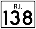
Route 138 is a numbered State Highway running 48.3 miles (77.7 km) in Rhode Island. It is the longest state numbered route in Rhode Island, and the second...
15 KB (818 words) - 17:58, 12 September 2024

is a county located in the U.S. state of Rhode Island. As of the 2020 census, the population was 129,839. Rhode Island counties have no governmental...
21 KB (1,483 words) - 21:41, 2 September 2024
Westerly is a town on the southwestern coastline of Washington County, Rhode Island, United States, first settled by English colonists in 1661, and incorporated...
26 KB (2,257 words) - 18:54, 2 September 2024

in the U.S. state of Rhode Island. As of the 2020 census, the population was 170,363, making it the second-most populous county in Rhode Island. The county...
18 KB (1,316 words) - 21:45, 1 September 2024

Pawtucket (/pəˈtʌkɪt/ puh-TUK-it) is a city in Providence County, Rhode Island. The population was 75,604 at the 2020 census, making the city the fourth-largest...
34 KB (3,243 words) - 06:01, 31 August 2024

Rhode Island, United States. The population was 9,974 as of the 2020 census. The villages of Chepachet and Harmony are in Glocester. Putnam Pike (U.S...
11 KB (893 words) - 13:00, 30 April 2024

Smaller routes include Route 37 (Lincoln Avenue Freeway) connecting 295 to U.S. Route 1, and the Airport Connector Road. The Rhode Island T. F. Green...
32 KB (2,549 words) - 17:51, 23 August 2024
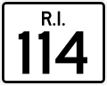
Route 114 is a 45.7-mile-long (73.5 km) numbered state highway in the U.S. state of Rhode Island. It connects the city of Newport to the city of Woonsocket...
22 KB (1,495 words) - 07:09, 10 February 2024
U.S. Route 1 or U.S. Highway 1 (US 1) is a major north–south United States Numbered Highway that serves the East Coast of the United States. It runs 2...
56 KB (5,381 words) - 23:56, 26 August 2024