
river is the Elbe, however, the longest river within the territory is the Výrovka. Short section of the Klejnárka River before its confluence with the Elbe...
10 KB (595 words) - 12:06, 15 August 2024

trail: Červenohorské sedlo – Velký Klínovec mountain – Hřebenová pass – Výrovka summit – Sedlo pod Malým Jezerníkem pass – Malý Jezerník summit – Velký...
37 KB (3,409 words) - 05:22, 4 August 2024

officially inaccessible. A path leads along the southeastern slope from chalet Výrovka to the memorial of the victims of the mountains and then continues to Luční...
4 KB (511 words) - 09:15, 30 July 2018

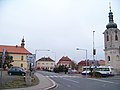
Toušice Municipality The Výrovka River in Toušice Flag Coat of arms Toušice Location in the Czech Republic Coordinates: 49°59′17″N 15°0′24″E / 49.98806°N...
3 KB (91 words) - 17:00, 17 June 2024

Žehrovka Libuňka (in Turnov) Oleška (in Semily) Kamenice Desná Mumlava Vlkava Výrovka Šembera Mrlina (in Nymburk) Cidlina (in Libice nad Cidlinou) Bystřice (in...
28 KB (1,828 words) - 18:42, 22 August 2024

of the Central Elbe Table. The town is situated on the left bank of the Výrovka River. The first written mention of Pečky is in a donation deed of King...
6 KB (330 words) - 18:17, 29 May 2024

of Prague. It lies in a flat landscape in the Central Elbe Table. The Výrovka River flows along the eastern and northeastern municipal border. The Šembera...
5 KB (215 words) - 12:02, 24 June 2024

Švýcárna mountain hut – Velký Jezerník Pass – Velký Jezerník – Kamzík – Výrovka [pl] – Velký Klínovec [pl] – Červenohorské sedlo [pl] The cycling routes...
23 KB (2,093 words) - 21:33, 2 August 2024

Elbe Table. The highest point is at 406 m (1,332 ft) above sea level. The Výrovka River flows through the territory. The first written mention of Zásmuky...
6 KB (427 words) - 08:22, 10 June 2024

highest point is the Radim hill at 268 m (879 ft) above sea level. The Výrovka River flows through the municipality. The first written mention of Radim...
6 KB (362 words) - 09:02, 28 May 2024

Brno. It lies in the Křižanov Highlands. The highest point is the hill Výrovka at 420 m (1,380 ft) above sea level. The municipality is situated on the...
6 KB (363 words) - 12:49, 27 May 2024

highest point is the hill Dubina at 440 m (1,440 ft) above sea level. The Výrovka River flows through the municipality and supplies the Vavřinecký Pond,...
6 KB (362 words) - 12:40, 23 July 2024
point is the hill Dračí skála at 516 m (1,693 ft) above sea level. The Výrovka River originates here and flows across the municipal territory. The first...
7 KB (442 words) - 09:56, 23 July 2024

It lies in a flat agricultural landscape in the Central Elbe Table. The Výrovka River flows along the western municipal border. There is an artificial...
5 KB (229 words) - 11:52, 21 August 2024

496 ft) above sea level. The eastern municipal border is formed by the Výrovka River. The first written mention of Barchovice is from 1340. The area was...
5 KB (306 words) - 12:45, 27 May 2024

above sea level. The market town is situated on the right bank of the Výrovka River. The first written mention of Plaňany is from 1222, under its old...
6 KB (422 words) - 08:38, 28 May 2024