
Vermont Route 73 (VT 73) is a 36.674-mile-long (59.021 km) east–west state highway in central Vermont, United States. It extends from VT 74 in Shoreham...
6 KB (335 words) - 03:16, 19 March 2023

S. Route 7 Vermont Route 12A Vermont Route 17 Vermont Route 22A Vermont Route 23 Vermont Route 30 Vermont Route 53 Vermont Route 73 Vermont Route 74 Vermont...
24 KB (2,069 words) - 15:05, 26 April 2024

water. Vermont Route 22A runs through the town, leading north to Vergennes and south to Fair Haven, where it continues into New York. Vermont Route 73 crosses...
12 KB (1,094 words) - 03:44, 11 May 2024

that extends north from Route 73 in the Brandon village of Forestdale toward Lake Dunmore in Addison County. Vermont Route 73 is an east–west highway...
30 KB (2,991 words) - 15:07, 26 April 2024
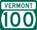
Vermont Route 100 (VT 100) is a north–south state highway in Vermont in the United States. Running through the center of the state, it travels nearly the...
14 KB (496 words) - 02:29, 27 June 2024
and Goshen Four Corners, in the center of the southern part of town. Vermont Route 73 runs east–west through Goshen, passing through Goshen Four Corners...
9 KB (703 words) - 03:40, 11 May 2024

New York State Route 74 (NY 74) and Vermont Route 74 (VT 74) are state highways in the northeastern United States, connected by one of the last remaining...
36 KB (3,470 words) - 20:25, 12 April 2024

Vermont Route 108 (VT 108) is a north–south state highway in northern Vermont, United States. Its southern terminus is at VT 100 in Stowe, and its northern...
6 KB (348 words) - 16:37, 29 August 2023

Rochester is drained by the White River. The town is crossed by Vermont Route 73 and Vermont Route 100. Rochester has a humid continental climate (Köppen Dfb)...
16 KB (974 words) - 03:58, 11 May 2024
Road 73 Texas Park Road 73 Utah State Route 73 Vermont Route 73 Virginia State Route 73 West Virginia Route 73 Wisconsin Highway 73 Wyoming Highway 73 Territories...
6 KB (406 words) - 23:06, 4 April 2024

(275 km) from Montpelier, Vermont, beginning at US 2, to Portland, Maine, at U.S. Route 1. It passes through the states of Vermont, New Hampshire and Maine...
25 KB (1,430 words) - 15:45, 21 March 2024

Highways, and Vermont routes. Routes in Vermont are abbreviated as "VT #" by VTrans and also abbreviated as "VT Route #" and "Route #" in common usage...
62 KB (1,082 words) - 15:16, 10 July 2024

Vermont Route 22A (VT 22A) is a 44.738-mile-long (71.999 km) state highway in western Vermont, United States. It is the northward continuation of New...
14 KB (1,240 words) - 20:42, 18 October 2022

Vermont Route 30 (VT 30) is a 111.870-mile-long (180.037 km) north–south state highway in the U.S. state of Vermont. VT 30 runs from U.S. Route 5 (US...
11 KB (546 words) - 02:03, 26 July 2024

U.S. Route 7 (US 7) is a north–south highway extending from southern Connecticut to the northernmost part of Vermont. In Vermont, the route extends for...
22 KB (959 words) - 04:03, 7 June 2024

Vermont (/vərˈmɒnt/ vər-MONT) is a state in the New England region of the Northeastern United States. It borders Massachusetts to the south, New Hampshire...
217 KB (21,695 words) - 16:45, 2 August 2024

Interstate 91 (redirect from Interstate 91 (Vermont))
miles (89 km) in Massachusetts, and 177 miles (285 km) in Vermont. I-91 parallels US Route 5 (US 5) for all of its length, and many of the exits along...
84 KB (5,171 words) - 06:43, 7 July 2024

Route 7 ("Ethan Allen Highway") Vermont Route 9 ("Molly Stark Trail") Vermont Route 7A ("Shires of Vermont Byway") Vermont Route 67A Vermont Route 279...
48 KB (4,550 words) - 21:09, 24 July 2024

Vermont Route 100 runs through the valley, connecting Waterbury to the north, with Warren and Rochester to the south. Vermont Route 17 leaves Route 100...
12 KB (757 words) - 00:37, 6 May 2024
Burlington is the most populous city in the U.S. state of Vermont and the seat of Chittenden County. It is located 45 miles (72 km) south of the Canada–United...
80 KB (8,096 words) - 13:23, 21 July 2024

Vermont Route 53 (VT 53) is a 9.310-mile-long (14.983 km) state highway in central Vermont, United States. It is a town-maintained highway that extends...
3 KB (241 words) - 03:12, 19 March 2023

1926, the former Route 2 was commissioned as US 5. At this point, the road was not paved. It was not paved until the state of Vermont started overseeing...
27 KB (1,631 words) - 14:48, 17 February 2024

Jeffersonville in the town of Cambridge. Vermont Route 100C leads northeast from Johnson village 4.5 miles (7.2 km) to Vermont Route 100 in North Hyde Park. According...
12 KB (824 words) - 04:08, 11 May 2024

New England road marking system (redirect from New England Interstate Route 17)
then U.S. Route 4, Vermont Route 30, U.S. Route 7, U.S. Route 2, and Vermont Route 225. Route 30A was superseded by Vermont Route 22A, and Route 30B was...
158 KB (6,445 words) - 17:10, 1 February 2024

The northeast corner of town is crossed by Vermont Route 30, following the Mettawee River. Vermont Route 153 runs north–south through the western part...
12 KB (1,026 words) - 03:32, 11 May 2024

Saint Anne's Shrine (category Buildings and structures in Isle La Motte, Vermont)
Shrine is a Roman Catholic shrine and retreat center in Isle La Motte, Vermont, on the shores of Lake Champlain. The shrine and retreat center is located...
5 KB (523 words) - 12:02, 10 June 2024
Manchester Center, Vermont Wikimedia Commons has media related to Manchester, Vermont. 43°10′37″N 73°03′25″W / 43.17694°N 73.05694°W / 43.17694; -73.05694...
9 KB (760 words) - 04:59, 10 July 2024
to U.S. Route 7, a super two freeway. The closest access from US 7 is 1 mile (1.6 km) south of the village in northern Bennington. Vermont Route 7A (the...
7 KB (545 words) - 04:59, 10 July 2024
Brandon, Rutland County, Vermont, United States. The community is located at the intersection of Vermont Route 53 and Vermont Route 73 15.5 miles (24.9 km)...
4 KB (190 words) - 02:59, 17 May 2024

populous county in the U.S. state of Vermont. As of the 2020 census, its population was 168,323. The county seat is Vermont's most populous municipality, the...
29 KB (2,546 words) - 15:06, 26 April 2024