Watersheds of Illinois is a list of basins or catchment areas into which the State of Illinois can be divided based on the place to which water flows....
4 KB (411 words) - 03:31, 22 February 2024

Commission, Lake county, Illinois Retrieved 5/24/21 "Major Watersheds of Illinois" (PDF). Illinois State Water Survey. Illinois Dept. of Natural Resources....
11 KB (866 words) - 22:02, 20 June 2024

natural resource usage, protection, and restoration. List of rivers of Illinois Watersheds of Illinois "Cache River and Cypress Creek Wetlands". Ramsar Sites...
15 KB (1,581 words) - 14:34, 3 August 2024
Ottawa Illinois Department of Natural Resources (2001). "Major Watersheds of Illinois" (PDF). Illinois State Water Survey. Illinois Department of Natural...
3 KB (259 words) - 05:15, 2 July 2024
Australia Watershed Park,a large wooded public park in Olympia, Washington Watershed Trail, a ex-rail footpath from Roxana to Edwardsville in Illinois, US Watershed...
2 KB (308 words) - 16:07, 5 August 2023

The Watersheds of Indiana consist of six distinct Indiana watershed regions that drain into five major bodies of water. With the Kankakee River, the Illinois...
4 KB (380 words) - 12:27, 22 April 2024
List of rivers in the United States Chicago Sanitary and Ship Canal Hennepin Canal Parkway State Park Illinois and Michigan Canal Watersheds of Illinois...
8 KB (581 words) - 01:52, 6 October 2022

County, Indiana List of Illinois rivers List of Indiana rivers Watersheds of Illinois "The National Map". U.S. Geological Survey. Archived from the original...
6 KB (490 words) - 15:46, 23 June 2024
River Watershed, Watersheds of Illinois – 1996, Illinois Environmental Protection Agency. Retrieved October 4, 2007. The Pecatonica River watershed covers...
6 KB (491 words) - 21:01, 19 May 2024

Wabash River (category Rivers of Illinois)
the river. Indiana portal List of Illinois rivers List of Indiana rivers List of rivers of Ohio Watersheds of Illinois Notes Benke, Arthur C.; Cushing...
27 KB (3,211 words) - 19:06, 17 June 2024

Great Lakes Basin (redirect from Great Lakes Watershed)
Lake Erie Basin, and each sub-basin consists of multiple watersheds, such as Pennsylvania's Lake Erie Watershed. The overall Great Lakes Basin is monitored...
4 KB (362 words) - 10:42, 20 June 2023

Ohio River (redirect from List of cities on the Ohio River)
River flood of 1937 Watersheds of Illinois Ohio River Valley AVA Ohio Valley in Kentucky Ohio River Trail Ohio River Water Trail Falls of the Ohio National...
81 KB (8,231 words) - 01:14, 6 August 2024

Global Watersheds, web app and API Stream Stats, from the US Geological Survey, allows you to delineate watersheds in the US only Model My Watershed, by...
30 KB (3,165 words) - 05:31, 6 May 2024

St. Lawrence River Divide (category Lists of coordinates)
Wisconsin south of the shore of Lake Superior. It then follows the boundary between the Wisconsin River and Fox River watersheds. In Illinois and Indiana...
9 KB (771 words) - 00:08, 22 December 2023

County Gallatin County Pope County List of rivers of Illinois Tuttle Bottoms Monster Watersheds of Illinois "GNIS Account Login". "Saline River". U.S...
11 KB (956 words) - 16:24, 28 March 2024
by George Rogers Clark's forces during the Illinois Campaign. List of Illinois rivers Watersheds of Illinois "USGS Current Conditions for USGS 03346500...
8 KB (668 words) - 15:59, 7 May 2024

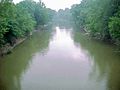
The Illinois River (Miami-Illinois: Inoka Siipiiwi) is a principal tributary of the Mississippi River at approximately 273 miles (439 km) in length. Located...
24 KB (2,153 words) - 18:24, 3 August 2024
the use of combined sewage overflow systems in use by several municipalities within the watershed. List of Illinois rivers Watersheds of Illinois CDM Smith...
5 KB (229 words) - 20:15, 20 February 2023

representatives from Illinois List of United States senators from Illinois List of watersheds in Illinois Maps of Illinois commons:Category:Maps of Illinois Mass media...
19 KB (1,760 words) - 21:35, 9 March 2024

Chicago (redirect from City of Chicago, Illinois)
populous city in the U.S. state of Illinois and in the Midwestern United States. With a population of 2,746,388, as of the 2020 census, it is the third-most...
252 KB (22,375 words) - 02:21, 7 August 2024

measured using Google Earth "Major Watersheds of Illinois" (PDF). Illinois State Water Survey. Illinois Department of Natural Resources. 2001. Archived...
28 KB (2,620 words) - 07:03, 28 July 2024

the U.S. state of Illinois. A suburb of Chicago, it lies about 30 miles (50 km) northwest of Downtown Chicago and 20 miles (32 km) north of O'Hare International...
93 KB (8,337 words) - 22:21, 27 July 2024

Kaskaskia River (category Rivers of Illinois)
Kaskaskia River is a tributary of the Mississippi River, approximately 325 miles (523 km) long, in central and southern Illinois in the United States. The...
6 KB (588 words) - 01:26, 9 November 2020

The Illinois Country (French: Pays des Illinois [pɛ.i dez‿i.ji.nwa]; lit. '"land of the Illinois (plural)"', i.e. the Illinois people) (Spanish: País de...
39 KB (4,586 words) - 10:38, 4 June 2024

the Skillet Fork of the Little Wabash River, part of the Ohio River watershed, which flows to the Mississippi River at Cairo, Illinois. The divide between...
7 KB (627 words) - 23:11, 12 May 2024

the village of Mundelein in northeastern Lake County, Illinois. The lake has an average depth of 7.61 feet (2.32 m), a maximum depth of 23 feet (7.0 m)...
6 KB (314 words) - 21:52, 13 June 2024
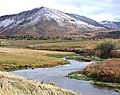
Portneuf River (Idaho) (category Rivers of Idaho)
& L. E. Gentry, 2006. "Timing of riverine export of nitrate and phosphorus from agricultural watersheds". in "Illinois: implications for reducing nutrient...
17 KB (1,850 words) - 14:12, 11 February 2024
of the Illinois River watershed. 3 miles (5 km) northwest of Varna and within the village's postal zone is the 1,400-acre (570 ha) gated community of...
10 KB (687 words) - 23:11, 12 May 2024
The Watershed Trail is a 1.3-mile long (2.1 km) rail trail in Edwardsville, Illinois, that follows an old section of Illinois Terminal Railroad tracks...
1 KB (155 words) - 15:40, 5 February 2023

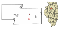
County, Illinois, United States. The population was 22,390 at the 2010 census, and in 2019 the population was recorded to be 23,270. It is part of the Chicago...
24 KB (1,627 words) - 11:26, 16 July 2024