
Willenabrina is a locality located midway between the towns of Warracknabeal and Rainbow in the Wimmera region of northwest Victoria, Australia. The population...
2 KB (131 words) - 05:13, 8 August 2023

Downs area of Queensland, areas around Beulah, Campbells Creek and Willenabrina in Victoria and parts of South Australia including Balaklava. Eventually mice...
22 KB (2,252 words) - 17:15, 2 August 2024

Challamba Dam) • Wilkur (1904–1957 Beyal, Cameron's, Wilkur South) • Willenabrina • Woomelang (Mount Pleasant, Mount Richards) • Wyperfield National...
136 KB (12,146 words) - 05:09, 28 June 2024

Road routes in Victoria assist drivers navigating roads throughout the state, as roads may change names several times between destinations, or have a second...
178 KB (1,263 words) - 13:29, 5 August 2024

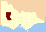
Shire of Yarriambiack (category Local government areas of Victoria (state))
The Shire of Yarriambiack is a local government area of Victoria, Australia, located in the north-western part of the state. It covers an area of 7,326...
9 KB (439 words) - 09:10, 7 September 2023
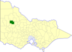
Shire of Warracknabeal (category Former local government areas of Victoria (state))
west-northwest of Bendigo and 60 kilometres (37 mi) north of Horsham, in western Victoria, Australia. The shire covered an area of 1,839 square kilometres (710.0 sq mi)...
5 KB (344 words) - 11:38, 12 May 2023
County of Borung (category Counties of Victoria (state))
Warra Warra Wartook Warung Watchem Watta Wella Werrigar Wilkur Willam Willenabrina Wirchilleba (part in the County of Kara Kara) Witchipool Wonwondah Yellangip...
4 KB (364 words) - 02:50, 23 February 2024