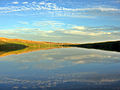
Willow Creek Dam (National Inventory of Dams ID MT00577) is a dam in Lewis and Clark County, Montana. The earthen dam was originally constructed between...
5 KB (177 words) - 18:53, 7 November 2023
Willow Creek Dam can refer to: Willow Creek Dam (Colorado) Willow Creek Dam (Montana) Willow Creek Dam (Nebraska) Willow Creek Dam (Oregon) This disambiguation...
190 bytes (55 words) - 20:52, 30 December 2019
Willow Creek No. 458, Saskatchewan Willow Creek, Alaska Willow Creek, California Willow Creek, Indiana Willow Creek, Minnesota Willow Creek, Montana Willow...
2 KB (336 words) - 20:05, 19 November 2022
Conservation Toston Dam, Toston Reservoir, Montana Department of Natural Resources Willow Creek Dam, Willow Creek Reservoir, USBR Yellowtail Dam, Bighorn Lake...
3 KB (343 words) - 15:12, 2 March 2024
inflows for the Morrison Dam Reservoir. The Poplar River has also been known as: Lost Child Creek and Middle Fork Poplar River. Montana portal List of rivers...
6 KB (522 words) - 13:44, 2 April 2024

2 miles (3 km) downstream of Morony Dam. It is named for the Little Belt Mountains, which it flows through. Willow, cottonwood, chokecherry, and wild roses...
4 KB (242 words) - 03:56, 15 September 2023

Willow Creek, Colorado Willow Creek Dam, Willow Creek, Montana Willwood Diversion Dam, Shoshone River, Wyoming Wind River Diversion Dam, Wind River, Wyoming...
23 KB (2,401 words) - 19:14, 27 September 2023

(2016). "Willow Creek Reservoir #3 (Malheur)". Archived from the original on March 13, 2016. Retrieved March 12, 2016. National Performance of Dams Program...
145 KB (5,874 words) - 04:41, 7 June 2024

List of tributaries of the Columbia River (redirect from Nancy Creek (Washington))
Dam and Lake Umatilla (Washington, Oregon) John Day River (Oregon) Willow Creek (Oregon) Rhea Creek Hinton Creek Umatilla River (Oregon) McNary Dam and...
23 KB (1,609 words) - 19:52, 22 March 2024
Cooney Dam (National Inventory of Dams ID MT00001) is a dam in Carbon County, Montana, that creates Cooney Reservoir. The earthen dam was constructed in...
3 KB (216 words) - 12:54, 8 May 2022

southern Saskatchewan, Canada, and northern Montana, United States, in the Big Muddy Valley and along Big Muddy Creek. Big Muddy Valley is a cleft of erosion...
12 KB (1,210 words) - 02:32, 20 April 2024
Cat Creek (also Frantz or Frantzville) is an unincorporated community in eastern Petroleum County, Montana, United States. The Cat Creek community is located...
21 KB (2,339 words) - 06:03, 9 August 2023

nation. Aurora Reservoir Barker Dam – Barker Reservoir Blue Mesa Dam – Blue Mesa Reservoir Chatfield Reservoir Cherry Creek Reservoir Dillon Reservoir Electra...
41 KB (3,524 words) - 03:57, 15 July 2024

Gibson Dam is a concrete arch dam on the Sun River, a tributary of the Missouri River, about 60 miles (97 km) west of Great Falls, Montana in the United...
18 KB (1,472 words) - 07:00, 3 June 2024

Glacial Lake Missoula (category Geology of Montana)
Oreille). The height of the ice dam typically approached 610 metres (2,000 ft), flooding the valleys of western Montana approximately 320 kilometres (200 mi)...
23 KB (2,487 words) - 03:13, 9 May 2024

Persons Creek Ross Creek Mitchell Creek Red Deer River Alkali Creek Swift Current Creek (flows into Lake Diefenbaker) Brightwater Creek Fish Creek McKay...
16 KB (1,487 words) - 04:22, 6 April 2024

Missouri River (category Rivers of Gallatin County, Montana)
the Fort Peck Dam, and immediately downstream, the Milk River joins from the north. Flowing eastward through the plains of eastern Montana, the Missouri...
189 KB (18,105 words) - 13:07, 8 June 2024
Northwestern Energy. Retrieved 2020-11-19. "Toston Dam (Broadwater-Missouri) Factsheet" (PDF). Montana Department of Natural Resources and Conservation...
27 KB (1,070 words) - 17:26, 17 April 2024

River, located on the Dakota side of the state border with Montana. Horse Creek and Willow Creek flow to the west across the upper portion of the county...
21 KB (1,534 words) - 20:13, 27 April 2024
List of flooded towns in the United States (category Dams in the United States)
flooded by Norris Lake. Willow Grove, flooded by Dale Hollow Lake. Morganton, flooded by Tellico Dam. Tuskegee, flooded by Tellico Dam. Aiken, under Belton...
22 KB (1,707 words) - 14:16, 16 April 2024

rubber boa. Native riparian plant life includes sandbar willows and cottonwoods, with Montana's state tree, the ponderosa pine, also being prevalent. Other...
164 KB (14,832 words) - 14:06, 24 May 2024
between Montana and the mouth of the Missouri that remain undammed or unchannelized. The last 20 miles of the Niobrara River and 6 miles of Verdigre Creek were...
13 KB (1,227 words) - 20:28, 13 April 2024

the river's tributaries include Cottonwood, Stump, Willow, Strawberry, Cedar, Jackknife, and Dry creeks. Towns near the river progressing north include Smoot...
7 KB (628 words) - 16:22, 11 January 2023

Management Trout Creek Mountain Area Grazing Management Project – Montana State University Study of Beavers and Trout on Willow Creek – Oregon State University...
44 KB (4,343 words) - 04:46, 5 December 2022
Wallace Stegner (category People from Great Falls, Montana)
Great Falls, Montana; Salt Lake City, Utah; and the village of Eastend, Saskatchewan, which he wrote about in his autobiography Wolf Willow. Stegner says...
33 KB (3,214 words) - 15:01, 7 April 2024
Snake River (redirect from Snake river dam removal)
during the same period. Caused by the repeated collapse of an ice dam in western Montana, dozens of floods overflowed into the lower Snake River from the...
152 KB (16,134 words) - 17:51, 20 June 2024

beaver dam measuring 2,139 feet (650 m) long, 14 feet (4.3 m) high and 23 feet (7.0 m) thick at the base was found in Three Forks, Montana. Dam building...
29 KB (3,130 words) - 14:00, 3 July 2024

in Alhambra Creek in 2006. The Martinez beavers built a dam 30 feet wide and at one time 6 feet high, and chewed through half the willows and other creekside...
77 KB (8,737 words) - 16:16, 23 June 2024
Jefferson River (category Rivers of Montana)
Park. After the canyon, the river passes into a broad valley again near Willow Creek. The Jefferson converges with the Madison River at Missouri Headwaters...
27 KB (3,040 words) - 13:08, 23 April 2024

662 feet (3,859 m). Mackay Dam and reservoir are on the southwest side of the highway. The highway crosses the Willow Creek Summit at 7,161 feet (2,183 m)...
11 KB (760 words) - 09:56, 24 February 2023