
State Trunk Highway 148 (Highway 148, STH-148 or WIS 148) was a state highway in Manitowoc County, Wisconsin. It ran from US Highway 151 (US 151) and County...
3 KB (368 words) - 21:36, 28 June 2021

organized system of Wisconsin State Trunk Highways (typically abbreviated as STH or WIS), the state highway system for the U.S. state of Wisconsin, was created...
99 KB (275 words) - 17:48, 14 July 2024
Farm to Market Road 148 Utah State Route 148 Virginia State Route 148 Wisconsin Highway 148 (former) Territories Puerto Rico Highway 148 This article includes...
3 KB (236 words) - 23:00, 4 April 2024

U.S. Route 151 (redirect from U.S. Highway 151 (Wisconsin))
U.S. Highway 151 (US 151) is a United States Numbered Highway that runs through the states of Iowa and Wisconsin. The southern terminus for US 151 is...
40 KB (2,426 words) - 03:56, 28 July 2024
State Trunk Highway 35 (STH-35, WIS 35) is a Wisconsin state highway running north–south across western Wisconsin. It is 412.15 miles in length, and is...
38 KB (2,924 words) - 03:07, 25 July 2024

State Trunk Highway 16 (often called Highway 16, STH-16 or WIS 16) is a Wisconsin state highway running from Pewaukee across the state to La Crosse. Much...
31 KB (1,710 words) - 13:06, 20 August 2023

S. Highway 10 U.S. Highway 41 U.S. Highway 45 Wisconsin Highway 21 Wisconsin Highway 26 Wisconsin Highway 44 Wisconsin Highway 47 Wisconsin Highway 76...
21 KB (1,492 words) - 00:33, 18 July 2024

State Trunk Highway 32 (often called Highway 32, STH-32 or WIS 32) is a state highway in the U.S. state of Wisconsin that runs north–south in the eastern...
27 KB (1,611 words) - 23:27, 27 July 2024

Interstate 41 (redirect from Interstate 41 (Wisconsin))
north–south Interstate Highway connecting the interchange of I-94 and U.S. Route 41 (US 41), located about a mile (1.6 km) south of the Wisconsin–Illinois border...
37 KB (1,611 words) - 17:08, 2 August 2024

Highway 26 (often called Highway 26, STH-26, or WIS 26) is a state highway in the U.S. state of Wisconsin. The route is partially a divided highway with...
16 KB (1,079 words) - 05:09, 9 August 2024

Interstate 43 (redirect from Highway 15 (Wisconsin 1933))
Interstate Highway located entirely within the US state of Wisconsin, connecting I-39/I-90 in Beloit with Milwaukee and I-41, U.S. Highway 41 (US 41)...
57 KB (4,262 words) - 22:05, 4 August 2024

U.S. Highway 10 (US 10) in Wisconsin runs east–west across the central part of the state. It runs from the Prescott Drawbridge over the St. Croix River...
31 KB (1,382 words) - 18:11, 20 February 2024

U.S. Highway 41 (US 41) is a north–south highway United States Numbered Highway in eastern Wisconsin. It runs from Pleasant Prairie on the Illinois border...
30 KB (1,177 words) - 03:28, 4 April 2024

Chief Lake is located in the town. U.S. Highway 63, Wisconsin Highway 27, Wisconsin Highway 77, and County Highway B are the main routes in the community...
6 KB (513 words) - 18:05, 9 May 2024

State Trunk Highway 147 (often called Highway 147, STH-147 or WIS 147) is a state highway in the U.S. state of Wisconsin. It runs in northwest–southeast...
3 KB (276 words) - 17:23, 16 February 2024

6 trustees. Presidential elections results Wisconsin Highway 35 – 2nd Avenue within Siren Wisconsin Highway 70 Burnett County Road B Burnett County Airport...
16 KB (1,408 words) - 02:05, 17 May 2024
village in Taylor County, Wisconsin, United States located at the junction of Wisconsin Highway 102 and Taylor County Highway D. The population was 910...
12 KB (1,087 words) - 04:09, 15 August 2020

Interstate 90 (redirect from Interstate Highway 90)
From the Wisconsin–Illinois state line to Massachusetts, approximately 760 miles (1,220 km) of I-90 uses turnpikes and other tolled highways with the...
126 KB (10,988 words) - 22:43, 16 August 2024

U.S. Highway 14 (US 14) in the state of Wisconsin runs northwest–southeast across the western to southwest portions of the state. It links La Crosse and...
22 KB (1,127 words) - 21:45, 8 July 2024

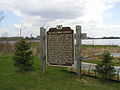
State Trunk Highway 149 (Highway 149, STH-149 or WIS 149) was a state highway in the U.S. state of Wisconsin. It ran through 40.1 miles (64.5 km) of Manitowoc...
5 KB (607 words) - 17:22, 16 February 2024

(signed by the Wisconsin Department of Transportation as "Two Creeks") is an unincorporated community at the intersection of Wisconsin Highway 42 and Two...
6 KB (405 words) - 12:45, 20 August 2024

Fairchild is a village in Eau Claire County, Wisconsin, United States. The population was 550 at the 2010 census. The village is located within the Town...
12 KB (940 words) - 06:10, 24 May 2024

Highway 14 Highway 56 (Wisconsin) Highway 58 (Wisconsin) Highway 60 (Wisconsin) Highway 80 (Wisconsin) Highway 130 (Wisconsin) Highway 131 (Wisconsin)...
16 KB (951 words) - 03:51, 1 August 2024

Illinois Route 83 (redirect from Kingery Highway)
state highway in northeast Illinois. It stretches from U.S. Route 30 (US 30, Lincoln Highway) by Lynwood and Dyer, Indiana, north to the Wisconsin border...
13 KB (530 words) - 04:09, 29 December 2023

Highway 51 U.S. Highway 151 Highway 13 Highway 16 Highway 22 Highway 23 Highway 33 Highway 44 Highway 60 Highway 73 Highway 78 Highway 89 Highway 113...
19 KB (1,239 words) - 06:36, 18 July 2024

U.S. Route 12 (redirect from United States Highway 12)
the North Dakota border at a distance of 92.4 miles (148.7 km). US 12 is a two-lane undivided highway that runs 87.47 miles (140.77 km), through Adams, Bowman...
36 KB (3,577 words) - 18:30, 23 August 2024

served by U.S. Route 12, as well as two Wisconsin state highways; Wisconsin Highway 50 and Wisconsin Highway 120. Margaret H. Bair - U.S. Air National...
19 KB (1,762 words) - 19:39, 17 August 2024
easternmost part of the Town of Eileen. The junction of US Highway 2 (US 2) and Wisconsin Highway 13 (WIS 13) is located at this city. It is the home of Northland...
56 KB (5,280 words) - 14:21, 7 August 2024

a village in Polk County, Wisconsin, United States. The population was 895 at the 2010 census. It is along Wisconsin Highway 35. The community has the...
12 KB (1,008 words) - 01:02, 16 May 2024
U.S. Route 12 in Minnesota (redirect from U.S. Highway 12 (Minnesota 1934))
U.S. Highway 12 (US 12) is a 192.798-mile-long (310.278 km) United States Numbered Highway in west- and east-central Minnesota, which travels from the...
13 KB (444 words) - 01:39, 5 August 2024