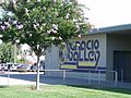
Ygnacio Valley Road is a major arterial road in central Contra Costa County, California. It extends from Interstate 680 and SR 24 in Walnut Creek to SR...
8 KB (250 words) - 18:43, 2 September 2024
Ygnacio Valley High School (YVHS) is a public secondary school located in Concord, California, United States. It draws students from Concord as well as...
12 KB (1,092 words) - 18:41, 8 September 2024
developer Joseph Eichler built a subdivision north of Shell Ridge and Ygnacio Valley Road.[citation needed] Rancho San Miguel Homeowner's Association Rancho...
959 bytes (102 words) - 23:32, 23 March 2023

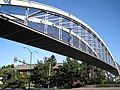
Creek, adjacent to Interstate 680 and near the Ygnacio Valley Road and California Boulevard arterial roads. The elevated BART tracks run approximately northeast–southwest...
11 KB (1,062 words) - 00:36, 23 May 2024

Iron Horse Regional Trail (category Amador Valley)
thoroughfares to help improve traffic flow; two notable ones cross over Ygnacio Valley Road in Walnut Creek and Treat Boulevard in Contra Costa Centre. Additional...
11 KB (977 words) - 18:54, 31 May 2024

include Willow Pass Road, Concord Avenue, Concord Boulevard, Clayton Road, Monument Boulevard, Ygnacio Valley Road, Oak Grove Road and Treat Boulevard...
55 KB (4,623 words) - 18:00, 22 August 2024

California State Route 24 (category Infobox road instances in California)
in Walnut Creek to Route 4 in Pittsburg that followed the Ygnacio Valley Road-Kirker Pass Road-Railroad Avenue corridor, presumably as a future extension...
16 KB (1,425 words) - 19:21, 6 June 2024

Baccalaureate program and the second high school in Contra Costa County, with Ygnacio Valley High School to have the rigorous program. The PVHS IB Diploma Programme...
8 KB (627 words) - 09:25, 2 September 2024

Interstate 680 (California) (category Infobox road instances in California)
was very close to the present I-680, following such roads as Pleasanton Sunol Road, San Ramon Valley Boulevard, Danville Boulevard, Main Street in Walnut...
40 KB (3,734 words) - 08:18, 11 September 2024
List of unconstructed state highways in California (category Lists of roads in California)
to SR 4 near Pittsburg is unconstructed. It is today's Ygnacio Valley Road, Kirker Pass Road and Railroad Avenue. Originally, the route overlapped I-680...
47 KB (5,449 words) - 03:19, 29 December 2023
San Ygnacio de la Alamosa, also known as Alamosa, is now a ghost town, in Sierra County, New Mexico, United States. San Ygnacio de la Alamosa was founded...
13 KB (1,877 words) - 00:28, 21 July 2024

Rancho La Ballona (redirect from Ygnacio Machado)
rancho was confirmed by Alta California Governor Juan Alvarado in 1839, to Ygnacio and Augustin Machado and Felipe and Tomas Talamantes. The Machados and...
14 KB (1,402 words) - 04:52, 3 March 2024
Mount Diablo Unified School District (redirect from Ygnacio Valley Elementary School)
Woodside Wren Avenue Ygnacio Valley Diablo View El Dorado Foothill Oak Grove Pine Hollow Pleasant Hill Riverview Sequoia (magnet school) Valley View College Park...
10 KB (748 words) - 05:37, 19 August 2023
Claremont Claremont Colleges - Claremont Mt. San Antonio College - Walnut Ygnacio Palomares Adobe, List of Registered Historic Places in Los Angeles County...
13 KB (1,149 words) - 00:35, 31 January 2024
Ysidro. This land had been granted to Californio ranchero Ygnacio Ortega in 1809. Following Ygnacio's death in 1833, his daughter Clara Ortega de Gilroy and...
39 KB (3,618 words) - 05:01, 8 September 2024
Russian River (California) (redirect from Russian River Valley)
Russian-American Company chart dated 1817. In 1827 the Spanish called it the San Ygnacio, and in 1843 the Spanish land grant referred to it as Rio Grande. The river...
29 KB (3,014 words) - 04:01, 2 July 2024
current route. Farm to Market Road 3169 (FM 3169) is located in Zapata County. The western terminus of FM 3169 is in San Ygnacio at US 83. The route travels...
46 KB (4,952 words) - 21:16, 26 August 2024

Paso/Juarez Historical Museum. Fish, Jean Y (1989). Brief History of San Ygnacio. Zapata, TX: Zapata County Historical Commission. p. 21b. "1000 Square...
31 KB (399 words) - 22:34, 29 August 2024

it 48 miles (77 km) southwards, distributing water to the Clayton and Ygnacio Canals in the process, and supplying water to Contra Loma Dam, eventually...
315 KB (19,703 words) - 14:16, 18 August 2024

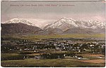
/ 37.90639; -122.06500. Portions lie in both the San Ramon Valley and the Ygnacio Valley below the western slopes of Mount Diablo. According to the United...
42 KB (3,800 words) - 22:08, 10 August 2024
Rancho El Conejo (category Conejo Valley)
California given in 1803 to Jose Polanco and Ygnacio Rodriguez that encompassed the area now known as the Conejo Valley in southeastern Ventura and northwestern...
7 KB (684 words) - 22:45, 1 May 2023

Business routes of U.S. Route 83 in Texas (redirect from U.S. Route 83 Business (San Ygnacio, Texas))
(Bus. US 83-N) is a business loop of US 83 that serves the town of San Ygnacio. Bus. US 83-N begins at an intersection with US 83 two blocks north of...
7 KB (813 words) - 20:21, 26 August 2024

in the San Ygnacio Historic District; note the structural similarity to Los Corralitos Building A two-story historic residence in San Ygnacio on U.S. Highway...
17 KB (1,298 words) - 15:32, 3 August 2024

planted a fruit tree there. The city was first settled by Ricardo Véjar and Ygnacio Palomares in the 1830s when California and much of the now-American Southwest...
59 KB (4,493 words) - 17:21, 28 August 2024
Mexican agricultural settlement named San Ygnacio de la Alamosa that had been founded in 1859. San Ygnacio de la Alamosa, commonly called Alamosa, was...
8 KB (671 words) - 17:36, 23 November 2023

Jornada del Muerto (redirect from Jornada del Muerto Valley)
use of the road led to native New Mexican settlements on the lower Rio Grande, at Santa Barbara, near Fort Thorn in 1853 and San Ygnacio de Alamosa 35...
22 KB (2,588 words) - 12:34, 20 March 2024
near the Pomona Freeway (SR 60), the Orange Freeway (SR 57), and the Chino Valley Freeway (SR 71). The zip code serving the neighborhood is 91766. Phillips...
8 KB (1,094 words) - 06:18, 28 July 2024
Bassett. Bernal Road — named after Ygnacio Bernal's 400 acres of fruit and vegetable farmland in southeast San Jose. Berryessa Road — named after San...
28 KB (3,321 words) - 00:31, 20 March 2024
Glendora, California (category Communities in the San Gabriel Valley)
areas in 6000 BC and lived there until the Spanish colonized California. Ygnacio Palomares received the 22,340-acre (90 km2) land grant Rancho San Jose...
48 KB (4,208 words) - 06:42, 9 September 2024

and is used as the headquarters of the Centinela Valley Historical Society. Two years later, Ygnacio was granted the 2,220-acre (9.0 km2) Rancho Aguaje...
106 KB (8,961 words) - 22:58, 7 September 2024