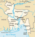
Bangladesh–India border, known locally as the Radcliffe line (IB), is an international border running between the republics of Bangladesh and India that...
43 KB (3,754 words) - 13:17, 21 November 2024
Republic of India shares borders with several sovereign countries; it shares land borders with China, Bhutan, Nepal, Pakistan, Bangladesh, and Myanmar...
33 KB (2,467 words) - 02:20, 24 October 2024
The 2001 Bangladesh–India border clashes were a series of armed skirmishes between India and Bangladesh in April 2001. The clashes took place between troops...
28 KB (2,480 words) - 17:47, 25 October 2024
the 4,427 kilometres (2,751 mi) border of Bangladesh with India and Myanmar. It was formerly known as the Bangladesh Rifles (BDR). BGB boasts a military...
47 KB (4,211 words) - 03:42, 17 November 2024
Bangladesh–India relations are the bilateral relations between the People's Republic of Bangladesh and the Republic of India, both of which are South Asian...
53 KB (5,322 words) - 14:02, 16 November 2024
Deaths along the Bangladesh–India border occur many times a year as result of people attempting to illegally cross into India from Bangladesh, for walking...
35 KB (2,496 words) - 01:10, 9 November 2024
along the Bangladesh–India border, in Bangladesh and the Indian states of West Bengal, Tripura, Assam and Meghalaya. The main body of Bangladesh contained...
67 KB (2,986 words) - 03:17, 22 October 2024
The Bangladesh–Myanmar border is the international border between the countries of Bangladesh and Myanmar (formerly Burma). The border stretches 271.0...
11 KB (952 words) - 03:24, 17 November 2024
India’s borders with Pakistan and Bangladesh. It was formed in the wake of the Indo-Pakistani War of 1965 to ensure the security of India’s borders and for...
48 KB (4,215 words) - 19:54, 2 November 2024
India–Bangladesh border haat is a Haat or a trading post on Bangladesh–India border, jointly organised by the governments of Bangladesh and India, held...
8 KB (542 words) - 12:24, 30 April 2024
The India–Myanmar border is the international border between India and Myanmar (formerly Burma). The border is 1,643 kilometres (1,021 mi) in length and...
24 KB (2,403 words) - 21:57, 10 November 2024
Publishing Limited, pp. 149-157 Jamwal, N.S. "Border Management: Dilemma of Guarding the India-Bangladesh border" (PDF). Strategic Analysis, January–March...
54 KB (5,554 words) - 10:08, 22 November 2024
the entire border due to densely forested rugged mountains, riverine and marshy areas. India has similar fence on borders with Bangladesh and Myanmar...
19 KB (1,765 words) - 05:28, 13 November 2024
Siliguri Corridor (redirect from Chicken's Neck (India))
connects the seven states of northeast India to the rest of the India. The countries of Nepal and Bangladesh lie on each side of the corridor and the...
16 KB (1,562 words) - 10:11, 14 September 2024
(China–Mongolia border) Bangladesh – India: 4,053 km (2,518 mi) (Bangladesh–India border) China – Russia: 3,645 km (2,265 mi) (China–Russia border) Mongolia...
67 KB (2,261 words) - 05:31, 19 October 2024
Dawki (category Bangladesh–India border crossings)
Meghalaya, India. It is located at 25°11′0″N 92°1′0″E / 25.18333°N 92.01667°E / 25.18333; 92.01667, on the border between India and Bangladesh. Dawki Integrated...
6 KB (359 words) - 08:01, 29 August 2024
Bangladeshis in India are members of the Bangladesh diaspora who currently reside in India. The mass migration into India since Bangladesh independence...
12 KB (1,314 words) - 18:41, 31 August 2024
Transport between India and Bangladesh bears much historical and political significance for both countries, which possessed no ground transport links for...
19 KB (1,742 words) - 14:26, 18 July 2024
Minister of Bangladesh. It is a daily military exercise, similar to the Wagah Border ceremony, and engages soldiers of Border Security Force (India) and the...
7 KB (478 words) - 02:37, 5 September 2024
is an international border crossing between Benapole, Jessore, Bangladesh, and Petrapole, North 24 Parganas, West Bengal, India. At the time of Partition...
10 KB (917 words) - 09:01, 22 October 2024
India also resolved its border disputes with Bangladesh and Sri Lanka. The territorial disputes between India and China result from the historical consequences...
41 KB (3,816 words) - 18:32, 30 September 2024
Banglabandha (category Bangladesh–India border)
Despite the geographical proximity of the borders of India, Bangladesh, Nepal and Bhutan, the issues of border control and territorial sovereignty have...
9 KB (823 words) - 22:40, 21 October 2024
10-year-old Bangladeshi girl who was shot and killed by Indian Border Security Force (BSF) on 7 January 2011, along the Bangladesh–India border. A photograph...
4 KB (318 words) - 01:51, 22 October 2024
Tin Bigha Corridor (category Bangladesh–India border)
strip of land belonging to India on the West Bengal–Bangladesh border which, in September 2011, was leased to Bangladesh so the country could access...
9 KB (937 words) - 00:10, 22 October 2024
The 2015 Bangladesh–Arakan Army border clash took place between 25 August 2015 and 26 August 2015 in the Bandarban District, near the Bangladesh–Myanmar...
11 KB (957 words) - 16:33, 27 October 2024
Dahala Khagrabari (category Bangladesh–India border)
Bangladesh–India border belonging to the district of Cooch Behar in the state of West Bengal. This was a piece of India within a piece of Bangladesh within...
5 KB (482 words) - 00:35, 22 October 2024
Indian side of Petrapole-Benapole border checkpoint between India and Benapole of Bangladesh, on the Bangladesh-India border, near Bongaon in North 24 Parganas...
12 KB (706 words) - 13:44, 25 May 2024
an area of 148,460 square kilometres (57,320 sq mi). Bangladesh shares land borders with India to the north, west, and east, and Myanmar to the southeast...
243 KB (20,341 words) - 04:55, 22 November 2024
Chilahati railway station (category Railway stations in Bangladesh opened in 1876)
border railway station in Bangladesh, situated in Nilphamari District, in Rangpur Division. It is an active railway transit point on the Bangladesh-India...
6 KB (548 words) - 05:10, 22 October 2024
of transboundary rivers in Bangladesh is about 57. The number of transboundary or joint rivers between India and Bangladesh is officially 54. But a 2023...
41 KB (642 words) - 17:50, 13 November 2024


