21 routes assigned to the "G" zone of the California Route Marker Program, which designates county routes in California. The "G" zone includes county highways...
82 KB (6,527 words) - 17:52, 3 September 2024
County routes in the U.S. state of California are controlled and maintained by the respective counties in which they are located. However, they are generally...
50 KB (444 words) - 00:29, 25 April 2024

98°W / 33.73; -115.98 Riverside County is a county located in the southern portion of the U.S. state of California. As of the 2020 census, the population...
140 KB (6,206 words) - 20:10, 31 August 2024

Southern California, United States. As of the 2020 census, the population was 3,186,989, making it the third-most-populous county in California, the sixth-most-populous...
213 KB (16,683 words) - 20:42, 8 September 2024

Mono County (/ˈmoʊnoʊ/ MOH-noh) is a county located in the east central portion of the U.S. state of California. As of the 2020 census, the population...
49 KB (2,016 words) - 16:31, 21 August 2024

Mendocino County (/ˌmɛndəˈsiːnoʊ/ ; Mendocino, Spanish for "of Mendoza") is a county located on the North Coast of the U.S. state of California. As of the...
84 KB (4,789 words) - 16:45, 21 August 2024

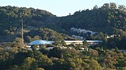
Santa Clara County, officially the County of Santa Clara, is the sixth-most populous county in the U.S. state of California, with a population of 1,936...
109 KB (6,280 words) - 15:23, 6 September 2024

San Mateo County (/ˌsæn məˈteɪ.oʊ/ SAN mə-TAY-oh), officially the County of San Mateo, is a county in the U.S. state of California. As of the 2020 census...
114 KB (5,953 words) - 14:00, 21 August 2024
2019 Ridgecrest earthquakes (redirect from 2019 earthquake in California)
5 occurred north and northeast of the town of Ridgecrest, California located in Kern County and west of Searles Valley (approximately 200 km [122 mi]...
68 KB (6,304 words) - 00:01, 3 September 2024

Portuguese Bend (category Geography of Los Angeles County, California)
Palos Verdes Peninsula, in Los Angeles County, California. Though once slated for development including the projected route of Crenshaw Boulevard, the...
22 KB (2,823 words) - 02:07, 9 September 2024

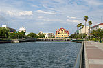
San Francisco (redirect from San Francisco County, California)
officially the City and County of San Francisco, is the commercial, financial, and cultural center of Northern California. With a population of 808...
267 KB (24,654 words) - 03:35, 11 September 2024

Monterey County (/ˌmɒntəˈreɪ/ MON-tə-RAY), officially the County of Monterey, is a county located on the Pacific coast in the U.S. state of California. As...
89 KB (4,427 words) - 18:34, 21 August 2024

both Route 7 and Route 710. The California Streets and Highways Code defines Route 710 as follows: 622. Route 710 is from Route 1 to Route 210 in Pasadena...
42 KB (3,311 words) - 08:39, 11 September 2024

The nearby State Routes 41 and 46 provide access to the Pacific Coast and the Central Valley of California. Founded by E. G. Lewis in 1913, the city grew...
31 KB (3,252 words) - 05:13, 6 September 2024

Sonoma County (/səˈnoʊmə/ ) is a county located in the U.S. state of California. As of the 2020 United States Census, its population was 488,863. Its seat...
139 KB (9,553 words) - 14:19, 21 August 2024

Modoc County (/ˈmoʊdɒk/ ) is a county located in the far northeast corner of the U.S. state of California. Its population is 8,700 as of the 2020 census...
58 KB (3,590 words) - 12:40, 22 August 2024

List of UTC offsets (redirect from Time Zone Map)
Island Mexico Baja California United Kingdom Pitcairn Islands United States (Pacific Time Zone) California Idaho The northern counties of Benewah, Bonner...
61 KB (4,178 words) - 20:52, 6 July 2024
S. state of California. As of the 2020 census, the population was 262,231. Its county seat and largest city is San Rafael. Marin County is across the...
92 KB (5,542 words) - 16:31, 31 August 2024

Ventura County (/vɛnˈtʊərə/ ) is a county located in the southern part of the U.S. state of California. As of the 2020 census, the population was 843,843...
140 KB (10,511 words) - 07:08, 7 September 2024

Humboldt County (/ˈhʌmboʊlt/ ) is a county located in the U.S. state of California. As of the 2020 census, the population was 136,463. The county seat is...
135 KB (7,777 words) - 09:26, 24 August 2024

three-digit route numbers are generally subsidiaries of two-digit primary routes. Of these two-digit routes, the principal north–south routes were assigned...
123 KB (10,937 words) - 21:47, 30 August 2024

city in Sierra County, California, United States. At the 2020 census, the population was 740, reflecting a decline of 29 from the 769 counted in 2010...
19 KB (1,617 words) - 22:21, 3 August 2024

Mount Tallac (category Tourist attractions in El Dorado County, California)
mountain peak southwest of Lake Tahoe, in El Dorado County, California. The peak lies within the Desolation Wilderness in the Eldorado National Forest. It is...
5 KB (438 words) - 08:54, 11 August 2024

California is a state in the Western United States, lying on the American Pacific Coast. It borders Oregon to the north, Nevada and Arizona to the east...
276 KB (23,804 words) - 19:01, 12 September 2024
its name with the county, is located in Fresno County. San Joaquin County was one of the original counties of California, created in 1850 at the time of...
80 KB (4,327 words) - 17:12, 31 August 2024
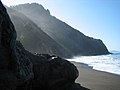
Lost Coast (category Geography of Humboldt County, California)
highway or county road builders to establish routes through the area, leaving it the most undeveloped and remote portion of the California coast. Without...
10 KB (1,185 words) - 16:54, 3 January 2024
Inyo County (/ˈɪnjoʊ/ ) is a county in the eastern central part of the U.S. state of California, located between the Sierra Nevada and the state of Nevada...
66 KB (3,697 words) - 15:04, 21 August 2024
data from zone.tab. The most extensive study of time zone history in Indiana was published in The American Atlas (1978) by Thomas G. Shanks, in which the...
36 KB (3,572 words) - 18:10, 12 August 2024

ZIP Code (redirect from Postal zone)
inconsistencies caused by the aforementioned sparse delivery routes, often known as Rural Routes or by some other similar designation. There are generally...
47 KB (5,668 words) - 03:50, 10 September 2024
Amador County (/ˈæmədɔːr/ ) is a county located in the U.S. state of California, in the Sierra Nevada. As of the 2020 census, the population was 40,474...
50 KB (2,419 words) - 19:56, 25 August 2024