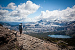
Eldorado National Forest is a U.S. National Forest located in the central Sierra Nevada mountain range, in eastern California. Most of the forest (72...
9 KB (834 words) - 01:03, 8 October 2024
girls in Placerville and hiding their bodies in the Eldorado National Forest in 1984. Dubbed The Forest Killer by the media, he was sentenced to death the...
8 KB (897 words) - 23:07, 27 August 2024
October 19, 2012. "Eldorado National Forest". U.S. Forest Service. Retrieved October 19, 2012. "El Yunque National Forest". U.S. Forest Service. Retrieved...
116 KB (2,722 words) - 01:13, 8 October 2024
Rubicon Trail (category Eldorado National Forest)
(19 km) long and passes in part through the Eldorado National Forest as well as the Tahoe National Forest and the Lake Tahoe Basin Management Unit. The...
12 KB (1,583 words) - 16:25, 10 July 2024
Tahoe Rim Trail (category Eldorado National Forest)
with shorter segments in the Tahoe National Forest and the Carson Ranger District of the Humboldt–Toiyabe National Forest. The main hiking season is usually...
5 KB (397 words) - 20:14, 23 March 2023
Mountain (Eldorado National Forest) Bald Mountain (Inyo National Forest) Bald Mountain (Sequoia National Forest) Bald Mountain (Sierra National Forest) Baldy...
28 KB (3,106 words) - 19:26, 16 October 2024
Heber Springs Bridalveil Fall, in Yosemite National Park Bridal Veil Falls (Eldorado), in Eldorado National Forest Bridal Veil Falls (Colorado Springs), in...
4 KB (454 words) - 15:19, 3 January 2024
Desolation Wilderness (category Eldorado National Forest)
960-acre (258.8 km2) federally protected wilderness area in the Eldorado National Forest and Lake Tahoe Basin Management Unit, in El Dorado County, California...
10 KB (930 words) - 02:04, 9 January 2024
Elephants Back (category Eldorado National Forest)
Elephants Back is a 9,585-foot-elevation (2,922 meter) mountain summit located in Alpine County, California, United States. This landmark of Hope Valley...
7 KB (610 words) - 06:00, 26 November 2023
summit. The cliffs of Lover's Leap run horizontally through the Eldorado National Forest for over a third of a mile (0.6 km), with heights between 250 and...
7 KB (480 words) - 16:02, 6 May 2023
California. The peak lies within the Desolation Wilderness in the Eldorado National Forest. It is quite visible from State Routes 89 and 28, and U.S. Route...
5 KB (438 words) - 08:54, 11 August 2024
List of Sierra Nevada topics (section National forests)
Postpile National Monument Eldorado National Forest Humboldt-Toiyabe National Forest Inyo National Forest Lake Tahoe Basin Management Unit Plumas National Forest...
11 KB (856 words) - 22:24, 20 July 2024
The town is accessible by State Route 88. Kirkwood is within the Eldorado National Forest. The population was 158 at the 2010 census. For statistical purposes...
17 KB (1,270 words) - 05:15, 29 October 2024
large wildfire that burned 221,835 acres (89,773 hectares) in the Eldorado National Forest and other areas of the Sierra Nevada in El Dorado, Amador, and...
72 KB (3,798 words) - 14:54, 30 October 2024
Hell Hole Reservoir (category Eldorado National Forest)
Water Agency. The agency controls two dams in the Eldorado National Forest and Tahoe National Forest. The water agency gained its power from financing...
18 KB (2,355 words) - 17:10, 18 October 2024
In 2014 the King Fire burned 97,717 acres (39,545 ha) in the Eldorado National Forest and on private land, destroying 80 structures, including residences...
17 KB (1,568 words) - 16:27, 30 October 2024
Eagle Falls trailhead (category Eldorado National Forest)
Falls trailhead or Eagle Lake trailhead is located in the El Dorado National Forest, in the Sierra Nevada, within Emerald Bay State Park, on the western...
1 KB (114 words) - 08:30, 23 March 2024
El Dorado County, California (redirect from Eldorado County)
northwest corner of the county. Much of the county is public land. The Eldorado National Forest comprises a significant portion (approximately 43%) of the county's...
63 KB (3,519 words) - 16:02, 9 November 2024
Jobs Sister (category Eldorado National Forest)
Alpine County, as well as the boundary Eldorado National Forest shares with Humboldt-Toiyabe National Forest. It is set on the crest of the Carson Range...
5 KB (406 words) - 10:46, 11 February 2024
The Nipple (category Eldorado National Forest)
It is set on the boundary shared by Humboldt–Toiyabe National Forest and Eldorado National Forest. Precipitation runoff from the peak's north and east...
5 KB (336 words) - 09:23, 4 November 2023
Horsetail Falls (California) (category Eldorado National Forest)
hiking north out of the Twin Bridges trailhead on U.S. Route 50. There is a forest service parking area designated to the area. It is located at 38°49′40.28″N...
2 KB (106 words) - 14:36, 9 May 2024
Upper American River Project (category Eldorado National Forest)
The Upper American River Project (UARP) is a hydroelectric system operated by the Sacramento Municipal Utility District (SMUD) of Sacramento, California...
7 KB (481 words) - 16:25, 23 September 2023
Kirkwood is accessible via State Route 88 and is nestled within the Eldorado National Forest. While most of the region's resorts are situated at the northern...
5 KB (341 words) - 23:46, 20 July 2024
Freel Peak (category Eldorado National Forest)
Alpine County; and the boundary between the Eldorado National Forest and the Humboldt-Toiyabe National Forest. At 10,886 feet (3,318 m), it is the tallest...
6 KB (390 words) - 17:13, 19 July 2024
the Rim Fire in Yosemite National Park and the Stanislaus National Forest and the King Fire on the Eldorado National Forest, has prompted concerns. A...
73 KB (7,455 words) - 19:24, 18 November 2024
Carson Pass (category Eldorado National Forest)
mountain pass on the crest of the central Sierra Nevada, in the Eldorado National Forest and Alpine County, eastern California. The pass is traversed by...
11 KB (746 words) - 19:35, 28 August 2024
Lyons trailhead (category Eldorado National Forest)
Pyramid Peak (California) can be reached from this trailhead as well. USDA Forest Service Trailhead Information 38°48′39.12″N 120°14′24.88″W / 38.8108667°N...
943 bytes (97 words) - 12:53, 29 September 2021
American River (category Eldorado National Forest)
Sacramento County. The river's three forks originate in the Tahoe and Eldorado National Forests. The North and Middle Forks join near Auburn, and continue downstream...
40 KB (4,164 words) - 19:33, 1 November 2024
Wrights Lake (category Eldorado National Forest)
Wrights Lake is in the Sierra Nevada mountain range, west of Lake Tahoe on the western border of the Desolation Wilderness. It can be reached via Wrights...
2 KB (102 words) - 15:47, 2 October 2024
Camino, Placerville and Lake Tahoe Railroad (category Eldorado National Forest)
Sacramento. It was built primarily to haul lumber from the El Dorado National Forest. The standard gauge line ran west 8.05 miles (12.96 km) from a sawmill...
5 KB (541 words) - 08:34, 26 September 2024


