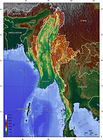
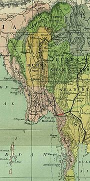
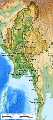
domain material from The World Factbook. CIA. Myanmar Marine Biodiversity Atlas Online Ramsar – Burma Burma – Geography The Geology of Burma (Myanmar)...
46 KB (3,406 words) - 23:15, 2 November 2024
Yangon (redirect from Geography of Yangon)
language The New Light of Myanmar – are published by the government. Semi-governmental The Myanmar Times weekly, published in Burmese and in English, is mainly...
106 KB (9,652 words) - 14:50, 21 November 2024
Britannica Geographic data related to Myanmar at OpenStreetMap Wikimedia Atlas of Myanmar Interactive timeline of turning points in Burmese history Archived...
272 KB (24,197 words) - 01:28, 22 November 2024
language, Burma is known as Myanmar Pyi (Burmese: မြန်မာပြည်). Myanmar Pyi is the written, literary name of the country, while Bama is the spoken name of the...
37 KB (4,352 words) - 23:13, 13 November 2024
Development of Myanmar. Singapore: Inst. of Southeast Asian Studies. ISBN 978-9812302113. "Best Time to visit Myanmar". 2018-02-02. "Myanmar Climate Report"...
29 KB (1,647 words) - 03:37, 7 April 2024
Lower Myanmar (Burmese: အောက်မြန်မာပြည်, also called Lower Burma) is a geographic region of Myanmar and includes the low-lying Irrawaddy Delta (Ayeyarwady...
3 KB (306 words) - 21:39, 18 November 2024
The Myanmar Civil War (Burmese: မြန်မာပြည်တွင်းစစ်), also known as the Burmese Civil War, Burmese Spring Revolution, or People's Defensive War, is an...
395 KB (33,462 words) - 14:11, 24 November 2024
(Burmese: အညာ) is a region of Myanmar located in central Upper Myanmar. The population centre of the country, as much as nearly one third of Myanmar's...
9 KB (837 words) - 21:13, 9 November 2024
Myanmar (formerly Burma) (Burmese: မြန်မာ) operates de jure as a unitary assembly-independent presidential republic under its 2008 constitution. On 1...
46 KB (4,916 words) - 16:18, 18 November 2024
Tatmadaw (redirect from Military of Myanmar)
forces of Myanmar (formerly Burma). It is administered by the Ministry of Defence and composed of the Myanmar Army, the Myanmar Navy and the Myanmar Air...
106 KB (9,925 words) - 16:20, 18 November 2024
Upper Myanmar (Burmese: အထက်မြန်မာပြည် or မြန်မာပြည်အထက်ပိုင်း, also called Upper Burma) is one of two geographic regions in Myanmar, the other being Lower...
17 KB (1,561 words) - 16:43, 19 November 2024
surrounded by Myanmar (Burma), Cambodia, the People's Republic of China, Thailand, and Vietnam. About seventy percent of its geographic area is made up of mountain...
22 KB (1,691 words) - 21:25, 15 November 2024
This is a demography of Myanmar (also known as Burma) including statistics such as population, ethnicity, language, education level, and religious affiliations...
42 KB (1,683 words) - 07:55, 23 November 2024
following outline is provided as an overview of and topical guide to Myanmar: Myanmar, also known as Burma, is the most extensive country in mainland Southeast...
16 KB (1,165 words) - 06:10, 19 October 2024
production in Myanmar accounts for approximately 43% of total agricultural production in the country, making it the seventh largest producer of rice in the...
18 KB (2,223 words) - 05:21, 14 October 2024
were lifted in 2012. Myanmar exported $1.6 billion worth of garments and textiles in 2016. Burma (Myanmar) is the largest producer of methamphetamines in...
94 KB (9,253 words) - 21:48, 31 October 2024
introduction of faster mobile 3G internet by transnational telecommunication companies Telenor Myanmar and Ooredoo Myanmar, later joined by national Myanmar Post...
51 KB (5,340 words) - 02:28, 11 November 2024
Many cities and towns in Myanmar were renamed in 1989 by the State Law and Order Restoration Council following a seizure of power by Saw Maung. Some places...
2 KB (73 words) - 12:26, 17 June 2024
system of Myanmar (also known as Burma) is operated by the government Ministry of Education. Universities and professional institutes from upper Burma and...
21 KB (2,407 words) - 17:42, 18 November 2024
display the Burmese script in this article correctly. Insurgencies have been ongoing in Myanmar since 1948, when the country, then known as Burma, gained...
160 KB (14,546 words) - 17:22, 22 November 2024
from Malaysia by the Straits of Johor. Geographically, Singapore comprises its mainland and other islands. The mainland of Singapore measures 50 kilometres...
23 KB (2,650 words) - 13:47, 13 November 2024
Karenni people (category Geography of Myanmar)
Karen people native to the Kayah State of Myanmar (Burma). According to a 1983 census, the Karenni consist of the following groups: Kayah, Geko (Kayan...
5 KB (467 words) - 08:52, 6 November 2024
Wa State (category Geography of Myanmar)
state in Myanmar (Burma) that has its own political system, administrative divisions and army. While the Wa State government recognises Myanmar's sovereignty...
62 KB (5,572 words) - 13:44, 15 November 2024
states and union territories of Ladakh, Himachal Pradesh, Uttarakhand, Sikkim and Arunachal Pradesh. The border with Burma (Myanmar) extends up to 1,643 km...
84 KB (9,215 words) - 09:04, 8 November 2024
863 km (3,022 mi) long with Myanmar, Cambodia, Laos and Malaysia. The nation's axial position influenced many aspects of Thailand's society and culture...
35 KB (3,436 words) - 17:27, 27 August 2024
Camp Victoria, Chinland (category Geography of Myanmar)
the Resistance Camps in Myanmar". The Diplomat – Asia-Pacific Current Affairs Magazine. Retrieved 17 May 2024. "Why the Myanmar Junta Bombed the Chin National...
2 KB (160 words) - 01:20, 9 June 2024
contains Burmese script. Without proper rendering support, you may see question marks, boxes, or other symbols instead of Burmese script. Myanmar is divided...
28 KB (1,943 words) - 14:31, 21 November 2024
affected Myanmar, a country adjacent to the Bay of Bengal in mainland Southeast Asia. Myanmar has witnessed some of the deadliest storms in the Bay of Bengal...
26 KB (2,223 words) - 10:37, 18 November 2024
Bamar people (category Buddhist communities of Myanmar)
language; "Bamar" is the diglossic low form of "Myanmar," which is the diglossic high equivalent. The term "Myanmar" is extant to the early 1100s, first appearing...
57 KB (5,658 words) - 13:59, 25 November 2024
script. The traditional Burmese units of measurement were a system of measurement used in Myanmar.[citation needed] Myanmar was one of three countries that...
12 KB (610 words) - 17:20, 18 November 2024


