The Tinaroo Dam, officially the Tinaroo Falls Dam, is a major ungated concrete gravity dam with a central ogee spillway across the Barron River located...
18 KB (1,579 words) - 00:18, 12 March 2024

Gillies Highway (redirect from Tinaroo Falls Dam Road)
Atherton Tableland. It then passes north of Lake Barrine and south of Tinaroo Dam before reaching Yungaburra, where it passes the exit to Malanda-Lake...
13 KB (1,055 words) - 12:31, 17 August 2024

Lake Tinaroo. Tinaroo is located on the shore of Lake Tinaroo, a man-made reservoir created by the impoundment of the Barron River by the Tinaroo Dam. Despite...
8 KB (698 words) - 04:21, 19 August 2024

across the plateau is the Barron River, which was dammed to form the irrigation reservoir named Lake Tinaroo. Unlike many other rural areas, the Tablelands...
19 KB (1,789 words) - 09:27, 18 June 2024

spillway of Tinaroo Dam. It has been designed to take advantage of water being released for irrigation, and water released when the dam is full. It was...
2 KB (98 words) - 20:47, 22 December 2023

needed] Mount Hypipamee Crater is a diatreme (crater).[citation needed] Tinaroo Dam submerged the old town of Kulara is visible, on whose cricket-pitch,...
21 KB (2,141 words) - 07:03, 28 July 2024

(primary coordinates) GPX (secondary coordinates) Dams and reservoirs in Australia is a link page for any dam or reservoir in Australia. There are three key...
76 KB (509 words) - 20:29, 25 September 2023
The Tinaroo Falls, a waterfall on the Barron River, is located in the below the Lake Tinaroo dam wall in Far North region of Queensland, Australia. The...
2 KB (130 words) - 02:20, 9 May 2021

coming from a single specimen found living at a freshwater stream near Tinaroo Dam, in north-eastern Queensland. The species name atratus is a Latin word...
4 KB (310 words) - 11:54, 11 September 2024
The locality includes the lake itself (also called Lake Tinaroo) created by the Tinaroo Dam as well as the foreshores of the lake and some of the creeks...
3 KB (252 words) - 22:48, 27 May 2024

Murray-Darling (at elevations below 200 metres, 650 ft) Are present in Tinaroo Dam, elevation 660m, often referred to as "Barra lollies" because of a tendency...
3 KB (298 words) - 15:09, 3 May 2023

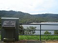
Anglican Church at Mossman, motor showrooms and a hotel in Atherton, the Tinaroo Dam lookout shelter, the Great Northern Hotel at Mareeba, the remodelling...
28 KB (4,269 words) - 12:50, 22 December 2023
School (former)) The town of Kulara was inundated with the filling of Tinaroo Dam in 1959. However, being on higher ground, the school building was not...
115 KB (3,133 words) - 05:31, 6 September 2024

Cullamungie Pocket (slightly south of Pelican Point but on the eastern side of Tinaroo Dam), Halloran's Hill, Nasser's Property (Wongabel), Wongabel State Forest...
8 KB (830 words) - 20:18, 31 January 2024

reliable enough as a source of water for irrigation. The establishment of Tinaroo Dam and the Mareeba-Dimbulah irrigation scheme provided water security which...
22 KB (2,177 words) - 06:28, 7 July 2024
Mount Lindesay Highway state-controlled roads (redirect from Maroon Dam Road)
associated with the intersecting roads described above: Maroon Dam Road Carneys Creek Road Maroon Dam Road is a state-controlled district road (number 2133),...
6 KB (496 words) - 02:20, 5 March 2024

late 1959 to investigate the economic use of irrigation water from the Tinaroo Dam. In the 2006 census, the locality of Walkamin and the surrounding area...
13 KB (877 words) - 03:40, 1 September 2024

Burnett Highway (redirect from Wuruma Dam Road)
Mundubbera–Durong Road Eidsvold–Theodore Road Wuruma Dam Road Monto–Mount Perry Road Gladstone–Monto Road Cania Dam Road Gavial–Gracemere Road Murgon–Barambah Road...
15 KB (910 words) - 06:03, 27 April 2024
North Queensland, in open forest habitats. The type locality is the Tinaroo Dam on the Atherton Tableland. Raven, RJ (1994). "Mygalomorph spiders of...
2 KB (122 words) - 00:32, 1 January 2024

megalitres of water (in comparison to Lake Tinaroo's 407,000 megalitres). A reinforced masonry wall was added to the dam crest in 1993 to prevent waves from...
4 KB (355 words) - 01:24, 10 August 2024
Anglican Church at Mossman, motor showrooms and a hotel in Atherton, the Tinaroo Dam lookout shelter, the Great Northern Hotel at Mareeba, the remodelling...
4 KB (428 words) - 08:22, 6 November 2022

Lake Tinaroo (created by the Tinaroo Dam) which then forms the northern boundary of the locality. Peterson Creek, also flowing into Lake Tinaroo, forms...
9 KB (712 words) - 22:51, 28 July 2024
includes: Burdekin Falls Dam Bjelke-Petersen Dam Kinchant Dam Wuruma Dam SunWater constructed, and owns and operates the Tinaroo Hydro Power Station, a...
6 KB (388 words) - 02:49, 25 June 2024

impoundments include Lake Tinaroo near Cairns in the Atherton Tablelands, Lake Proserpine west of Proserpine, Queensland, Teemburra Dam near Mackay, Lake Moondarra...
19 KB (1,935 words) - 14:50, 13 August 2024

Tinaroo Dam to impound the Barron River resulted in the inundation of Dunbulla's farms and facilities. Most people had moved away by the time the dam...
13 KB (1,155 words) - 07:50, 25 May 2024
School opened on 17 June 1912. It closed on 1 September 1958, when the Tinaroo Dam began to fill, inundating the town. However, being on higher ground,...
6 KB (438 words) - 07:07, 27 June 2024
Mackay–Eungella Road (redirect from Eungella Dam Road)
state-controlled regional road (number 532). At the western end it becomes Eungella Dam Road. (see below) The road commences at an intersection with the Peak Downs...
10 KB (1,052 words) - 17:33, 25 July 2024
Mundubbera–Durong Road (redirect from Boondooma Dam Road)
road (number 4356). It runs from the intersection of Okeden Road (Boondooma Dam Road) and Wondai–Proston Road in Proston to Mundubbera–Durong Road in Boondooma...
14 KB (1,106 words) - 17:43, 25 July 2024
Nerang–Murwillumbah Road (redirect from Hinze Dam Road)
north-western extremity of Advancetown Lake, the body of water retained by the Hinze Dam. The road continues in a southerly direction, following the western shore...
13 KB (1,074 words) - 17:45, 25 July 2024
Cunningham Highway state-controlled roads (redirect from Leslie Dam Road)
It runs from the Cunningham Highway in Allan to the Leslie Dam campground in Leslie Dam, a distance of 5.9 kilometres (3.7 mi). It does not intersect...
22 KB (1,702 words) - 22:38, 9 February 2024