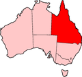
The Warrego Highway is located in southern Queensland, Australia. It connects coastal centres to the south western areas of the state, and is approximately...
30 KB (2,105 words) - 12:42, 9 March 2024
Brisbane Valley Highway is a state highway in Queensland, Australia. It links the Warrego Highway near Ipswich and the D'Aguilar Highway about 4 km (2 mi)...
13 KB (759 words) - 12:20, 15 July 2024
Warrego Highway state-controlled roads presents information about how the Warrego Highway is described for administrative and funding purposes by the...
23 KB (1,837 words) - 00:40, 22 January 2024
Highways. In Queensland, the highway links with Balonne and Warrego Highways and its northern terminus is at its junction with Landsborough Highway....
22 KB (1,541 words) - 00:32, 9 September 2024
Great Dividing Range. Gore Highway (A39) was rerouted via the bypass between Athol (in the south) and the Warrego Highway (A2) interchange at Charlton...
12 KB (954 words) - 05:22, 14 June 2024
The Moonie Highway is a state highway of Queensland, Australia. Part of State Route 49, it leaves the Warrego Highway at Dalby and runs for over 290 km...
7 KB (549 words) - 10:30, 27 October 2024
south-westerly direction from Goomeri to Dalby. The highway connects the Warrego and Burnett Highways. It is a state-controlled regional road (numbers 45A...
8 KB (438 words) - 02:42, 15 January 2024
Landsborough Highway Warrego Highway Flinders Highway Ipswich Motorway Cunningham Highway New England Highway Gore Highway Captain Cook Highway Gulf Developmental...
5 KB (381 words) - 02:22, 30 July 2024
north-eastern terminus of the Cunningham Highway is situated a short distance west of where the Warrego Highway reaches its eastern terminus with the Ipswich...
20 KB (1,363 words) - 22:27, 27 January 2024
England and Cunningham Highways route and the Pacific Highway route Brisbane to Cairns – Bruce Highway Brisbane to Darwin – Warrego, Landsborough, Barkly...
37 KB (2,681 words) - 06:45, 7 October 2024
Toowoomba Bypass (category Highways in Queensland)
5%. The Warrego Highway is a major Brisbane-Darwin highway that passes through Toowoomba and utilises the existing range road. The Gore Highway is part...
21 KB (1,676 words) - 18:18, 25 July 2024
The Warrego River is an intermittent river that is part of the Darling catchment within the Murray–Darling basin, which is located in South West Queensland...
11 KB (886 words) - 01:16, 25 May 2023
Landsborough Highway is a highway in western Queensland, Australia, running in the northwest–southeast direction from Morven to Cloncurry. The Landsborough...
10 KB (542 words) - 11:07, 27 July 2023
Freeways in Australia (category Highways in Australia)
Motorway Bruce Highway Sunshine Motorway Bruce Highway (Bald Hills to Kybong, Townsville Ring Road) Toowoomba Bypass Warrego Highway (Helidon Spa to...
31 KB (2,594 words) - 06:55, 7 October 2024
intersects with section 17A: Warrego Highway The following state-controlled roads intersect with section 17B: Ipswich–Cunningham Highway Connection Road River...
22 KB (1,702 words) - 04:45, 19 October 2024
the Warrego Highway (A2) at Brassall to the (M1) at Eight Mile Plains via the following corridors: (M2) Northern Ipswich Bypass (Warrego Highway) from...
1 KB (138 words) - 18:56, 18 July 2022
The Flinders Highway is a highway that crosses Queensland east to west, from Townsville on the Pacific coast to Cloncurry. The road continues as the Barkly...
19 KB (1,267 words) - 00:30, 5 May 2024
short concurrency with Warrego Highway, and continues south to St George, where it meets the Moonie, Balonne, and Castlereagh Highways. It crosses the state...
20 KB (1,518 words) - 08:37, 5 January 2024
The Dawson Highway is a state highway in Queensland, Australia. It runs for 405 kilometres (252 mi) between Gladstone and Springsure where it terminates...
20 KB (1,285 words) - 20:52, 28 July 2024
Highway 1 along either coast. Roads that make up the highway are: Great Central Road Gunbarrel Highway Lasseter Highway Stuart Highway Plenty Highway...
9 KB (310 words) - 05:03, 11 February 2024
The Barkly Highway is a national highway in Queensland and the Northern Territory in Australia. It is the only sealed road between Queensland and the...
13 KB (829 words) - 12:40, 24 June 2024
Mount Lindesay Highway is an Australian national highway located in Queensland. The highway runs southwest from Brisbane, where it leaves Ipswich Road...
26 KB (1,537 words) - 06:49, 13 August 2024
The Bruce Highway is a major highway in Queensland, Australia. Commencing in the state capital, Brisbane, it passes through areas close to the eastern...
104 KB (5,363 words) - 05:57, 11 November 2024
New England Highway is an 883-kilometre (549 mi) long highway in Australia running from Yarraman, north of Toowoomba, Queensland, at its northern end...
41 KB (2,871 words) - 23:58, 1 November 2024
The Capricorn Highway is located in Central Queensland, Australia, and links the city of Rockhampton with western Queensland. The highway is 575 kilometres...
18 KB (1,298 words) - 20:53, 18 May 2024
Traffic sign (redirect from Highway signs)
known as Highway Gothic, which is the standard typeface for highway signs in the U.S. The adoption of Clearview for traffic signs over Highway Gothic has...
23 KB (2,382 words) - 13:47, 12 November 2024
Castlereagh Highway is a 790-kilometre (490 mi) state highway located in New South Wales and Queensland, Australia. From north to south the highway traverses...
21 KB (1,602 words) - 06:36, 13 August 2024
Metroad (category Highways in Australia)
Motorway (Tugun) to Cooroy Metroad 2 – Cunningham Highway (National Highway 15)/Warrego Highway (National Highway A2) Junction to Gateway Motorway (Metroad 1)...
7 KB (746 words) - 05:23, 19 October 2024
Leichhardt Highway is a major transport route in Queensland, Australia. It is a continuation northward from Goondiwindi of the Newell Highway, via a 2.0-kilometre...
9 KB (266 words) - 22:59, 27 May 2024
heritage-listed university campus of the University of Queensland at Warrego Highway, Lawes (east of Gatton), Lockyer Valley Region, Queensland, Australia...
64 KB (9,616 words) - 19:54, 20 October 2024


