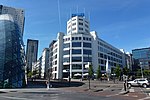
's-Hertogenbosch (Dutch: [ˌsɛrtoːɣə(m)ˈbɔs] ), colloquially known as Den Bosch (pronounced [dɛm ˈbɔs] ), is a city and municipality in the Netherlands...
50 KB (5,315 words) - 03:01, 21 October 2024
The Citadel of 's-Hertogenbosch is a fortress on the north side of the town center of 's Hertogenbosch in the Netherlands. It was constructed from 1637...
19 KB (2,519 words) - 01:57, 24 March 2024
Church or Protestant Church is located in 's-Hertogenbosch. It is the main Protestant church of 's-Hertogenbosch. At the place of the current church, there...
7 KB (790 words) - 17:09, 21 November 2022
Vught (redirect from Vught (gemeente))
and lies just south of the industrial and administrative centre of 's-Hertogenbosch. Many commuters live there, and in 2004 the town was named "Best place...
17 KB (1,580 words) - 05:09, 1 September 2024
the gemeente Someren, counting 3510 residents by 2007. Someren-Eind is located near the Zuid-Willemsvaart, a canal that connects 's-Hertogenbosch and...
4 KB (293 words) - 10:13, 5 December 2023
brick industry, was its first rail line which ran from Tilburg to 's-Hertogenbosch. Although originally constructed to transport bricks, it allowed the...
5 KB (323 words) - 23:30, 18 August 2023
Lintsen, Harry; et al. (eds.), De canon van Eindhoven (in Dutch), 's-Hertogenbosch: Heinen, pp. 29–34, ISBN 9789086801275 Melssen, Jan (1994), "De geschiedenis...
8 KB (688 words) - 21:58, 24 August 2024
in the province of North Brabant, situated between Nijmegen and 's-Hertogenbosch. Dutch Topographic map of Oss (municipality), June 2015 Oss has a shopping...
15 KB (1,016 words) - 19:00, 27 October 2024
with the name Beatrixpark are also in the Dutch cities of Almere, 's-Hertogenbosch, Schiedam, Utrecht and Ede. The Beatrixpark can be reached by Amsterdam...
8 KB (790 words) - 12:05, 23 October 2024
Rosmalen (category 's-Hertogenbosch)
about 7 km east of 's-Hertogenbosch and can be reached via the A59. Eikenburg Markt, Rosmalen Rosmalen Noord Herindeling 4 - Gemeente Rosmalen de laatste...
3 KB (273 words) - 21:00, 25 October 2024
has services to Amsterdam, Amsterdam Airport, Utrecht, Nijmegen, 's-Hertogenbosch, Breda, Tilburg and to cities in Germany. Aalten also has an hourly...
7 KB (367 words) - 05:05, 1 September 2024
from the Peel. These channels connect Nederweert to Maastricht and 's-Hertogenbosch. Nederweert was originally called 'Merefelt' which means 'amongst the...
8 KB (385 words) - 19:09, 31 October 2024
located in North Brabant between the cities of Tilburg, Eindhoven and 's-Hertogenbosch. It includes nature reserves such as the Kampina, the Oisterwijk forests...
3 KB (250 words) - 02:40, 25 May 2023
1944 in Someren) Bishop emeritus of the Roman Catholic Diocese of 's-Hertogenbosch Marie-José de Groot (born 1966 in Someren) a Dutch rower, competed...
7 KB (298 words) - 05:09, 1 September 2024
ˈfʏxt]) was a Nazi concentration camp located in Vught near the city of 's-Hertogenbosch, Netherlands. The camp was opened in 1943 and held 31,000 prisoners...
13 KB (1,413 words) - 09:04, 7 November 2024
Brabant, Netherlands that operates four coffeeshops in the cities of 's-Hertogenbosch and Tilburg. The Grass Company was the first company to open a coffeeshop...
5 KB (553 words) - 18:26, 20 August 2024
Sluis 0 (category Buildings and structures in 's-Hertogenbosch)
surroundings from commercial to recreational shipping] (PDF) (in Dutch), Gemeente 's-Hertogenbosch Rijkswaterstaat (2020), Vaarwegen in Nederland [Waterways in the...
7 KB (884 words) - 16:07, 12 April 2024
Loosbroek became part of the States of Brabant within the Meierij van 's-Hertogenbosch. In 1795 the French invaded the Dutch Republic and "freedom of faith"...
6 KB (367 words) - 20:55, 19 August 2022
part of the Duchy of Brabant. Dinther was part of the Meierij of 's-Hertogenbosch one of the four administrative parts of the Duchy of Brabant. In 1352...
7 KB (741 words) - 19:08, 19 July 2024
of a small village centre on the railway line between Utrecht and 's-Hertogenbosch and a 5 km long ribbon of farms along the small channel Schalkwijksche...
5 KB (314 words) - 22:38, 24 August 2024
the municipality of Zaltbommel, and lies about 11 km northwest of 's-Hertogenbosch. Kerkwijk was a separate municipality between 1818 and 1999, when it...
5 KB (240 words) - 11:31, 16 May 2022
is a city in North Brabant that lies north of Tilburg and west of 's-Hertogenbosch. To its north runs the Bergse Maas canal, with the River Waal further...
9 KB (570 words) - 05:02, 1 September 2024
omstreden gemeentevlag". "De Volkskrant". 's-Hertogenbosch, 17 juli 1982. via kb.nl "Gemeentewapen en -logo". Gemeente Leudal. Archived from the original on...
377 KB (10,952 words) - 17:44, 9 November 2024
a number of villages and rural areas just south and south east of 's-Hertogenbosch. Most inhabitants are commuters preferring to live in these quite villages...
9 KB (530 words) - 05:09, 1 September 2024
Netherlands, close to the A2 Motorway, the railway line from Utrecht to 's‑Hertogenbosch and the rivers Waal and Maas. Dutch Topographic map of Zaltbommel (municipality)...
11 KB (575 words) - 05:07, 1 September 2024
century Franciscus Sonnius (1506–1576) - theologian, first Bishop of 's-Hertogenbosch and later first Bishop of Antwerp Antoon van de Ven (1867–1934) - farmer...
11 KB (668 words) - 17:23, 29 October 2024
Nicaragua Zielona Góra, Poland Hengelo Emsdetten, Germany Ogre, Latvia 's-Hertogenbosch Leuven, Belgium Trier, Germany Hof van Twente Keszthely, Hungary Hoogeveen...
51 KB (2,958 words) - 04:42, 31 August 2024
from the original on 5 July 2017. Retrieved 7 July 2017. "Kerngegevens gemeente Wieringermeer". sdu.nl. Archived from the original on 6 January 2008. Retrieved...
210 KB (20,215 words) - 11:44, 7 November 2024
Dieze Bridge (category Buildings and structures in 's-Hertogenbosch)
road traffic, which spans the rivers Dieze and Aa, just north of 's-Hertogenbosch, Netherlands. The Dieze Railway bridge is somewhat further downstream...
17 KB (2,114 words) - 11:23, 15 August 2024


