Caloundra Road is a continuous 9.3-kilometre (5.8 mi) road route in the Sunshine Coast local government area of Queensland, Australia. Most of it is designated...
20 KB (1,292 words) - 16:44, 25 July 2024

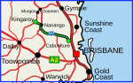
suburb of Caloundra had a population of 3,932 people. Caloundra is 90 kilometres (55.9 mi) north of the Brisbane central business district. Caloundra is accessible...
31 KB (2,611 words) - 08:04, 5 June 2024

Bruce Highway (category WikiProject Australian Roads articles with a junction list using templates)
and Landsborough before terminating at the Caloundra Road interchange.[citation needed] The Caloundra Road Interchange is also Australia's first Diverging...
103 KB (5,398 words) - 16:42, 25 July 2024

Diverging diamond interchange (category Road junction types)
Department of Transport and Main Roads on November 28, 2019. The interchange, located in Caloundra, Queensland, connects Caloundra Road to the Bruce Highway. The...
32 KB (2,980 words) - 17:24, 24 June 2024
Connection Road Caboolture–Bribie Island Road D'Aguilar Highway Pumicestone Road Glass House Mountains Road Bells Creek Arterial Road Caloundra Road Sunshine...
40 KB (3,348 words) - 15:45, 4 April 2024
Crossing Road Kalbar Connection Road Boonah–Fassifern Road Lake Moogerah Road New England Highway Freestone Road Warwick–Yangan Road Warwick–Allora Road Warwick–Killarney...
22 KB (1,802 words) - 22:38, 9 February 2024
Haigslea–Amberley Road Rosewood–Marburg Road Laidley–Plainland Road Forest Hill–Fernvale Road Gatton–Esk Road Gatton–Helidon Road Toowoomba Second Range...
23 KB (1,932 words) - 00:40, 22 January 2024
two roads named South Pine Road to the north of Brisbane in Queensland, Australia. They are two separate roads rather than a disconnected single road. It...
28 KB (1,684 words) - 17:25, 5 April 2024
22A: Kingaroy–Cooyar Road Oakey–Cooyar Road Pechey–Maclagan Road Esk–Hampton Road Murphys Creek Road Toowoomba Connection Road (former Warrego Highway)...
12 KB (1,052 words) - 01:05, 22 January 2024

Burnett Highway (redirect from Murgon–Barambah Road)
Kilkivan–Tansey Road Murgon–Gayndah Road Gayndah–Mount Perry Road Mundubbera–Durong Road Eidsvold–Theodore Road Wuruma Dam Road Monto–Mount Perry Road Gladstone–Monto...
15 KB (930 words) - 06:03, 27 April 2024
Marlborough–Sarina Road is a state-controlled district road (number 512) rated as a local road of regional significance (LRRS). It runs from the Bruce...
18 KB (1,471 words) - 05:56, 19 December 2023
Bundaberg–Port Road (known as Burnett Heads Road) is a state-controlled district road (number 175) in the Bundaberg region of Queensland, Australia. It...
12 KB (828 words) - 16:41, 25 July 2024
Douglas–Garbutt Road Garbutt–Upper Ross Road North Townsville Road North Ward Road Ross River Road Shaw Road South Townsville Road Townsville Connection Road Townsville...
29 KB (2,361 words) - 18:21, 25 July 2024
Brisbane–Woodford Road is the official name for a continuous 60.5-kilometre (37.6 mi) road route in the Moreton Bay local government area of Queensland...
19 KB (1,058 words) - 16:40, 25 July 2024
Mundubbera–Durong Road is a continuous 105-kilometre (65 mi) road route in the North Burnett and South Burnett local government areas of Queensland, Australia...
14 KB (1,151 words) - 17:43, 25 July 2024

Flinders Highway, Queensland (redirect from Julia Creek–Kynuna Road)
Road Burdekin Falls Dam Road Aramac–Torrens Creek Road Hughenden–Muttaburra Road Richmond–Winton Road Julia Creek–Kynuna Road Julia Creek–Kynuna Road...
19 KB (1,272 words) - 00:30, 5 May 2024
Eumundi–Noosa Road is a continuous 15.8-kilometre (9.8 mi) road route in the Sunshine Coast and Noosa local government areas of Queensland, Australia...
13 KB (1,026 words) - 16:59, 25 July 2024
D'Aguilar Highway (redirect from Caboolture Connection Road)
Road Esk–Kilcoy Road Brisbane Valley Highway New England Highway Nanango–Tarong Road Burnett Highway Kingaroy–Cooyar Road Kingaroy–Barkers Creek Road...
22 KB (1,114 words) - 16:52, 25 July 2024
Sarina–Homebush Road, Eton–Homebush Road, Marian–Eton Road, and Marian–Hampden Road. The entire route is signed as State Route 5. The four roads are state-controlled...
13 KB (1,021 words) - 18:04, 25 July 2024
state-controlled roads: Gladstone–Benaraby Road Boyne Island Road Gladstone Port Access Road Gladstone–Mount Larcom Road Boyne Island Road is a state-controlled...
3 KB (267 words) - 00:03, 5 March 2024
Hughenden–Muttaburra–Aramac–Barcaldine Road is a continuous 359-kilometre (223 mi) road route in the Flinders and Barcaldine local government areas of...
14 KB (1,047 words) - 17:14, 25 July 2024
Gin Road is a state-controlled district road (number 176) in the Bundaberg region of Queensland, Australia. It runs from Bundaberg–Bargara Road (Quay...
13 KB (1,025 words) - 16:41, 25 July 2024
Redcliffe Peninsula road network is a group of roads that provide access to the Redcliffe Peninsula in Queensland, Australia, and enable travel between...
13 KB (1,137 words) - 17:59, 25 July 2024
Tin Can Bay Road is a continuous 56.1 kilometres (34.9 mi) road route in the Gympie region of Queensland, Australia. Part of it is signed as State Route...
14 KB (1,179 words) - 18:19, 25 July 2024
it ends. The physical road continues east as Caloundra Road (State Route 6). Land use along the road is mainly rural. The road is fully sealed, and most...
12 KB (903 words) - 21:57, 28 July 2024

Dawson Highway (redirect from Dawson Developmental Road)
Gladstone–Benaraby Road Gladstone–Monto Road Biloela–Callide Road Blackwater–Rolleston Road Orion Ten Chain Road Biloela–Callide Road is a state-controlled...
20 KB (1,305 words) - 20:52, 28 July 2024
Isisford–Blackall Road is a continuous 122-kilometre (76 mi) road route in the Longreach and Blackall-Tambo local government areas of Queensland, Australia...
11 KB (908 words) - 17:16, 25 July 2024
Nambour–Bli Bli Road is a continuous 8.1-kilometre (5.0 mi) road route in the Sunshine Coast local government area of Queensland, Australia. It is signed...
11 KB (732 words) - 23:27, 8 May 2024
Atherton–Herberton–Longlands Gap Road is a continuous 33.5-kilometre (20.8 mi) road route in the Tablelands local government area of Queensland, Australia...
8 KB (690 words) - 16:32, 25 July 2024

proposed to branch off the North Coast line at Beerwah and operate via Caloundra to Maroochydore. In 2011, the Queensland Government released a major transport...
55 KB (3,779 words) - 22:44, 22 July 2024