
habitation going back as far as the Hunsrück-Eifel Culture in La Tène times. In the more recent past, the Asbach Ironworks down below on the Fischbach...
8 KB (932 words) - 02:04, 1 June 2023
Arft Argenschwang Argenthal Armsheim Arnshöfen Arzbach Arzfeld Asbach, Birkenfeld Asbach (Westerwald) Aschbach Aspisheim Astert Attenhausen Atzelgift Auderath...
106 KB (3,022 words) - 19:37, 2 July 2024
whose seat is in Herrstein. The municipality lies on the Ebesbach in the Hunsrück southeast of the Idar Forest. Hottenbach borders in the north on the municipality...
18 KB (2,237 words) - 02:06, 1 June 2023

Breitenthal, Rhineland-Palatinate (redirect from Breitenthal (Hunsrück))
Breitenthal (Hunsrück) (Hunsrückisch: Bränel) is an Ortsgemeinde – a municipality belonging to a Verbandsgemeinde, a kind of collective municipality –...
39 KB (5,013 words) - 20:37, 23 April 2024

268 2680 Mündersbach 2681 Altenkirchen (Westerwald) 2682 Hamm (Sieg) 2683 Asbach (Westerwald) 2684 Puderbach (WW) 2685 Flammersfeld 2686 Weyerbusch 2687...
186 KB (15,928 words) - 06:11, 27 June 2024

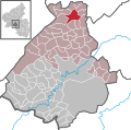
Herrstein-Rhaunen, whose seat is in Herrstein. Hellertshausen lies in the Hunsrück on the southern edge of the Idar Forest. The municipal area is 71.2% wooded...
5 KB (507 words) - 02:06, 1 June 2023

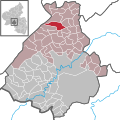
municipality of Hellertshausen, in the northeast on the municipality of Asbach, in the southeast on the municipality of Kempfeld, in the southwest on the...
8 KB (836 words) - 02:10, 1 June 2023
of Sankt Wendel (Saarland), Trier-Saarburg, Bernkastel-Wittlich, Rhein-Hunsrück, Bad Kreuznach and Kusel. In the early nineteenth century, the Nahe River...
6 KB (372 words) - 21:57, 25 March 2024

whose seat is in Herrstein. Weiden lies on the edge of the Naturpark Saar-Hunsrück between Mörschied and Hottenbach. Half the municipal area is covered by...
4 KB (373 words) - 02:11, 1 June 2023

Steingerüttelkopf, which at 756 m above sea level is one of the highest peaks in the Hunsrück. Much of the local countryside is wooded, and Bruchweiler's elevation of...
23 KB (2,963 words) - 02:04, 1 June 2023
Weeser Jochen Bülow Marianne Altgeld (FW) Christian Link (PARTEI) Klaus Asbach (dieBasis) Markus Erdmann (Ind.) Norbert Schmitt (Ind.) 198 Ahrweiler Mechthild...
292 KB (2,785 words) - 23:26, 14 April 2024

edge of the Schwarzwälder Hochwald, a self-contained forest within the Hunsrück. The municipal area measures 1 133 ha, of which somewhat more than half...
10 KB (1,270 words) - 02:08, 1 June 2023

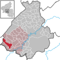
town. The municipality lies on the Leiselbach at the Idar Forest in the Hunsrück. The municipal area is 65% wooded. Leisel borders in the northeast on the...
10 KB (1,116 words) - 02:07, 1 June 2023
Verbandsgemeinde Rhaunen. The municipality lies at the Idar Forest in the Hunsrück in a sprawling, well watered hollow. The hollow separates the Idar Forest...
22 KB (2,569 words) - 01:55, 1 June 2023

lies on the Deutsche Edelsteinstraße (“German Gem Road”) in the southern Hunsrück between the Idar Forest in the north and the town of Idar-Oberstein in...
15 KB (1,892 words) - 02:06, 1 June 2023
municipality lies on the Traunbach in the Schwarzwälder Hochwald (forest) in the Hunsrück. The municipal area is 62.3% wooded. Within Brücken's limits, on the Friedrichskopf...
14 KB (1,745 words) - 02:04, 1 June 2023

Idarkopf (746 m above sea level) at the edge of the Idar Forest in the Hunsrück. The municipal area is 71.1% wooded. Stipshausen borders in the north on...
15 KB (1,758 words) - 02:09, 1 June 2023