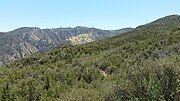
The Santa Rosa Plateau is an upland plateau and southeastern extension of the Santa Ana Mountains in Riverside County, California. It is bounded by the...
13 KB (1,803 words) - 10:16, 14 November 2024
Elsinore Mountains is the Santa Rosa Plateau, named for the Rancho Santa Rosa that once encompassed it. At the south end of the plateau there is a steep escarpment...
17 KB (1,720 words) - 19:33, 3 November 2024
registered as a California Historical Landmark. The Santa Rosa Plateau became Rancho Santa Rosa under an 1846 Mexican land grant to cattle and sheep...
6 KB (627 words) - 21:07, 15 October 2024
Santa Rosa (Spanish pronunciation: [ˈsanta ˈrosa]) is a city in the Argentine Pampas (lowlands), and the capital of La Pampa Province, Argentina. It lies...
12 KB (588 words) - 01:52, 8 December 2024
Columbia Plateau extends northeast from the north end of the range. The range was so named on account of wild roses which grow in the area. "Santa Rosa Range"...
3 KB (197 words) - 18:00, 23 May 2021
La Cresta is an unincorporated community in the Santa Rosa Plateau region in Riverside County, California, United States. It is situated west of Murrieta...
6 KB (401 words) - 07:12, 20 June 2024
The Santa Rosa Wilderness is a 72,259-acre (292.42 km2) wilderness area in Southern California, in the Santa Rosa Mountains of Riverside and San Diego...
10 KB (1,025 words) - 11:51, 24 August 2023
sustaining life in the arid Southwest. For example, tenajas at the Santa Rosa Plateau in southern California allow western pond turtles, California newts...
4 KB (272 words) - 16:17, 3 July 2024
California, United States. The school is nestled at the base of the Santa Rosa Plateau, at the western end of the city. It is operated by the Murrieta Valley...
8 KB (500 words) - 04:39, 23 December 2024
ISBN 9781439666272. "The Old Adobe Circa 1845: History". Retrieved May 23, 2020. "SANTA ROSA PLATEAU ER&VC". RivCoParks. Retrieved 2022-06-09. "Adobe Flores (73000404)"...
61 KB (2,373 words) - 22:38, 5 August 2024
Santa Ana Irvine Chula Vista Fremont Santa Clarita San Bernardino Modesto Fontana Moreno Valley Roseville Elk Grove Visalia Chico Redding Santa Rosa Cities...
54 KB (322 words) - 23:48, 13 December 2024
Area Lake Skinner Recreation Area McCall Memorial Equestrian Park Santa Rosa Plateau The 2010 United States Census reported that Riverside County had a...
137 KB (5,692 words) - 05:55, 25 December 2024
Los Alamos Canyon Creek (category Santa Ana Mountains)
descending from the Elsinore Mountains. and one that drains the western Santa Rosa Plateau and the east slope of the Tenaja Mountain highland and descends to...
5 KB (353 words) - 09:33, 17 March 2023
De Luz Heights, California (category Santa Ana Mountains)
County, California, United States. De Luz Heights is on the Santa Rosa Plateau of the Santa Ana Mountains. It is between De Luz Road to the west and Sandia...
4 KB (124 words) - 04:17, 24 July 2023
range. The largest remaining stands of Engelmann oaks are on the Santa Rosa Plateau, near Murrieta in Riverside County, and on Black Mountain near Ramona...
5 KB (536 words) - 05:41, 8 November 2024
The two latter creeks drain the Santa Rosa Plateau. Approximately 4,334 acres (1,754 ha) of the middle course of the Santa Margarita River in Temecula Canyon...
14 KB (1,379 words) - 06:18, 30 November 2024
Dieguito Lagoon San Elijo Lagoon San Felipe Creek San Joaquin River Santa Rosa Plateau Springville Stone Corral Sycamore Canyon Sycuan Peak Thomes Creek...
7 KB (592 words) - 22:00, 17 December 2024
mountains. The current southernmost California populations are on the Santa Rosa Plateau in Riverside County, and within the Upper Las Virgenes Canyon Open...
20 KB (1,974 words) - 10:30, 5 July 2024
Shasta Cascade Klamath Basin Modoc Plateau North Coast Lost Coast Bay Area North Bay San Francisco Peninsula South Bay (Santa Clara Valley) East Bay Central...
275 KB (23,839 words) - 01:08, 25 December 2024
Ecological Reserve, Chino Hills State Park, Crystal Cove State Park, the Santa Rosa Plateau Reserve, and Torrey Pines State Natural Reserve. In Baja California...
18 KB (1,621 words) - 02:54, 26 October 2024
views of the Coachella Valley, the Salton Sea, the San Andreas Fault, the Santa Rosa Mountains, and the city of Palm Springs. Nature walks inside the park...
48 KB (4,915 words) - 21:03, 12 December 2024
bears and human food: Study reveals changing diets over past century". UC Santa Cruz News. Archived from the original on June 18, 2022. Retrieved June 27...
116 KB (10,986 words) - 04:00, 21 December 2024
Dieguito Lagoon San Elijo Lagoon San Felipe Creek San Joaquin River Santa Rosa Plateau Springville Stone Corral Sycamore Canyon Sycuan Peak Thomes Creek...
5 KB (580 words) - 20:58, 1 August 2024
Characteristic shrubs include coyote brush (Baccharis pilularis), yerba santa (Eriodictyon californicum), coast silk-tassel (Garrya elliptica), salal...
10 KB (980 words) - 00:41, 12 August 2024
California montane chaparral and woodlands (category Natural history of the Santa Monica Mountains)
jeffreyi forest in the San Gabriel Mountains Quercus engelmannii in the Santa Rosa Plateau The region contains many species of small vertebrate, including the...
10 KB (852 words) - 20:43, 28 October 2024
0 km) wide. Santa Rosa Island (Chumash: Wi'ma) is the second largest of the Channel Islands covering over 53,000 acres (210 km2). Santa Rosa island is located...
57 KB (5,457 words) - 00:27, 3 September 2024
district on the north end of town. There is an unsubstantiated story of Rosa May, a prostitute who, in the style of Florence Nightingale, came to the...
38 KB (3,529 words) - 16:29, 3 December 2024
Channel Islands National Park (category Parks in Santa Barbara County, California)
reserve under UNESCO in 1976. And five — Anacapa, Santa Barbara, Santa Cruz, San Miguel and Santa Rosa — were made constituent to the new national park...
31 KB (3,094 words) - 19:05, 17 November 2024
Dieguito Lagoon San Elijo Lagoon San Felipe Creek San Joaquin River Santa Rosa Plateau Springville Stone Corral Sycamore Canyon Sycuan Peak Thomes Creek...
7 KB (619 words) - 08:18, 15 August 2024
Dieguito Lagoon San Elijo Lagoon San Felipe Creek San Joaquin River Santa Rosa Plateau Springville Stone Corral Sycamore Canyon Sycuan Peak Thomes Creek...
18 KB (2,142 words) - 08:30, 20 October 2024


