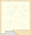
Catron County is a county in the U.S. state of New Mexico. As of the 2020 census, the population was 3,579, making it New Mexico's third-least populous...
24 KB (2,437 words) - 14:47, 26 April 2024
establishment of the U.S. state of New Mexico, and served as one of its first United States Senators. Catron has defenders but enemies have described...
23 KB (2,266 words) - 16:07, 28 June 2024
Catron County, New Mexico, United States. The population was 289 as of the 2010 census, down from 387 in 2000. It is the county seat of Catron County...
16 KB (1,096 words) - 18:13, 27 May 2024
Catron can refer to: Catron, Missouri, in the United States Catron County, New Mexico, in the United States John Catron (1786–1865), United States Supreme...
538 bytes (94 words) - 00:09, 16 October 2020
in Catron County, New Mexico, United States. As of the 2010 census it had a population of 54. Located at the intersection of U.S. Route 60 and New Mexico...
12 KB (558 words) - 19:02, 27 May 2024
and census-designated place located along U.S. Highway 60 in Catron County, New Mexico. As of the 2010 census, it had a population of 186. Pie Town's...
10 KB (714 words) - 20:14, 28 May 2024
in Catron County, New Mexico. Indian Peak is found in the Mogollon Mountains and is ranked the 203rd highest peak, and 1077th by prominence, for New Mexico...
3 KB (136 words) - 21:58, 16 May 2023
Aragon is a census-designated place on the Tularosa River in Catron County, New Mexico, United States. As of the 2010 census it had a population of 94...
7 KB (430 words) - 18:48, 27 May 2024
Black Mountain is a mountain located in Catron County, New Mexico, on the northern boundary of the Gila Wilderness and in the Gila National Forest. Black...
3 KB (207 words) - 20:18, 13 May 2024
Baca and Lea Counties were created in 1917, followed by Hidalgo County in 1920 and Catron and Harding Counties in 1921. Los Alamos County was created in...
16 KB (592 words) - 14:45, 26 April 2024
Quemado is a census-designated place in Catron County, New Mexico, United States. As of the 2010 census it had a population of 228. Walter De Maria's...
11 KB (301 words) - 21:14, 28 May 2024
Luna is a census-designated place in northwestern Catron County, New Mexico, United States. As of the 2010 census it had a population of 158. It is situated...
10 KB (384 words) - 10:15, 4 July 2024
This is a list of properties and districts in New Mexico that are on the National Register of Historic Places. There are more than 1,100 listings. Of these...
7 KB (378 words) - 17:57, 13 January 2024
is a former mining town located in the Mogollon Mountains in Catron County, New Mexico, United States. Located east of Glenwood and Alma, it was founded...
12 KB (1,138 words) - 03:20, 30 May 2024
New Mexico's 2nd congressional district serves the southern half of New Mexico, including Las Cruces, and the southern fourth of Albuquerque. It is currently...
43 KB (539 words) - 09:21, 29 May 2024
County Route 35A (CR 35A) at the Catron–Cibola county line. CR 35A continues north to NM 36. The portion from the Cibola County line north to NM 36 maintenance...
3 KB (171 words) - 02:41, 16 February 2024
Gila Cliff Dwellings National Monument (category Museums in Catron County, New Mexico)
extreme southern portion of Catron County. Visitors can access the monument by traveling northbound from Silver City, New Mexico, 45 miles (72 km) on NM 15...
13 KB (1,377 words) - 11:41, 22 June 2024
Zuñi Salt Lake (category Landforms of Catron County, New Mexico)
classic maar, located in Catron County, New Mexico, United States, about 60 miles (97 km) south of the Zuni Pueblo, New Mexico. Zuñi Salt Lake is extremely...
10 KB (942 words) - 18:48, 23 June 2024
Zuni people (redirect from Zuni Tribe of the Zuni Reservation, New Mexico)
New Mexico. The Zuni tribe lived in multi level adobe houses. In addition to the reservation, the tribe owns trust lands in Catron County, New Mexico...
28 KB (3,372 words) - 17:32, 24 June 2024
1946. She was sunk as a target in 1948. Catron was named for Catron County, New Mexico and was launched on 28 August 1944 under a Maritime Commission...
5 KB (403 words) - 01:02, 20 May 2024
located in the Gila Wilderness in Catron County, New Mexico. Grouse Mountain is found in the Mogollon Mountains. For New Mexico, Grouse Mountain is ranked the...
3 KB (137 words) - 03:33, 7 June 2023
Glenwood is a census-designated place in Catron County, New Mexico, United States. As of the 2010 census it had a population of 143. The area was founded...
10 KB (555 words) - 13:49, 7 June 2024
Alegres Mountain (category Landforms of Catron County, New Mexico)
Colorado Plateau in Catron County, New Mexico. Alegres Mountain is found in the Mangas Mountains and is the 180th highest peak in New Mexico and ranked 30th...
3 KB (169 words) - 02:33, 26 April 2023
by Quemado Lake. The entire route is in Catron County. KML file (edit • help) Template:Attached KML/New Mexico State Road 103 KML is not from Wikidata...
2 KB (124 words) - 02:38, 16 February 2024
New Mexico (Spanish: Nuevo México [ˈnweβo ˈmexiko] ; Navajo: Yootó Hahoodzo Navajo pronunciation: [jòːtʰó hɑ̀hòːtsò]) is a state in the Southwestern region...
382 KB (33,875 words) - 03:53, 1 July 2024
Plains of San Agustin (category Landforms of Catron County, New Mexico)
southwestern U.S. state of New Mexico in the San Agustin Basin, south of U.S. Highway 60. The area spans Catron and Socorro Counties, about 50 miles (80 km)...
9 KB (642 words) - 09:42, 22 September 2023
Whitewater Creek is a stream within a canyon in Catron County, western New Mexico, United States. It lies along the northwest boundary of the Gila Wilderness...
3 KB (128 words) - 00:58, 26 April 2023
Apache–Sitgreaves National Forests (category Protected areas of Catron County, New Mexico)
Greenlee, Apache, Navajo, and Coconino counties in eastern and east-central Arizona, and Catron County in western New Mexico. The more northwesterly Sitgreaves...
13 KB (1,123 words) - 17:29, 6 December 2023
Black Range (redirect from Black Mountains (New Mexico))
mountain range running north–south in Sierra, Grant, and Catron counties in southwest New Mexico, in the Southwestern United States. The range's central...
5 KB (455 words) - 20:41, 16 March 2024
the West Fork of the Gila River. It is bordered to the north by Catron County. New Mexico State Road 15 passes through the community, leading northwest...
9 KB (241 words) - 20:30, 20 May 2024


