
A geodetic datum or geodetic system (also: geodetic reference datum, geodetic reference system, or geodetic reference frame, or terrestrial reference...
31 KB (3,346 words) - 06:28, 11 August 2024

WGS 84, defines an Earth-centered, Earth-fixed coordinate system and a geodetic datum, and also describes the associated Earth Gravitational Model (EGM) and...
24 KB (2,843 words) - 13:42, 3 August 2024
North American Datum of 1988. It superseded the National Geodetic Vertical Datum of 1929 (NGVD 29), previously known as the Sea Level Datum of 1929. NAVD...
7 KB (732 words) - 16:18, 31 January 2024
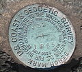
The National Geodetic Vertical Datum of 1929 is the official name since 1973 of the vertical datum established for vertical control surveying in the United...
4 KB (397 words) - 01:26, 19 November 2023

The North American Datum (NAD) is the horizontal datum now used to define the geodetic network in North America. A datum is a formal description of the...
13 KB (1,613 words) - 18:25, 12 August 2024


National Geodetic Survey. In the United States, prominent vertical datums in use by professionals include the National Geodetic Vertical Datum of 1929...
10 KB (1,459 words) - 03:47, 10 July 2024
Geographic coordinate conversion (redirect from Datum transformation)
referenced to the same geodetic datum. A geographic coordinate transformation is a translation among different geodetic datums. Both geographic coordinate...
34 KB (5,200 words) - 08:18, 10 August 2024
Liverpool datum. But following the Third Geodetic Levelling, Ordnance Survey maps published since March 1956 give spot heights above the Newlyn datum. Newlyn...
7 KB (777 words) - 03:21, 14 July 2024

Geographic coordinate system (section Geodetic datum)
19111 standards, also includes a choice of geodetic datum (including an Earth ellipsoid), as different datums will yield different latitude and longitude...
22 KB (2,491 words) - 18:21, 12 August 2024
The South American Datum (SAD) is a regional historical geodetic datum for South America. The most common version was established in 1969 (SAD69), as...
2 KB (255 words) - 20:02, 13 August 2023
Mariana plates will have their own respective geodetic datums. The North American-Pacific Geopotential Datum of 2022 (NAPGD2022) will separately define the...
7 KB (762 words) - 18:49, 12 August 2024

Wayback Machine Clearer notes on converting ECEF coordinates to WGS-84 datum geodetic datum overview orientation of the coordinate system and additional information...
9 KB (904 words) - 13:39, 7 January 2024
ED50 (redirect from European Datum 1950)
("European Datum 1950", EPSG:4230) is a geodetic datum which was defined after World War II for the international connection of geodetic networks. Some...
8 KB (927 words) - 23:56, 8 June 2024
European Terrestrial Reference System 1989 (redirect from ETRS89 datum)
continental drift. The development of ETRS89 is related to the global ITRS geodetic datum, in which the representation of the continental drift is balanced in...
6 KB (611 words) - 09:24, 3 July 2024
The Geocentric Datum of Australia 1994 (GDA94) is a geodetic datum covering the Australian continent. Details of this datum are provided by the GDA94 Technical...
4 KB (396 words) - 23:35, 17 November 2023
dimensioning and tolerancing (GD&T), aviation, surveying, geodesy (geodetic datums), and others. In carpentry, an alternative, more common name is "face...
6 KB (900 words) - 02:47, 7 September 2023

from the tide table. Using charts and tables not based on the same geodetic datum can result in incorrect calculation of water depths. In recent years...
10 KB (1,156 words) - 00:08, 23 July 2024
as geodetic datum. In 1913, the datum was adopted across all of North America, and the system revised and formalized as the North American Datum of 1927...
15 KB (1,486 words) - 22:19, 16 November 2023

coordinates are generally in some particular map projection, unit, and geodetic datum. In "classical geodesy" (up to the sixties) control networks were established...
7 KB (718 words) - 14:11, 14 May 2024

established with triangulation station Balanacan as its datum origin. The Luzon Datum became the primary geodetic reference of all surveys in the Philippines. H...
2 KB (298 words) - 09:41, 17 March 2023
EPSG Geodetic Parameter Dataset (also EPSG registry) is a public registry of geodetic datums, spatial reference systems, Earth ellipsoids, coordinate...
5 KB (450 words) - 10:37, 21 July 2024

National Spatial Reference System (redirect from Datum of 2022)
American-Pacific Geopotential Datum of 2022 (NAPGD2022) is a new geodetic datum set to be produced by the U.S. National Geodetic Survey in 2024–2025 to improve...
6 KB (555 words) - 18:29, 12 August 2024
(SRID=2100). The system specifies a local geodetic datum and a projection system. In some documents it is called Greek Geodetic Reference System 1987 or GGRS87...
7 KB (827 words) - 10:07, 15 December 2023

Earth's sea level as an equipotential gravitational surface (see Geodetic datum § Vertical datum). The term elevation is mainly used when referring to points...
7 KB (571 words) - 19:18, 20 July 2024

tide tables (one year in advance) and maps of India. Surveys: geodetic datum, geodetic control network, topographical control, geophysical surveys, cadastral...
14 KB (1,165 words) - 13:52, 17 July 2024

Latitude (redirect from Geodetic Latitude)
reference datum may be illustrated by a simple example. On the reference ellipsoid for WGS84, the centre of the Eiffel Tower has a geodetic latitude of...
47 KB (6,184 words) - 07:20, 18 August 2024

Local geodetic coordinates Geodetic datum Geodesics on an ellipsoid Planetary coordinate system National Geodetic Survey (U.S.).; National Geodetic Survey...
7 KB (893 words) - 13:52, 25 March 2024
projects of geodesy. The most important applications are: Establishment of geodetic datum systems (e.g. ED50) or at expeditions apparent places of stars, and...
4 KB (425 words) - 23:24, 14 January 2024
square to the north of 49 is N40, etc. The grid is based on the OSGB36 datum (Ordnance Survey Great Britain 1936, based on the Airy 1830 ellipsoid),...
20 KB (2,197 words) - 07:51, 11 August 2024