

Fallersleben is a part (Ortsteil) of the City of Wolfsburg, Lower Saxony, Germany, with a population of 11,269 (as of 2010). The village of Fallersleben...
1 KB (86 words) - 08:46, 22 October 2022
Mosel is a village (Ortsteil) and a former municipality in the Zwickau district in Saxony, Germany. It was incorporated into the municipality of Zwickau...
2 KB (89 words) - 00:47, 5 November 2022

Mainflingen is a village and part (Ortsteil) of the municipality Mainhausen, in the district of Offenbach in Hesse with about 4000 inhabitants. It is known...
3 KB (284 words) - 09:37, 5 November 2021

Ahlbeck is a village (Ortsteil) of the Heringsdorf municipality on the island of Usedom on the Baltic coast. It is the easternmost of the so-called Kaiserbäder...
3 KB (188 words) - 12:45, 9 April 2024
Großbrembach Ortsteil of Buttstädt Coat of arms Location of Großbrembach Großbrembach Show map of Germany Großbrembach Show map of Thuringia Coordinates:...
879 bytes (35 words) - 22:01, 21 July 2024

Börnicke is a component locality (Ortsteil) of the town of Nauen in the Landkreis Havelland district of Brandenburg, Germany. Tietzow Staffelde Günefeld...
1 KB (59 words) - 18:51, 7 November 2021

Gropiusstadt (German: [ˈɡʁoːpi̯ʊsˌʃtat] ) is a locality (Ortsteil) within the Berlin borough (Bezirk) of Neukölln. It was named after the architect who...
4 KB (261 words) - 20:19, 20 August 2024
Kreuzebra Ortsteil of Dingelstädt Coat of arms Location of Kreuzebra Kreuzebra Show map of Germany Kreuzebra Show map of Thuringia Coordinates: 51°20′31″N...
840 bytes (30 words) - 08:01, 15 October 2022
Breisgau-Hochschwarzwald in Baden-Württemberg. Since January 1973, it is an Ortsteil of Bad Krozingen. St. Sebastian Church St. Sebastian, church entrance "Quellenhalle"...
2 KB (71 words) - 19:09, 6 January 2024

The village of Sachrang is an Ortsteil (quarter) of the municipality Aschau im Chiemgau, in Bavaria, Germany. It is the namesake for the Sachrang Formation...
1 KB (37 words) - 01:25, 4 November 2023

Stadt Calau Ortsteil Bolschwitz Ortsteil Buckow Ortsteil Craupe with Radensdorf and Schrakau Ortsteil Gollmitz with Settinchen Ortsteil Groß Jehser with...
10 KB (1,014 words) - 15:29, 20 August 2024
Gerterode Ortsteil of Niederorschel Coat of arms Location of Gerterode Gerterode Show map of Germany Gerterode Show map of Thuringia Coordinates: 51°22′50″N...
2 KB (57 words) - 16:50, 28 February 2024
Heteborn Ortsteil of Selke-Aue Location of Heteborn Heteborn Show map of Germany Heteborn Show map of Saxony-Anhalt Coordinates: 51°53′35″N 11°17′28″E...
1 KB (42 words) - 15:44, 1 November 2022

pronunciation: [ˈmɪtə] ; German for "middle" or "center") is a central section (Ortsteil) of Berlin, Germany, in the eponymous borough (Bezirk) of Mitte. Until...
9 KB (627 words) - 20:09, 20 August 2024

Großhennersdorf Ortsteil of Herrnhut Coat of arms Location of Großhennersdorf Großhennersdorf Show map of Germany Großhennersdorf Show map of Saxony Coordinates:...
2 KB (149 words) - 09:00, 7 November 2022
Vollenborn Ortsteil of Deuna Coat of arms Location of Vollenborn Vollenborn Show map of Germany Vollenborn Show map of Thuringia Coordinates: 51°21′44″N...
877 bytes (30 words) - 19:16, 10 June 2022
Wedderstedt Ortsteil of Selke-Aue Location of Wedderstedt Wedderstedt Show map of Germany Wedderstedt Show map of Saxony-Anhalt Coordinates: 51°50′21″N...
1 KB (42 words) - 13:07, 2 April 2024
can refer to: Eiche (Potsdam), a locality (Ortsteil) of Potsdam, Germany Eiche (Barnim), a locality (Ortsteil) of Ahrensfelde, Germany Eiche or Eichbach...
521 bytes (84 words) - 17:01, 20 July 2023
Silberhausen Ortsteil of Dingelstädt Coat of arms Location of Silberhausen Silberhausen Show map of Germany Silberhausen Show map of Thuringia Coordinates:...
846 bytes (30 words) - 08:09, 15 October 2022
Kallmerode Ortsteil of Leinefelde-Worbis Coat of arms Location of Kallmerode Kallmerode Show map of Germany Kallmerode Show map of Thuringia Coordinates:...
850 bytes (31 words) - 04:53, 2 May 2023
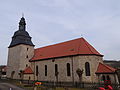
Helmsdorf Ortsteil of Dingelstädt Church in Helmsdorf Coat of arms Location of Helmsdorf Helmsdorf Show map of Germany Helmsdorf Show map of Thuringia...
1 KB (46 words) - 07:57, 15 October 2022
Großbodungen Ortsteil of Am Ohmberg Location of Großbodungen Großbodungen Show map of Germany Großbodungen Show map of Thuringia Coordinates: 51°28′N 10°30′E...
2 KB (59 words) - 16:31, 28 February 2024

Lichtenberg (German: [ˈlɪçtn̩ˌbɛʁk] ) is a quarter (Ortsteil) of Berlin in the homonymous borough (Bezirk) of Lichtenberg. Until 2001 it was an autonomous...
5 KB (449 words) - 20:09, 20 August 2024
Kefferhausen Ortsteil of Dingelstädt Coat of arms Location of Kefferhausen Kefferhausen Show map of Germany Kefferhausen Show map of Thuringia Coordinates:...
916 bytes (30 words) - 08:00, 15 October 2022

region of East Frisia, in Lower Saxony, Germany. Administratively, it is an Ortsteil of the municipality of Hinte, of which it is located to the northwest....
2 KB (107 words) - 18:42, 19 March 2024
Hohenwalde is an Ortsteil of Frankfurt (Oder), Brandenburg, Germany, with a population of 425. The town of Müllrose is also close by. "municipals -". frankfurt-oder...
693 bytes (53 words) - 04:48, 8 July 2024
Hausen Ortsteil of Niederorschel Coat of arms Location of Hausen Hausen Show map of Germany Hausen Show map of Thuringia Coordinates: 51°22′47″N 10°22′43″E...
932 bytes (38 words) - 07:57, 15 October 2022

Hesborn is a village and a civil parish (Ortsteil) of the German town of Hallenberg, located in the Hochsauerlandkreis district in North Rhine-Westphalia...
2 KB (158 words) - 01:36, 25 October 2020
municipality named Ortsteile (plural of Ortsteil), named from small villages or hamlets or localities. The Ortsteil (suburb or township) may have been a...
9 KB (1,008 words) - 21:49, 7 April 2024