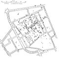
Geographic information systems (GIS) play a constantly evolving role in geospatial intelligence (GEOINT) and United States national security. These technologies...
22 KB (2,582 words) - 10:15, 8 May 2024
Advanced Geospatial Intelligence and imagery-derived Measurement and Signature Intelligence (MASINT) and geospatial information and services (GIS); formerly...
20 KB (2,154 words) - 08:16, 2 December 2024
The National Geospatial-Intelligence Agency (NGA) is a combat support agency within the United States Department of Defense whose primary mission is collecting...
52 KB (4,514 words) - 20:53, 15 December 2024
as the USGS or National Geospatial-Intelligence Agency), GIS software vendors, standards bodies such as the Open Geospatial Consortium, informal user...
23 KB (2,986 words) - 22:26, 6 January 2024
Geographic information system (redirect from GIS)
field work. Geographic information systems (GIS) play a constantly evolving role in geospatial intelligence (GEOINT) and United States national security...
99 KB (12,948 words) - 06:49, 22 December 2024
Geographic data and information (redirect from GIS data)
engineering Earth observation data Geographic feature Georeferencing Geospatial intelligence Ubiquitous geographic information Geolexica, the authoritative...
3 KB (257 words) - 12:25, 18 October 2024
a list of GIS data sources (including some geoportals) that provide information sets that can be used in geographic information systems (GIS) and spatial...
43 KB (514 words) - 19:06, 13 November 2024
spatial data GIS in archaeology GIS and aquatic science GIS in geospatial intelligence GIS and public health List of GIS data sources List of GIS software...
31 KB (3,473 words) - 18:24, 3 December 2024
The Australian Geospatial-Intelligence Organisation (AGO) is an Australian government intelligence agency that is part of the Department of Defence responsible...
7 KB (388 words) - 19:15, 4 November 2024
Spatial database (redirect from Geospatial database)
extensions, and some GIS software vendors have developed their own spatial extensions to database management systems. The Open Geospatial Consortium (OGC)...
22 KB (2,037 words) - 23:38, 19 December 2024
Global Intelligence Solutions (GIS) mission area develops and integrates large-scale, high-performance signals intelligence (SIGINT), geospatial intelligence...
10 KB (858 words) - 01:56, 2 May 2024
(ASD) Australian Geospatial-Intelligence Organisation (AGO) Defence Intelligence Organisation (DIO) Office of National Intelligence (ONI) Bundesministerium...
87 KB (5,089 words) - 11:41, 22 December 2024
QGIS (redirect from Quantum gis)
and analysis of geospatial data in a range of data formats. Its name comes from an abbreviation of its previous name, Quantum GIS. QGIS functions as...
10 KB (884 words) - 10:28, 20 December 2024
comprised: The National Centre for Geospatial Intelligence (NCGI), formerly known as the Defence Geospatial Intelligence Fusion Centre (DGIFC) and prior...
27 KB (2,582 words) - 07:17, 9 December 2024
of 2008 Geospatial intelligence Human intelligence (espionage) Imagery intelligence Intelligence Branch (Canadian Forces) List of intelligence gathering...
54 KB (6,786 words) - 16:27, 24 October 2024
Spatial analysis (redirect from Geospatial analysis)
utilizes geospatial and hydrospatial analysis in a variety of contexts, operations and applications. Geospatial and Hydrospatial analysis, using GIS, was...
62 KB (9,992 words) - 07:30, 6 July 2024
NV5 Geospatial Software develops products for the visualization, analysis, and management of geospatial imagery and scientific data. The company develops...
7 KB (575 words) - 23:10, 21 November 2024
Secret Intelligence Service (ASIS), Defence Intelligence Organisation (DIO), Australian Signals Directorate (ASD), Australian Geospatial-Intelligence Organisation...
86 KB (9,011 words) - 03:49, 13 December 2024
In business intelligence, location intelligence (LI), or spatial intelligence, is the process of deriving meaningful insight from geospatial data relationships...
9 KB (960 words) - 01:00, 23 December 2024
Five Eyes (redirect from Nine Eyes (signals intelligence))
military intelligence (MILINT), human intelligence (HUMINT), and geospatial intelligence (GEOINT). Five Eyes remains a key element in the intelligence and...
89 KB (7,223 words) - 10:34, 14 December 2024
standard for GIS data exchange (by Open Geospatial Consortium) Simple Features – specification for vector data storage (by Open Geospatial Consortium)...
3 KB (238 words) - 10:42, 18 July 2024
Defense Intelligence Agency (DIA) is an intelligence agency and combat support agency of the United States Department of Defense, specializing in defense...
88 KB (9,824 words) - 11:41, 25 November 2024
Joint Air Reconnaissance Intelligence Centre (JARIC)) and then known for several years as the Defence Geospatial Intelligence Fusion Centre, it can trace...
15 KB (1,593 words) - 23:23, 30 October 2024
Keyhole Markup Language (category Open Geospatial Consortium)
Inc, which was acquired by Google in 2004. KML became an international standard of the Open Geospatial Consortium in 2008. Google Earth was the first program...
8 KB (799 words) - 11:47, 14 December 2024
released in 1982 as ARC/INFO, a command line-based GIS. ARC/INFO was later merged into ArcGIS Desktop, which was eventually superseded by ArcGIS Pro in 2015...
54 KB (5,370 words) - 14:36, 13 December 2024
military services. Subsequently, NPIC was transferred to the National Geospatial-Intelligence Agency (NGA).[citation needed] The Directorate of Support has organizational...
216 KB (22,407 words) - 03:31, 19 December 2024
The Military Intelligence Corps is the intelligence branch of the United States Army. The primary mission of military intelligence in the U.S. Army is...
48 KB (1,350 words) - 19:55, 20 December 2024
from space GIS in GEOINT Geospatial intelligence (GEOINT) National Collection of Aerial Photography (NCAP) National Geospatial-Intelligence Agency (American...
23 KB (2,655 words) - 23:45, 21 July 2024
Geographic information science (redirect from GIS&T)
systems (GIS), which are the actual repositories of geospatial data, the software tools for carrying out relevant tasks, and the profession of GIS users...
10 KB (991 words) - 19:46, 26 October 2024
the Australian Intelligence Community and is part of the Defence Intelligence Group (DIG) with the Australian Geospatial-Intelligence Organisation (AGO)...
9 KB (555 words) - 13:11, 25 June 2024


