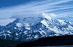
The Latady Mountains (74°45′S 64°18′W / 74.750°S 64.300°W / -74.750; -64.300 (Latady Mountains)) are a group of mountains rising west of Gardner Inlet...
8 KB (1,393 words) - 07:40, 25 April 2024
Ice Shelf on the coast. The Scaife Mountains are to the east of Gardner Inlet, separated from the Latady Mountains to the northeast by the Ketchum Glacier...
8 KB (1,272 words) - 06:47, 28 April 2024
coordinates) The Scaife Mountains are in Ellsworth Land. They are southwest of the Latady Mountains and east of the Sweeney Mountains. They are bounded by...
7 KB (1,233 words) - 13:22, 24 April 2024
Mount Saint Elias (category Mountains of Alaska)
his brother Cornelius, Andrew and Betty Kauffman, Maynard Miller, William Latady, and Benjamin Ferris. William Putnam was a member of the expedition but...
11 KB (929 words) - 21:30, 21 August 2024
Guettard Range (category Mountain ranges of Palmer Land)
Sea. The Latady Mountains are west of the Irvine Glacier, and the Hutton Mountains are east of the Johnson Glacier. The Playfair Mountains are to the...
5 KB (780 words) - 15:27, 24 April 2024
The Ellsworth Land Volcanic Group is a geological formation in the Latady Basin, Ellsworth Land, Antarctic Peninsula, with a calculated maximum depositional...
24 KB (2,104 words) - 21:15, 28 August 2024

(55 nmi) west of Alexander Island, and about 57 kilometres (31 nmi) north of Latady Island. A notable landmark of the island is its northernmost point, Cape...
3 KB (285 words) - 21:09, 26 September 2024
The Spire (Graham Land) (redirect from The Spire (Blackwall Mountains))
Research Expedition (RARE). The name was first used in 1949 by William Latady, aerial photographer with RARE. "The Spire". Geographic Names Information...
1 KB (139 words) - 14:15, 19 July 2024
FLOWERDEW, M. J.; MILLAR, I. L. (2006-09-28). "A new stratigraphy for the Latady Basin, Antarctic Peninsula: Part 1, Ellsworth Land Volcanic Group". Geological...
37 KB (2,057 words) - 21:14, 14 February 2024

2021. Cantrill, D. J.; Hunter, M. A. (2005). "Macrofossil floras of the Latady Basin, Antarctic Peninsula". New Zealand Journal of Geology and Geophysics...
67 KB (3,747 words) - 01:26, 21 August 2024

250; -55.750 (Joinville) Latady, Isla Argentine Antarctica 70°40′S 74°00′W / 70.667°S 74.000°W / -70.667; -74.000 (Latady) Laurie, Isla Argentine Antarctica...
15 KB (234 words) - 13:02, 9 April 2023

Douglas Range (category Mountain ranges of Alexander Island)
Antarctica: Includes Islands South of Latitude 60.̊, P 206 William Robertson Latady, REPORT ON THE AERIAL PHOTOGRAPHY OF THE RONNE ANTARCTIC RESEARCH EXPEDITION...
6 KB (545 words) - 08:58, 22 December 2023
Cantrill, David J.; Hunter, Morag A. (2005). "Macrofossil floras of the Latady Basin, Antarctic Peninsula". New Zealand Journal of Geology and Geophysics...
24 KB (2,567 words) - 17:23, 17 August 2023
171 David J. Cantrill & Morag A. Hunter (2005), Macrofossil floras of the Latady Basin, Antarctic Peninsula, New Zealand Journal of Geology and Geophysics...
3 KB (256 words) - 00:42, 29 April 2022

J.; Flowerdew, M. J.; Millar, I. L. (2006). "A new stratigraphy for the Latady Basin, Antarctic Peninsula: Part 1, Ellsworth land volcanic group" (PDF)...
51 KB (5,647 words) - 06:20, 22 September 2024