
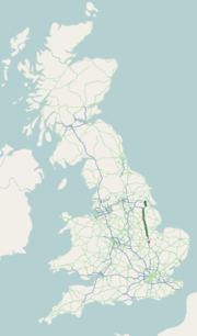
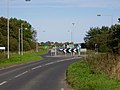
The A63 is a major road in Yorkshire, England between Leeds and Kingston upon Hull. A section between North Cave and Hull forms the eastward continuation...
23 KB (2,426 words) - 16:56, 17 November 2023
A63 or A-63 may refer to: A63 road, a road in England connecting Leeds and Hull A63 motorway (France), a road connecting Bordeaux and the border with...
428 bytes (93 words) - 08:11, 10 March 2016
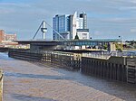
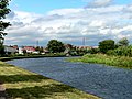
Swing Bridge is a road bridge over the River Hull, in the city of Kingston upon Hull, Yorkshire, England. The bridge carries the A63 road through the south...
13 KB (1,496 words) - 21:16, 30 March 2024

was expected to be open in early 2021. Meanwhile, preparation for the A63 road development commenced in October 2020 with the exhumation of 19,000 bodies...
16 KB (1,275 words) - 17:02, 9 July 2024

from the A63 junction to Dunswell, is known to have traffic problems. The route starts at the junction of the A1174 road and the A1079 road, heading east...
10 KB (1,093 words) - 19:37, 16 May 2023
River Ouse swing bridge (category Road bridges in England)
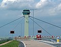
River Ouse swing bridge is a road bridge over the River Ouse in North Yorkshire, England. It was opened in 2004 when the A63 road bypassed the town of Selby...
6 KB (467 words) - 21:39, 15 September 2023

Yorkshire urban belt in the west. To the north the A63 road via Howden provides local access to the A19 road to Selby and York. The M18 runs west of the town...
24 KB (2,526 words) - 15:41, 7 July 2024
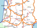
The A63 autoroute is a motorway in southwest France, connecting Bordeaux (from Junction 15 of the Rocade) to the border with Spain and Basque Country...
7 KB (284 words) - 00:32, 13 February 2023

together as 70mph dual carriageway for about a half mile. A63 road Selby Road The then former A63 between M1 J46 and Whitkirk Roundabout (Skyliner) was redesignated...
7 KB (554 words) - 17:53, 7 May 2024

mile (1.6 km) on a hill to the south east of Leeds city centre, with the A63 road (Pontefract Lane) running through the middle and dividing it into a residential...
5 KB (472 words) - 15:30, 17 October 2023

Kingston upon Hull (section Roads)
fourth-best cycling city in the United Kingdom. The main road into and out of Hull is the M62 motorway/A63 road, one of the main east–west routes in Northern England...
228 KB (19,594 words) - 19:46, 7 July 2024

in 2005 and that of a man jumping from the bridge to his death on the A63 road below in September 2006. Plans were announced on 26 December 2009 to construct...
40 KB (4,405 words) - 22:32, 30 June 2024

which it is nearly contiguous. The village is bounded to the south by the A63 road, and is 0.6 miles (1 km) north of the Humber Estuary bank. The village...
19 KB (1,904 words) - 19:52, 26 November 2023
Green and is located with the M1 Motorway on its southern edge and the A63 road on its eastern edge. In July 2018, it was announced that the site had been...
10 KB (1,100 words) - 23:17, 21 May 2024

an increase of over 700%. On 13 August, a set of safety barriers on the A63 road at South Cave buckled in the heat, less than a year after being installed...
76 KB (8,298 words) - 19:13, 24 June 2024
southern extreme, and into the Yorkshire Wolds in the northern part. The A63 road and Hull to Selby railway line both bisect the parish east–west, south...
25 KB (2,670 words) - 12:28, 2 May 2024
and South Cave. It lies 1 mile (1.6 km) north of the A63 road and 1 mile west of the A1034 road. Everthorpe forms part of the civil parish of North Cave...
3 KB (205 words) - 01:02, 3 July 2024

miles (23 km) to the west of Hull city centre on the A1034 road just to the north of the A63 road. North Cave is approximately 2 miles (3 km) to the north-west...
10 KB (1,116 words) - 21:42, 9 July 2024
dismantled railway bridge. which used to cross just to the south of the A63 road bridge. Immediately afterwards, another original bridge carries Brayton...
20 KB (2,893 words) - 19:55, 13 June 2023

(3 km) north of Brough, 12 miles (19 km) west of Hull and north of the A63 road. The 2011 UK Census gave the parish had a population of 370, marking a...
10 KB (1,131 words) - 19:25, 12 May 2022
September 1995 and is in the village of Brantingham, which is off the A63 road between Brough and South Cave. Hull Ionians was formed in 1989 by the merger...
7 KB (390 words) - 09:55, 6 May 2024

Cyclone Xaver (section Road)
Hessle foreshore to homes and businesses; and around Albert Dock. The A63 road through the city was closed until midday 6 December, flooded. Humberside...
62 KB (5,519 words) - 06:09, 3 April 2024

A1(M) motorway junction 42, (A1 road), and 5 miles (8 km) north of the M62 motorway, junction 33, at Ferrybridge. The A63 road, Leeds to Selby, runs through...
6 KB (579 words) - 19:41, 16 March 2024
crosses the A63 and meets a roundabout with A164 (for Beverley) and A1105, then turns left along a short section of dual-carriageway (former A63) to end at...
40 KB (3,218 words) - 00:05, 8 March 2024

M62 motorway (category Infobox road maps for Wikidata migration)
miles (16 km) after this, the road runs towards Hull, serving Howden and North Cave, before downgrading to the A63 road. Coordinate list 53°24′22″N 2°53′47″W...
64 KB (4,828 words) - 02:50, 25 March 2024
List of A roads in zone 1 in Great Britain beginning north of the River Thames, east of the A1 (roads beginning with 1). "Old Stoke Bridge, Ipswich"....
99 KB (79 words) - 15:53, 8 July 2024

A roads in zone 6 in Great Britain starting east of the A6 and A7 roads, and west of the A1 (road beginning with 6). "A613 (Gateshead)". sabre-roads.org...
47 KB (76 words) - 15:44, 8 July 2024

The A30 is a major road in England, running 284 miles (457 km) WSW from London to Land's End. The road has been a principal axis in Britain from the 17th...
37 KB (3,888 words) - 23:11, 6 July 2024
B roads are numbered routes in Great Britain of lesser importance than A roads. See the article Great Britain road numbering scheme for the rationale behind...
86 KB (29 words) - 16:10, 8 July 2024
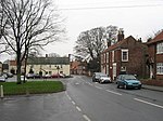
served by the main A63 road, being bypassed in 1961, which links to the M62 motorway to the west and Hull to the east. The former A63 is now the B1231....
13 KB (1,374 words) - 21:58, 22 April 2024