
Anamudi ("Elephant head") is a mountain located in Ernakulam district and Idukki district of the Indian state of Kerala. With an elevation of 2,695 metres...
12 KB (810 words) - 08:10, 19 May 2024

Division, which also runs the nearby Mathikettan Shola National Park, Anamudi Shola National Park, Pambadum Shola National Park, Chinnar Wildlife Sanctuary...
9 KB (901 words) - 06:14, 23 May 2024
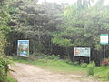
Anamudi Shola National Park is a protected area located along the Western Ghats of Idukki district in Kerala state, India. It is composed of Mannavan...
4 KB (386 words) - 13:17, 30 September 2024
access to the summit. It is the third highest peak in South India next to Anamudi and Meesapulimala. The peaks Hecuba (2375 m), Kattadadu (2418 m) and Kulkudi...
4 KB (289 words) - 08:00, 1 August 2024

due to its mountainous nature. The 2,695 metres (8,842 ft) high peak of Anamudi, which is also the highest point of elevation in India outside the Himalayas...
79 KB (7,279 words) - 16:06, 19 November 2024
Western Ghats have several peaks that rise above 2,000 m (6,600 ft), with Anamudi (2,695 m (8,842 ft)) being the highest peak. The average elevation is around...
51 KB (4,902 words) - 06:39, 13 November 2024
coordinates) GPX (primary coordinates) GPX (secondary coordinates) Agastyamalai Anamudi Anginda Apharwat Peak Bamba Dhura Bandarpunch Betlingchhip Blue Mountain...
16 KB (549 words) - 13:57, 27 October 2024

in the world where cultivation takes place below sea level. The peak of Anamudi, which is also the point of highest altitude in India outside the Himalayas...
40 KB (3,900 words) - 19:43, 22 November 2024

Pambar River originates near Anamudi in Idukki district of Kerala state in South India. It traverses Turner's Valley in Eravikulam National Park and flows...
3 KB (228 words) - 07:29, 1 May 2024

Sitamma Konda in Survey of India maps. Arma Konda lies second only to Anamudi in India in terms of its topographic isolation. The peak has an isolation...
3 KB (188 words) - 13:39, 17 November 2024

means 'mountain', and thus literally translatable as 'Elephant mountain'. Anamudi Peak (8,842 feet (2,695 metres)) lies at the southern end of the range...
12 KB (1,254 words) - 16:56, 17 November 2024
Kun (7,135 m) Kangto (7,090 m) Reo_Purgyil(6,816 m) Sandakphu (3,636 m) Anamudi (2,695 m) Gurushikhar Mount Abu (1,722 m) Kalsubai (1,646 m) List of hill...
16 KB (433 words) - 18:46, 11 November 2024

With a height of 8841 feet (2,695 metres), Anamudi is the highest peak in India outside Himalayas. Anamudi is located in Idukki district in Kerala. The...
29 KB (3,291 words) - 13:34, 17 September 2024

fifth-highest peak in South India as well as the third-highest in Kerala after Anamudi (2,696 m [8,845 ft]) and Meesapulimala (2,651 m [8,698 ft]), is the highest...
18 KB (1,602 words) - 21:05, 10 October 2024

part of the South Western Ghats moist deciduous forests ecoregion. The Anamudi is the tallest peak in South India, on the border of Ernakulam and Idukki...
41 KB (3,447 words) - 21:53, 18 November 2024

Wildlife Sanctuary to the north east, the Eravikulam National Park and Anamudi Shola National Park to the north, the Pampadum Shola National Park to the...
19 KB (1,635 words) - 00:33, 13 July 2024

level, while the highest peaks reach around 2,500 metres (8,200 feet). Anamudi in the Idukki district is the highest peak in south India, is at an elevation...
335 KB (30,263 words) - 17:19, 10 November 2024

the nearby Mathikettan Shola National Park, Eravikulam National Park, Anamudi Shola National Park, Chinnar Wildlife Sanctuary and the Kurinjimala Sanctuary...
7 KB (625 words) - 07:18, 16 January 2024
Ministry of Environment and Forests (India). Periyar Silent Valley Eravikulam Anamudi Karimpuzha Mathikettan Pambadum The state of Kerala covers an area of 38...
9 KB (898 words) - 18:41, 10 June 2024

Forestry Research and Education Thamirabarani River Tirunelveli Papanasam Anamudi - Highest peak in Western Ghats Tourism in Thiruvananthapuram Google Maps...
11 KB (1,081 words) - 10:58, 26 August 2024
The peak of Anamudi is the highest point of elevation in South India...
225 KB (16,730 words) - 21:50, 24 October 2024

Wildlife Sanctuary to the north east, the Eravikulam National Park and Anamudi Shola National Park to the north, the Pampadum Shola National Park to the...
9 KB (698 words) - 01:23, 13 July 2024

Airport. India portal Western Ghats - Ponmudi is a part of Western Ghats Anamudi (ആനമുടി) - Highest peak in Kerala Agastya Mala (അഗസ്ത്യമല) - Highest peak...
9 KB (1,016 words) - 13:50, 1 November 2024
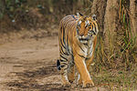
Karnataka Kali Tiger Reserve Bandipur Bannerghatta Kundremukh Nagarhole Kerala Anamudi Shola Eravikulam Mathikettan Shola Pampadam Shola Periyar Silent Valley...
28 KB (3,061 words) - 17:39, 9 July 2024

situated in the high ranges are susceptible to erosion and mass movements. Anamudi, at 2,695 metres (8,842 ft) the highest peak in South India, is the highest...
57 KB (6,318 words) - 11:18, 15 August 2024

The crest of the hills form the boundary between Kerala and Tamil Nadu. Anamudi (8,842 ft (2,695 m)) in Eravikulam National Park, is the highest peak in...
13 KB (1,158 words) - 18:25, 1 May 2024
Name Notable Features Fauna Rivers and lakes inside the national park Anamudi Shola National Park The park is administered by Munnar Wildlife Division...
46 KB (371 words) - 19:10, 22 November 2024
on to Eravikulam village. It passes near Eravikulam National Park and Anamudi, the tallest Indian peak south of the Himalayas and into Marayoor town...
5 KB (308 words) - 19:53, 25 August 2024

in the higher elevation hill regions of the Nilgiris, Anaimalai, around Anamudi, Palni hills, Meghamalai, Agasthyamalai to the south and the Malnad and...
12 KB (1,363 words) - 19:42, 25 September 2024

extremely short limbs and numerous macroglands and was discovered from the Anamudi summit (2695 m asl) in the Western Ghats of Kerala, India and is known...
6 KB (706 words) - 21:43, 30 December 2023