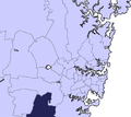
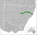
Appin Road is a New South Wales secondary highway linking Campbelltown and Sydney's western suburbs with Wollongong. It is named after Appin, which lies...
8 KB (552 words) - 00:47, 5 September 2023
Appin (Scottish Gaelic: An Apainn) is a coastal district of the Scottish West Highlands bounded to the west by Loch Linnhe, to the south by Loch Creran...
6 KB (491 words) - 00:34, 8 November 2024
Appin is a town on the south-west fringe of Sydney in the Macarthur Region in Tharawal country near its boundary with Gandangara country, New South Wales...
23 KB (2,508 words) - 02:54, 3 December 2024
homestead complex, residence, inn and farm and now residence located at Appin Road, St Helens Park in the City of Campbelltown local government area of New...
23 KB (3,042 words) - 07:12, 9 December 2024
brothers, Robert Kerr Fulton was born into a non-theatrical family at 46 Appin Road, Dennistoun, Glasgow. Fulton's mother, who was 40 at the time of his birth...
21 KB (2,240 words) - 15:41, 6 January 2025
the oldest building in the suburb. That honour goes to a farmhouse on Appin Road called Denfield and Curtilage which was built in the 1830s by John Farley...
5 KB (632 words) - 16:28, 16 September 2024
Outer Sydney Orbital (category Proposed roads in Australia)
between Richmond Road and Hume Motorway - announced in June 2018 Stage 2 Sector 1: between Hume Motorway and Appin Road east of Appin - announced in August...
7 KB (655 words) - 19:40, 18 November 2024
Campbelltown Road: Denham Court (homestead) Gilead, 767 Appin Road: Beulah, Gilead Gilead, Menangle Road: Sugarloaf Farm Ingleburn, 196 Campbelltown Road: Robin...
30 KB (2,391 words) - 06:20, 27 December 2024
Beulah is a heritage-listed farm at 767 Appin Road, Gilead, New South Wales, an outer suburb of Sydney, Australia in the Macarthur region. It was built...
90 KB (13,590 words) - 07:07, 9 December 2024
A9 (Sydney) (redirect from The Northern Road)
Wollongong via Sydney's western suburbs, along Putty Road, the current A9 route, and Appin Road. It was replaced by Metroad 9 between Windsor and Campbelltown...
22 KB (1,637 words) - 01:59, 8 January 2025
Princes Motorway (redirect from Mount Ousley Road)
dual-carriageway road, taking more or less a parallel route with Princes Highway until the sprawling interchange with Appin Road and Princes Highway...
33 KB (2,766 words) - 00:31, 9 September 2024
Kings Highway (Australia) (category WikiProject Australian Roads articles with a junction list using templates)
State government through the Main Roads Board (later Transport for NSW). Main Road No. 51 was declared along this road on 8 August 1928, from the intersection...
19 KB (1,678 words) - 11:22, 31 December 2024
Hume Highway (redirect from Great South Road (New South Wales))
Goulburn, followed by Hamilton Hume and William Hovell's overland journey from Appin (near Campbelltown) to Port Phillip and return in 1824, development of the...
94 KB (10,496 words) - 03:20, 29 October 2024
has a number of heritage-listed sites, including: 767 Appin Road: Beulah, Gilead Menangle Road: Sugarloaf Farm Australian Bureau of Statistics (28 June...
4 KB (383 words) - 10:32, 25 August 2024
Bells Line of Road is a 59-kilometre (37 mi) major road located in New South Wales, Australia, providing an alternative crossing of the Blue Mountains...
17 KB (1,566 words) - 06:32, 13 August 2024
Princes Highway (redirect from Dandenong Road)
via Liverpool, Campbelltown, Appin to Bulli Tops. As a named route, the highway came into being when pre-existing roads were renamed Prince's Highway...
84 KB (5,311 words) - 22:31, 5 January 2025
Reserve Rosemeadow can be accessed via Appin Road or via surrounding suburbs of Ambarvale and Glen Alpine. The main road passing through Rosemeadow would be...
7 KB (650 words) - 02:15, 11 October 2024
Castlereagh Highway (redirect from A55 road (Queensland))
October 1997, subsuming Main Road 77 (previously Trunk Road 77). The southern end of Main Road 56 (previously Trunk Road 56) was truncated to meet State...
21 KB (1,602 words) - 06:36, 13 August 2024
Monaro Highway (category WikiProject Australian Roads articles with a junction list using templates)
are numerous crossings. The road also parallels the former Bombala railway line in several locations. Within the ACT, the road becomes a high volume roadway...
49 KB (4,378 words) - 18:30, 23 November 2024
Road routes in New South Wales assist drivers navigating roads in urban, rural, and scenic areas of the state. Today all numbered routes in the state are...
77 KB (1,271 words) - 21:50, 1 January 2025
Olympic Highway (category WikiProject Australian Roads articles with a junction list using templates)
Olympic Highway is a 317-kilometre (197 mi) rural road in the central western and south-eastern Riverina regions of New South Wales, Australia. It services...
18 KB (1,515 words) - 02:57, 24 December 2024
Pacific Motorway (Brisbane–Brunswick Heads) (category WikiProject Australian Roads articles with a junction list using templates)
was spent on the motorway between 1990 and 1998, including widening the road and safety measures. The motorway passes Gold Coast attractions such as Warner...
56 KB (3,887 words) - 08:58, 4 January 2025
Sydney Bypass refers to a number of roads, existing and proposed, that motorists can use to avoid the congested approaches to the Sydney central business...
12 KB (1,377 words) - 10:31, 17 January 2024
Federal Highway (Australia) (category WikiProject Australian Roads articles with a junction list using templates)
Street and Flemington Road, and 70 km/h (43 mph) between Flemington Road and the end of the road at Barton Highway (where the road runs parallel with the...
17 KB (1,156 words) - 00:40, 9 September 2024
Nerang–Murwillumbah Road is a continuous 36.4 kilometres (22.6 mi) road route in the Gold Coast region of Queensland, Australia. The entire road is signed as...
13 KB (1,074 words) - 17:45, 25 July 2024
Great Western Highway (redirect from Great Western Road (New South Wales))
Road (Princes Highway), where the highway changes name to Parramatta Road and heads generally west towards Parramatta. Hume Highway (Liverpool Road)...
57 KB (5,784 words) - 13:30, 30 December 2024
Newell Highway (category WikiProject Australian Roads articles with a junction list using templates)
national highway in New South Wales (NSW), Australia. It provides the major road link between southeastern Queensland and Victoria via central NSW and as...
30 KB (2,352 words) - 23:07, 7 November 2024
Kosciuszko Road is a road in the Snowy Mountains of New South Wales, Australia which runs from Pine Valley, to the ski resort of Charlotte Pass in Kosciuszko...
8 KB (545 words) - 05:40, 13 August 2024
NSW). Main Road No. 179 was declared on 8 August 1928 from Campbelltown via Maldon and Wiltin to Appin. With the passing of the Main Roads (Amendment)...
11 KB (915 words) - 03:58, 23 April 2023
Oxley Highway (category WikiProject Australian Roads articles with a junction list using templates)
Bendemeer existed as a mapped road in 1857, was surveyed in 1867, and proclaimed a Parish Road in c.1889. West of Walcha the road was only suitable for bullock...
16 KB (1,281 words) - 06:02, 13 August 2024


