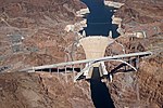
State Route 68, also known as SR 68, is an east–west highway in northwestern Arizona running from its western terminus at its junction with State Route...
6 KB (413 words) - 15:19, 23 February 2024
with State Route 68 north of town. There is a short SR 95 Truck at Parker, formerly a section of Arizona State Route 72, connecting to California State Highway...
10 KB (574 words) - 10:33, 29 March 2024
State Route 79 (SR 79), also known as the Pinal Pioneer Parkway, is a 58.40 mi (93.99 km) long state highway in the U.S. state of Arizona. It serves as...
19 KB (1,921 words) - 00:36, 5 August 2024
state of Arizona's State Routes are usually abbreviated as SR. The Arizona State Highway system was introduced on September 9, 1927, by the State Highway...
50 KB (1,442 words) - 23:47, 19 July 2024
partnership with Crystal Collins to develop most of the land south of Arizona State Route 68 into 2.5-acre (1.0 ha) parcels. The company's name was Golden Valley...
13 KB (1,202 words) - 21:41, 4 October 2024
Arizona State Route 202 (SR 202) or Loop 202 (202L) is a semi-beltway circling the eastern and southern areas of the Phoenix metropolitan area in central...
45 KB (3,323 words) - 06:39, 8 December 2024
State Route 89A (SR 89A) is an 83.85-mile (134.94 km) state highway that runs from Prescott north to Flagstaff in the U.S. state of Arizona. The highway...
28 KB (2,141 words) - 21:37, 5 January 2025
State Route 80 (SR 80) is a 120.20-mile (193.44-kilometre) long, roughly arc-shaped highway lying in southeastern Arizona. Starting in downtown Benson...
15 KB (1,571 words) - 00:36, 5 August 2024
State Route 69 (SR 69) is a highway that serves as the main road to Prescott, Arizona, from Interstate 17. The highway mainly consists of four-lanes (two...
7 KB (581 words) - 02:14, 28 December 2024
Route 93 Arizona State Route 66 Business Loop 40 and Arizona SR 66 are composed of the remnants of what was U.S. Route 66. Arizona State Route 68 Interstate...
42 KB (4,135 words) - 17:12, 2 October 2024
Nevada and Arizona. Between Las Vegas and Barstow, California, the route was co-signed with U.S. Route 91. However, the state of Arizona continued to...
13 KB (1,260 words) - 06:43, 29 June 2024
State Route 264 (SR 264) is a state highway in northeastern Arizona, that runs from a junction with US 160 near Tuba City to the New Mexico state line...
9 KB (864 words) - 04:59, 28 December 2024
State Route 77 (SR 77) is a 253.93-mile (408.66-kilometre) long state highway in Arizona that traverses much of the state's length, stretching from its...
23 KB (1,878 words) - 03:41, 19 November 2024
summary of the former state routes in Arizona, including mileage tables and maps. Between the establishment of Arizona's numbered state highway system in...
93 KB (8,932 words) - 22:00, 4 August 2024
State Route 68 Arizona State Route 68 Arkansas Highway 68 (former) California State Route 68 Colorado State Highway 68 (former) Connecticut Route 68 Florida...
5 KB (385 words) - 16:11, 27 August 2024
Arizona (/ˌærɪˈzoʊnə/ ARR-iz-OH-nə; Navajo: Hoozdo Hahoodzo [hoː˥z̥to˩ ha˩hoː˩tso˩]; O'odham: Alĭ ṣonak [ˈaɭi̥ ˈʂɔnak]) is a state in the Southwestern...
164 KB (13,930 words) - 09:35, 5 January 2025
U.S. Route 93 (US 93) is a United States Numbered Highway in the state of Arizona that begins in Wickenburg and heads north to the Nevada state line at...
27 KB (2,959 words) - 01:46, 5 August 2024
Signage at an intersection with State Route 64 in Valle, Arizona 40 miles (64 km) northwest of Flagstaff indicates that the route starts at SR 64, which is...
16 KB (1,574 words) - 22:55, 30 May 2024
Interstate 17 (redirect from Arizona State Route 79 (1950-1968))
is a north–south Interstate Highway located entirely within the US state of Arizona. I-17's southern terminus lies in Phoenix, at I-10/US 60 and its northern...
26 KB (1,449 words) - 01:16, 15 December 2024
U.S. Route 60 is a major east–west United States highway, traveling 2,655 miles (4,273 km) from southwestern Arizona to the Atlantic Ocean coast in Virginia...
50 KB (5,482 words) - 13:30, 20 November 2024
the early years, US 70 had a different route between Clovis, New Mexico and eastern Arizona, taking the route of current US 60 and US 180 to an endpoint...
46 KB (5,187 words) - 18:45, 8 November 2024
State Route 587, also known as SR 587, is a state highway in south-central Arizona that travels from its junction with State Route 87 just south of Sun...
5 KB (355 words) - 01:23, 8 September 2023
State Route 67 (SR 67) is a 43.4 mi (69.8 km) long, north–south state highway in northern Arizona. Also called the Kaibab Plateau – North Rim Parkway...
14 KB (1,234 words) - 22:20, 7 November 2024
about two miles (3.2 km) upstream from Davis Dam and accessed from Arizona State Route 68. The National Park Service, which administers Katherine Landing...
2 KB (191 words) - 02:13, 27 August 2024
Arizona State Route 78 (SR 78) and New Mexico State Road 78 (NM 78) are a pair of adjoining state highways located in eastern Arizona and western New...
7 KB (542 words) - 02:19, 12 April 2024
southerly is from Littlefield, Arizona, to St. George, Utah, where the two routes took different paths through the Arizona Strip. The more northerly and...
31 KB (3,020 words) - 05:04, 25 June 2024
Mike O'Callaghan–Pat Tillman Memorial Bridge (category U.S. Route 93)
US 95, Nevada State Route 163, the Colorado River crossing between Laughlin, Nevada and Bullhead City, Arizona, and Arizona State Route 68. The detour was...
31 KB (2,957 words) - 16:12, 13 December 2024
Interstate 8 (redirect from Arizona State Route 8)
These were later replaced by U.S. Route 80 (US 80) across California and part of Arizona, and Arizona State Route 84 (SR 84) between Gila Bend and Casa...
113 KB (12,102 words) - 03:25, 7 January 2025
northeast Arizona. The western terminus is at U.S. Route 160 in Teec Nos Pos, Arizona. The highway's eastern terminus is at NC 12 and U.S. Route 158 at Whalebone...
31 KB (2,918 words) - 19:54, 8 December 2024
In the U.S. state of Arizona, Interstate 10 (I‑10), the major east–west Interstate Highway in the United States Sun Belt, runs east from California, enters...
62 KB (4,286 words) - 02:51, 28 December 2024


