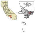
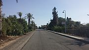
Avocado Heights (pronunciation) is an unincorporated census-designated place (CDP) in the San Gabriel Valley of Los Angeles County, California, United...
19 KB (1,701 words) - 02:53, 18 August 2024
2018, the city of La Habra Heights celebrated the Hass avocado at its Annual La Habra Heights Avocado Festival. Hass avocado trees, like some other cultivars...
11 KB (1,293 words) - 05:17, 14 September 2024
The avocado, alligator pear or avocado pear (Persea americana) is an evergreen tree in the laurel family (Lauraceae). It is native to the Americas and...
83 KB (8,668 words) - 23:00, 12 November 2024
California's 38th congressional district (category Avocado Heights, California)
place Avocado Heights, the cities of Whittier, Montebello, Norwalk, Pico Rivera, Diamond Bar, La Mirada, Walnut, Santa Fe Springs, La Habra Heights, and...
59 KB (985 words) - 04:07, 10 November 2024
California's 32nd congressional district (category Avocado Heights, California)
California's 32nd congressional district is a congressional district in the U.S. state of California based in Los Angeles County. The 32nd district takes...
59 KB (906 words) - 05:11, 14 October 2024
Alhambra (small portion in the 213/323 area code) Altadena Arcadia Avocado Heights Azusa Baldwin Park Bassett Bradbury Charter Oak Citrus Covina Duarte...
4 KB (355 words) - 05:27, 12 July 2024
cities of Glendora and Monrovia, and the census-designated places Avocado Heights, North El Monte, South San Jose Hills, West Puente Valley, Valinda...
54 KB (917 words) - 18:53, 9 November 2024
United States, within the Census-designated places boundaries of Avocado Heights and West Puente Valley. Its ZIP Code is 91746 and it uses area code...
3 KB (234 words) - 03:55, 23 June 2024
Rose Hills Memorial Park (category Avocado Heights, California)
Group) and is the largest cemetery in North America. Mausoleums Whittier Heights Mausoleum, built in 1917 as "Mausoleum #1" or "The Little Mausoleum", was...
11 KB (1,085 words) - 13:27, 14 October 2024
Estimate, the most populous are: Acton Agua Dulce Alondra Park Altadena Avocado Heights Castaic Charter Oak Citrus Del Aire Desert View Highlands East Los...
130 KB (7,917 words) - 02:49, 11 November 2024
Canyon 11,901 Agua Dulce 20,330 Alondra Park 8,592 Altadena 43,975 Avocado Heights 16,007 Bandini Islands 0 Castaic 19,015 Castaic/Val Verde 31,844 Channel...
10 KB (236 words) - 05:30, 18 April 2024
California's 57th State Assembly district (category Avocado Heights, California)
Los Angeles County – 4.7% Avocado Heights East La Mirada Hacienda Heights Industry – 93.6% La Habra Heights La Mirada La Puente Norwalk – 62.2% Santa...
22 KB (120 words) - 21:21, 27 March 2024
Avocado production is important to the economy of Mexico with the country being the world's largest producer of the crop. Mexico supplies 45 percent of...
18 KB (1,954 words) - 20:47, 6 November 2024
Puente Hills Landfill (category Avocado Heights, California)
urban communities are unincorporated Hacienda Heights to the east, and unincorporated Avocado Heights and the City of Industry to the north. 15 m3/s...
7 KB (558 words) - 09:23, 12 September 2024
I-105 in Norwalk I-5 in Santa Fe Springs SR 72 in Whittier SR 60 in Avocado Heights I-10 in Baldwin Park I-210 in Irwindale North end Huntington Drive...
16 KB (1,081 words) - 06:20, 17 November 2024
3.9% 0.8% 35.7% Avalon City 3,690 93.7% 5.5% 0.4% 0.5% 0.0% 61.7% Avocado Heights CDP 15,378 38.4% 50.3% 9.6% 1.6% 0.1% 80.2% Azusa City 46,177 44.9%...
91 KB (1,509 words) - 18:56, 29 June 2024
Hacienda La Puente Unified School District (category Hacienda Heights, California)
Hacienda Heights, portions of the cities of Industry, La Puente and West Covina and portions of the unincorporated communities of Avocado Heights, Valinda...
4 KB (401 words) - 11:54, 23 July 2024
cities of La Habra Heights, La Puente, and the unincorporated communities of Avocado Heights, Valinda, Bassett, Hacienda Heights and North Whittier (Spyglass/Rose...
39 KB (3,440 words) - 03:39, 13 September 2024
List of former Metro Local routes (section 274 - Avocado Heights - West Covina - Glendora via Puente Ave - Citrus Ave)
Foothill Transit retained Line 274 south of Plaza West Covina to Avocado Heights (now extended to Whittier) via Puente Ave while Foothill Transit Line...
67 KB (8,759 words) - 04:50, 14 November 2024
Rancho La Puente (category Avocado Heights, California)
County. The present communities of Avocado Heights, Bassett, Baldwin Park, San Dimas, Rowland Heights, Hacienda Heights, City of Industry, La Puente, Walnut...
14 KB (1,951 words) - 21:03, 15 October 2024
Alum Rock (70.7%) Arvin (92.7%) Avenal (71.8%) Avocado Heights (82.1%) Bay Point (54.9%) Bloomington (81.0%) Blythe (53.2%) Brawley (81.5%) Cherryland...
19 KB (121 words) - 18:40, 31 July 2024
neighborhoods of the San Gabriel Valley include: Alhambra Altadena Arcadia Avocado Heights Azusa Baldwin Park Bassett Bradbury Claremont Charter Oak Citrus City...
61 KB (6,691 words) - 19:05, 9 November 2024
eastward to Chino Hills, Diamond Bar, the City of Industry, Hacienda Heights, Rowland Heights, Walnut, and West Covina. Numerous Mandarin, Hokkien, Hakka, Teochew...
38 KB (4,261 words) - 19:05, 9 November 2024
Ramot (Israeli settlement) (redirect from Ramot, Golan Heights)
רָמוֹת, lit. "Heights") is an Israeli settlement organized as a moshav, near the eastern shores of the Sea of Galilee in the western Golan Heights. Named "Ramot"...
5 KB (383 words) - 05:41, 26 October 2024
Road at Beverly Boulevard. Route 35 would wind through Rose Hills and Avocado Heights as Workman Mill Road and would then turn into Puente Avenue at Valley...
18 KB (1,711 words) - 18:26, 30 May 2024
City and West Covina as well as the unincorporated communities of Avocado Heights, Charter Oak, Citrus, East Pasadena, East San Gabriel, Mayflower Village...
11 KB (880 words) - 23:18, 13 September 2024
Wednesday and Saturday Schedule Avocado Heights/Bassett/West Valinda Shuttle Avocado Heights Don Julian Rd & Avocado Heights Park Bassett Sunkist Av & Hayland...
20 KB (1,431 words) - 04:04, 15 November 2024
Whittier (portion) Unincorporated areas Avocado Heights Charter Oak East Los Angeles Hacienda Heights Rowland Heights San Jose Hills South San Gabriel Valinda...
38 KB (2,695 words) - 14:59, 13 November 2024
the pair subdivided the area and named it North Whittier Heights, which became known for avocado, citrus and walnut orchards. However, from the Great Depression...
25 KB (2,149 words) - 06:10, 8 November 2024
Montebello, Pico Rivera, Whittier, Hacienda Heights, La Puente, Valinda, Avocado Heights, Industry, Rowland Heights, Walnut, and Diamond Bar, along with Brea...
21 KB (192 words) - 20:57, 20 April 2024


