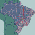
Brazilian Highway System (redirect from Br 101)
and toll-collection. Currently, the longest National Highway in Brazil is BR-116 with 4,486 km (2,787 mi). As of 2023[update], the system consists of 1...
37 KB (3,807 words) - 00:19, 12 October 2024
BR-364 is an inter-state highway in Brazil connecting the southeast state of São Paulo to the western state of Acre. The highway was opened in the 1960s...
33 KB (3,601 words) - 01:06, 5 November 2024
List of federal highways in Brazil (category CS1 Brazilian Portuguese-language sources (pt-br))
in 1973. Brazilian federal road names are composed of the ISO 3166 code "BR", a dash and three numbers. State highways in the country are classified as...
22 KB (675 words) - 16:25, 16 January 2024
town are paved. There is a fully paved road (BR-479) leading west to Cabeceiras to join the important BR-020, 22 kilometers east of Formosa. The distance...
10 KB (573 words) - 18:43, 21 May 2024
British Rail Class 86 (redirect from BR Class 86)
Freightliner trains collide on West Coast". Rail Magazine. No. 479. 29 October 2003. p. 11. "Hornby BR Class 86". Hornby. Retrieved 1 February 2020. Wild, Mike...
117 KB (7,372 words) - 02:12, 9 November 2024
British Rail Class 455 (redirect from BR Class 455)
19. July 2003. p. 47. "South Central upgrades 455s". Rail Magazine. No. 479. 21 January 2004. p. 24. "First SouthCentral refurbished Class 455s re-enter...
36 KB (3,177 words) - 10:28, 4 November 2024
Number 39416-48-3 Y 3D model (JSmol) Interactive image ECHA InfoCard 100.049.479 PubChem CID 11983801 UNII W0AF353S0O Y CompTox Dashboard (EPA) DTXSID80885771...
3 KB (256 words) - 09:04, 7 April 2023
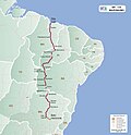
The BR-101 (also called Translitorânea (transcoastal), officially named Rodovia Governador Mário Covas. and nicknamed Briói in some regions) is a longitudinal...
11 KB (994 words) - 23:57, 24 January 2024
BR-116 is a federal route of highways of Brazil and the longest highway in the country, with 4,542 km (2,822 mi) of extension. The road connects Fortaleza...
9 KB (753 words) - 20:58, 31 July 2024
BR-319 is an 870-kilometre (540 mi) federal highway that links Manaus, Amazonas to Porto Velho, Rondônia. The highway runs through a pristine part of the...
25 KB (2,860 words) - 04:12, 26 September 2024
Trans-Amazonian Highway (redirect from BR-230)
The Trans-Amazonian Highway (official designation BR-230, official name Rodovia Transamazônica Portuguese pronunciation: [ho.doˈvi.ɐ tɾɐ̃.za.maˈzõ.ni.kɐ])...
25 KB (2,903 words) - 08:46, 20 October 2024
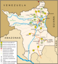
BR-174 is a federal highway of Brazil. The 3,321 km (2,064 mi) road connects Cáceres to Pacaraima on the Venezuelan border. It is the only road connection...
7 KB (362 words) - 09:23, 26 August 2024
BR-146 is a federal highway of Brazil. The 678.7 kilometre road connects Patos de Minas, Minas Gerais to Guarulhos, São Paulo. "BR-146". Ministry of Transport...
1 KB (45 words) - 09:24, 26 August 2024
BR-459 is a federal highway that connects Poços de Caldas, in Minas Gerais, to Lorena, in the state of São Paulo. Its extension is planned to the municipality...
5 KB (407 words) - 23:37, 20 August 2023
Ukrainian BS-3 crew firing on Russian positions. Ammunition AP: BR-412 APBC: BR-412B, BR-412D HE/Fragmentation Projectile weight AP/APBC: 15.88 kg (35 lbs)...
9 KB (701 words) - 21:49, 25 October 2024
BR-153 is a major federal highway of Brazil, officially named the Transbrasiliana Highway. It also serves as part of the Belém–Brasília Highway in the...
4 KB (300 words) - 09:19, 26 August 2024
(2011). "An evidence-based systematic review of gymnema (Gymnema sylvestre R. Br.) by the Natural Standard Research Collaboration". Journal of Dietary Supplements...
14 KB (1,468 words) - 07:42, 23 March 2024
Murray) Count Ivor Carlac Christmas Double Issue The Union Jack (2nd Series) 479 The Case of the Balkan War Correspondent Anon. (William Murray Graydon) The...
418 KB (1,746 words) - 02:02, 19 August 2024
the junction with the BR-450 (Via EPIA) and BR-251 (Via EPCT). The road ends at Praça Mauá at the Port of Rio de Janeiro. The BR-040 traverses Distrito...
12 KB (1,497 words) - 09:21, 26 August 2024
LMS Stanier Class 8F (redirect from BR Stanier Class 8F)
originally LMS 8025, was bought by BR in 1957 and renumbered 48775. Thus 299 former LMS locomotives were eventually in BR stock. Not all were required immediately...
44 KB (3,758 words) - 16:11, 8 November 2024
population is 4,879 (2020 est.) in an area of 129 km². The elevation is 479 m. The municipality was created by state law in 1948. In telecommunications...
4 KB (134 words) - 04:05, 26 June 2024
BR-135 is a federal highway of Brazil. The 2518 kilometre road connects São Luís to Belo Horizonte. The road passes through the MATOPIBA region (in the...
3 KB (149 words) - 09:24, 26 August 2024
BR-392 is a federal highway in Rio Grande do Sul. The highway begins at the port town of Rio Grande in the south and runs north across the state, connecting...
3 KB (150 words) - 09:50, 29 August 2024
BR-156 is a federal highway of Brazil. The road consists of 552 km between Oiapoque and Macapá, and 271 km between Macapá and Laranjal do Jari (except...
3 KB (191 words) - 09:19, 26 August 2024
BR-163 is a highway in Brazil, going from Tenente Portela, in the state of Rio Grande do Sul, to Santarém, Pará, on 3579 kilometers (the stretch between...
8 KB (819 words) - 19:42, 12 May 2024
BR-304 is a Brazilian federal highway that begins in Beberibe, Ceará and ends in Natal, Rio Grande do Norte. The highway also serves the municipalities...
2 KB (125 words) - 09:49, 29 August 2024
The BR-010 (official name Rodovia Engenheiro Bernardo Sayão) is a federal highway of Brazil that connects the national capital Brasília, to the city of...
4 KB (440 words) - 09:21, 26 August 2024
The BR-316 is a Brazilian federal highway that connects the cities of Belém, in the state of Pará, and Maceió in Alagoas. It has a total length of 2,054...
3 KB (134 words) - 09:25, 26 August 2024
BR-210 is a federal highway of Brazil. The 411.7 kilometre road, popularly known as Perimetral Norte ("north perimeter"), is primarily located in the Northern...
4 KB (205 words) - 09:50, 29 August 2024


