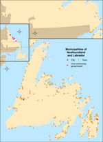
Bauline (/bəˈliːn/ bə-LEEN) is a small town in the Canadian province of Newfoundland and Labrador, located on the Avalon Peninsula north of St. John's...
8 KB (497 words) - 02:12, 28 January 2023
Ferryland (redirect from Bauline East, Newfoundland and Labrador)
Ferryland is a town in Newfoundland and Labrador on the Avalon Peninsula. According to the 2021 Statistics Canada census, its population is 371. Ferryland...
8 KB (582 words) - 19:46, 13 August 2024
Baulines Craft Guild is a non-profit organization dedicated to promoting California's craft arts legacy. It was established in 1972 by Tom D'Onofrio. The...
1 KB (136 words) - 08:31, 28 June 2020
It contains the unincorporated communities of Admiral's Cove, Bauline East, Bauline South, Burnt Cove, Devils Kitchen, Flat Rock, St. Michaels and Seal...
6 KB (228 words) - 06:56, 27 January 2021
Rancho Las Baulines was a 8,911-acre (36.06 km2) Mexican land grant in present-day Marin County, California, given in 1846 by Governor Pío Pico to Gregorio...
5 KB (478 words) - 20:54, 15 October 2024
Cove, Flatrock, Bay Bulls, Witless Bay, Petty Harbour-Maddox Cove and Bauline. Also as of the 2021 census, there are 178,427 people in the St. John's...
151 KB (12,589 words) - 04:53, 1 November 2024
Point Reyes (section Rancho Tomales y Baulines)
leagues (8,911 acres (3,606 ha)) in March 1836. Named Rancho Tomales y Baulines, it is believed to have included the entire Olema Valley from Tomales Bay...
43 KB (5,454 words) - 10:24, 25 October 2024
Bunyan's Cove Burgoyne's Cove Burnside-St. Chads Burnt Cove, St. Michael's, Bauline South Burnt Point-Gull Island-Northern Bay Calvert Campbells Creek Canning's...
12 KB (1,050 words) - 00:54, 11 July 2024
Goulds as well as the communities of: Admiral's Cove, Aquaforte, Bay Bulls, Bauline East, Biscay Bay, Brigus South, Burnt Cove, Calvert, Cape Broyle, Cappahayden...
13 KB (295 words) - 22:52, 7 February 2024
Mount Pearl St. John's Admirals Beach Aquaforte Arnold's Cove Avondale Bauline Bay Bulls Bay Roberts Bay de Verde Bishop's Cove Branch Brigus Bryant's...
12 KB (526 words) - 20:50, 30 October 2024
39th General Election are: "All that area consisting of: (a) the towns of Bauline, Flatrock, Logy Bay-Middle Cove-Outer Cove, Portugal Cove-St. Philip's...
34 KB (1,027 words) - 14:13, 28 October 2024
Avalon Peninsula, including the outer stretches of St. John's as well as Bauline, Flatrock, Logy Bay-Middle Cove-Outer Cove, Pouch Cove and Torbay. Torbay...
22 KB (715 words) - 18:48, 6 February 2024
1,179 1,619 1,640 Bay Bulls Town 1,014 1,078 1,283 1,500 1,566 Petty Harbour – Maddox Cove Town 949 915 924 960 947 Bauline Town 364 379 397 452 412...
14 KB (253 words) - 05:57, 30 July 2024
Burnt Cove, St. Michael's, Bauline South is a local service district and designated place in the Canadian province of Newfoundland and Labrador. Burnt...
5 KB (268 words) - 06:16, 7 January 2022
311 1,313 −0.2% 371.37 3.5 Baine Harbour Town 126 124 +1.6% 4.15 30.4 Bauline Town 412 452 −8.8% 16.05 25.7 Bay Bulls Town 1,566 1,500 +4.4% 30.60 51...
65 KB (846 words) - 14:47, 17 August 2024
Route 21, also known as Bauline Line, is a 9.3-kilometre-long (5.8 mi) north-south highway on the Avalon Peninsula of Newfoundland in the Canadian province...
4 KB (321 words) - 14:56, 22 October 2022
Bulls Petty Harbour-Maddox Cove Musgrave Harbour Carmanville Mount Moriah Bauline Isle-Aux-Morts Large acquisitions: cable operations of Famous Players (Canadian...
21 KB (2,093 words) - 17:48, 10 November 2024
History Archived June 15, 2007, at the Wayback Machine "Rancho Baulines (Las Baulines), Marin County". Co.marin.ca.us. Retrieved July 30, 2012. "OLDEST...
38 KB (3,988 words) - 00:35, 1 November 2024
Rancho Tomales y Baulines was a 9,468-acre (38.32 km2) Mexican land grant in present-day Marin County, California, given in 1836 by Governor Nicolás Gutiérrez...
4 KB (431 words) - 21:08, 15 October 2024
Bolinas and present-day Stinson Beach were once encompassed by Rancho Las Baulines, a Mexican land grant given by Governor Pío Pico to Gregorio Briones in...
32 KB (3,067 words) - 23:32, 14 August 2024
have been organized independently in communities such as Summerside and Bauline, which held an "Ugly Stick Clinic" in 2018. Expats and travelling musicians...
17 KB (2,073 words) - 22:10, 25 March 2024
Appleton Aquaforte Arnold's Cove Avondale Badger Baie Verte Baine Harbour Bauline Bay Bulls Bay de Verde Bay L'Argent Bay Roberts Baytona Beachside Bellburns...
9 KB (189 words) - 00:35, 13 March 2023
Richard Berry 8,878 acres (3,593 ha) 385 ND Inverness Marin Tomales y Baulines 1836 Nicolas Gutierrez Rafael Garcia 8,863 acres (3,587 ha) 418 ND Marin...
127 KB (1,602 words) - 20:53, 15 October 2024
(Newfoundland) Bartletts Harbour (Newfoundland) Barton (Newfoundland) Bauline East (Newfoundland) Bayview, Twillingate (Newfoundland) Beaches (Newfoundland)...
43 KB (239 words) - 04:32, 5 November 2024
Trepassey 481 133 Middle Arm 474 134 Lourdes 465 135 Chapel Arm 457 136 Bauline 452 137 Campbellton 452 138 Winterton 450 139 Port au Port West-Aguathuna-Felix...
53 KB (1,629 words) - 00:48, 1 October 2024
Torbay, with access to the major intersecting roads of Indian Meal Line and Bauline Line; prior to its construction, the highway number continued through the...
5 KB (302 words) - 23:28, 14 February 2024
runs 7.7 km north with access via traffic lights to Indian Meal Line, and Bauline Line, before it meets Torbay Road at its northern terminus. This project...
15 KB (1,633 words) - 00:42, 31 October 2024
Witless Bay Line Route 20, Torbay Road and Pouch Cove Road Route 21, Bauline Line Route 30, Logy Bay Road Route 40, Portugal Cove Road Route 41, Beachy...
39 KB (2,795 words) - 03:06, 2 March 2024
Tyler Walshe Torbay D 15 Chris Ryan Port Saunders F 16 Chris Blackwood Bauline F 18 Andrew Temple Normans Cove F 19 Chris Mooney Outer Cove F 21 Andrew...
12 KB (1,465 words) - 22:08, 4 November 2024
Freshwater River on the Cape In order from North to South: Pincombes Brook Bauline River Discharge of Brocks Head Pond Main Millers Pond River Northeast Pond...
13 KB (1,240 words) - 20:40, 16 September 2023


