
Beaverhead Rock, also known as Point of Rocks, is a rock formation overlooking the Beaverhead River in Montana protected as Beaverhead Rock State Park...
4 KB (322 words) - 05:54, 1 August 2023

south-western Montana. The name of the Beaverhead originates from Beaverhead Rock on the middle river. This rock formation was recognized by Sacajawea...
6 KB (443 words) - 05:05, 21 December 2022

Beaverhead County is the largest county by area in the U.S. state of Montana. As of the 2020 census, the population was 9,371. Its county seat is Dillon...
15 KB (1,034 words) - 23:16, 25 April 2024

The mountains take their name from Beaverhead Rock, to the north of the mountains. Major summits in the Beaverheads include Garfield Mountain (10,961 ft)...
9 KB (641 words) - 21:53, 18 October 2023

first in Hell Roaring Creek then west into the Red Rock; swings northeast to become the Beaverhead River; and finally joins with the Big Hole to form...
189 KB (18,105 words) - 04:10, 5 September 2024
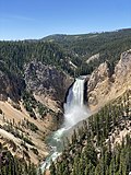
observing boiling springs, spouting water, and a mountain of glass and yellow rock. These reports were largely ignored because Bridger was a known "spinner...
163 KB (15,776 words) - 16:51, 11 September 2024
Johnson's Shut-Ins State Park, Reynolds County Tower Rock, Perry County Beaverhead Rock Castle Rock Spire Chief Mountain, Glacier National Park Chinese...
23 KB (1,582 words) - 04:53, 12 September 2024

Pompeys Pillar National Monument (redirect from Pompey's Rock)
Pompeys Pillar National Monument is a rock formation located in south central Montana, United States. Designated a national monument on January 17, 2001...
7 KB (514 words) - 21:29, 8 August 2023
Ackley Lake Anaconda Smelter Stack Beaverhead Rock Beavertail Hill Big Arm Black Sandy Brush Lake Chief Plenty Coups Clark's Lookout Cooney Council Grove...
21 KB (189 words) - 20:09, 26 October 2023

License plate prefix Population Area Map Beaverhead County 001 Dillon February 2, 1865 Original County Beaverhead Rock in the Jefferson River, which is shaped...
24 KB (565 words) - 16:37, 10 September 2024

Roaring Creek begins in southern Montana, and when combined with the Red Rock, Beaverhead, Jefferson, Missouri, and Mississippi River, is the longest river in...
267 KB (24,576 words) - 22:47, 10 September 2024

Bannack, Montana (category Populated places in Beaverhead County, Montana)
Bannack is a ghost town in Beaverhead County, Montana, United States, located on Grasshopper Creek, approximately 11 miles (18 km) upstream from where...
16 KB (1,310 words) - 00:58, 2 June 2024

Lost Trail Medicine Lake Ninepipe Pablo Red Rock Lakes Swan River UL Bend War Horse National Forests Beaverhead–Deerlodge Bitterroot Custer Flathead Gallatin...
11 KB (1,211 words) - 12:43, 29 June 2024

010 km2). Its furthest tributary, Hell Roaring Creek, originates in the Beaverhead National Forest within a few hundred meters of the North American Continental...
4 KB (288 words) - 02:46, 12 June 2022

the Beaverhead River where they camped at Beaverhead Rock 45°23′11″N 112°27′35″W / 45.38639°N 112.45972°W / 45.38639; -112.45972 (Beaverhead Rock) on...
38 KB (5,214 words) - 18:06, 20 August 2024

Lost Trail Medicine Lake Ninepipe Pablo Red Rock Lakes Swan River UL Bend War Horse National Forests Beaverhead–Deerlodge Bitterroot Custer Flathead Gallatin...
7 KB (635 words) - 17:22, 31 July 2024

years ago when ancient rocks were forced eastward up and over much younger rock strata. Known as the Lewis Overthrust, these sedimentary rocks are considered...
105 KB (10,085 words) - 20:04, 8 September 2024

The Beaverhead–Deerlodge National Forest is the largest of the National Forests in Montana, United States. Covering 3.36 million acres (13,600 km2), the...
9 KB (811 words) - 20:28, 9 January 2024

being below ground. The stepped bottom of the foundation fits the stepped rock formation upon which it rests. The floor of the stack is generally conical...
16 KB (1,831 words) - 05:51, 1 August 2023

a rock pile at the source of Hellroaring Creek which flows into Red Rock River and then into Clark Canyon Reservoir where it joins the Beaverhead then...
9 KB (841 words) - 00:45, 27 July 2024
Bitterroot Range (section Beaverhead Mountains)
a rock cairn at the source of Hellroaring Creek, which flows into Red Rock River and then into Clark canyon reservoir, where it joins the Beaverhead River...
9 KB (867 words) - 17:38, 9 August 2024

Hawaii; an unnamed tributary to Big Branch Bayou in Lacombe, Louisiana; Beaverhead Rock Pond (Madison County), Montana; Clark County, Nevada; and Texas. It...
11 KB (1,222 words) - 22:36, 4 August 2024

August 8 Sacagawea recognizes a natural formation from her childhood, Beaverhead Rock, indicating they are in the area where the Shoshone spend their summers...
41 KB (1,442 words) - 17:30, 17 May 2024

Lost Trail Medicine Lake Ninepipe Pablo Red Rock Lakes Swan River UL Bend War Horse National Forests Beaverhead–Deerlodge Bitterroot Custer Flathead Gallatin...
10 KB (985 words) - 02:11, 2 December 2023
Lost Trail Medicine Lake Ninepipe Pablo Red Rock Lakes Swan River UL Bend War Horse National Forests Beaverhead–Deerlodge Bitterroot Custer Flathead Gallatin...
2 KB (147 words) - 18:14, 1 September 2024
United States Geological Survey, United States Department of the Interior. "Rock Creek". Geographic Names Information System. United States Geological Survey...
4 KB (276 words) - 07:03, 31 July 2024

Tower Rock State Park is a state park near the community of Cascade in the U.S. state of Montana in the United States. The centerpiece of the park is Tower...
37 KB (4,419 words) - 00:29, 27 July 2024
Lost Trail Medicine Lake Ninepipe Pablo Red Rock Lakes Swan River UL Bend War Horse National Forests Beaverhead–Deerlodge Bitterroot Custer Flathead Gallatin...
4 KB (350 words) - 17:21, 31 July 2024

Lost Trail Medicine Lake Ninepipe Pablo Red Rock Lakes Swan River UL Bend War Horse National Forests Beaverhead–Deerlodge Bitterroot Custer Flathead Gallatin...
7 KB (535 words) - 12:33, 4 March 2024

Lost Trail Medicine Lake Ninepipe Pablo Red Rock Lakes Swan River UL Bend War Horse National Forests Beaverhead–Deerlodge Bitterroot Custer Flathead Gallatin...
11 KB (977 words) - 01:28, 28 February 2023