
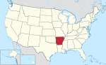
Beedeville is a town in Jackson County, Arkansas, United States. The population was 107 at the 2010 census. Beedeville is located at 35°25′47″N 91°6′31″W...
7 KB (552 words) - 04:03, 11 July 2024

Campbell Station Diaz Grubbs Newport (county seat) Swifton Tuckerman Amagon Beedeville Jacksonport Tupelo Weldon Balch Centerville Denmark Heffington Kenyon...
19 KB (1,341 words) - 13:48, 22 April 2024
Arkansas is a state in the Southern United States. According to the 2020 United States census, it is the 33rd most populous state with 3,011,524 inhabitants...
157 KB (1,299 words) - 17:13, 9 April 2024
and serves all of Newport, Amagon, Beedeville, Jacksonport, Tupelo, and Weldon, and portions of Diaz. The Beedeville School District consolidated into...
4 KB (225 words) - 15:36, 27 July 2023

AR 37 begins north of McCrory at AR 17 and runs north to AR 145 near Beedeville and AR 14 in Amagon. The route passes near the Cache River National Wildlife...
9 KB (593 words) - 02:31, 16 March 2024
Arkansas. BNSF Railway (BNSF) Kansas City Southern Railway (KCS) Union Pacific Railroad (UP) Missouri and Northern Arkansas Railroad (MNA) Arkansas,...
36 KB (316 words) - 18:12, 23 June 2024
Arkansas. List of power stations in Arkansas Energy in Arkansas "Arkansas Electric Cooperative Corporation 2013 Financial Statement" (PDF). Arkansas Electric...
56 KB (89 words) - 04:13, 23 June 2022

historic and cultural region known as the Arkansas Delta. The western terminus is at Highway 37 south of Beedeville and just east of the Cache River National...
17 KB (1,581 words) - 16:33, 16 February 2024

designation a state highway in the U.S. state of Arkansas. The highway is located mainly in Eastern Arkansas and is split into seven segments, though two...
13 KB (776 words) - 02:38, 16 March 2024

by the Arkansas State Highway and Transportation Department (AHTD). The highway begins at US 49 in eastern Woodruff County within the Arkansas Delta between...
6 KB (494 words) - 16:36, 16 February 2024

S. state of Arkansas renumbered its highways into a more traditional format. The system to be replaced was established in 1924 as Arkansas' first comprehensive...
16 KB (174 words) - 21:34, 20 July 2023

McFadden. Highway 145 begins at Highway 37 north of the small town of Beedeville and runs west as a section line road. The highway crosses the Cache River...
16 KB (1,371 words) - 08:32, 24 January 2024

Highway 14 (AR 14, Ark. 14, and Hwy. 14) is an east–west state highway in Arkansas. The route of 227.35 miles (365.88 km) begins at Boat Dock Road near Table...
41 KB (3,521 words) - 02:41, 16 March 2024

unincorporated communities, and other recognized places in the U.S. state of Arkansas whose name begins with the letter B. It also includes information on the...
55 KB (52 words) - 00:38, 22 November 2022
April 18, 2018. {{cite report}}: Unknown parameter |agency= ignored (help) Arkansas Event Report: EF1 Tornado (Report). National Centers for Environmental...
103 KB (3,387 words) - 04:51, 29 April 2024
List of tornadoes in the tornado outbreak of December 10–11, 2021 (category 2021 in Arkansas)
in Little Rock, Arkansas. December 15, 2021. Archived from the original on December 16, 2021. Retrieved December 16, 2021. Arkansas Event Report: EF0...
113 KB (4,219 words) - 21:34, 11 July 2024