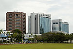
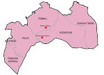
Bukit Bunga–Ban Buketa Bridge (Malay: Jambatan Bukit Bunga–Ban Buketa, Thai: สะพานบูเก๊ะตา) is a bridge crossing the Kolok River (Malay: Sungai Golok)...
4 KB (295 words) - 21:57, 19 September 2024
the Bukit Bunga-Ban Buketa Bridge on December 21, 2007. Across the border is the Thai town of Ban Buketa in Amphoe Waeng, Narathiwat Province. Bukit Bunga...
1 KB (181 words) - 00:12, 22 February 2023
Island Armenia-Georgia Friendship bridge, between Sadakhlo and Bagratashen, over the Debed river Bukit Bunga–Ban Buketa Bridge, between Malaysia and Thailand...
2 KB (364 words) - 09:38, 15 August 2023
constituency), state constituency in Kelantan, Malaysia. Bukit Bunga–Ban Buketa Bridge, bridge crossing the Kolok River at the Malaysia–Thailand border...
356 bytes (76 words) - 02:54, 27 July 2023
upstream, a new friendship bridge connects the town of Bukit Bunga on the Malaysian side with the Thai town of Ban Buketa. The Golok River originates...
5 KB (311 words) - 01:11, 4 September 2024
Kompleks CIQ Bukit Bunga, Federal Route 480 is an institutional facilities federal road in Kelantan, Malaysia. It is a main route to Bukit Bunga Checkpoint...
5 KB (75 words) - 12:31, 10 May 2024
Malaysia–Thailand border (section Bukit Jeli)
reaches Jeli Hill (Malay: Bukit Jeli). Among the mountain peaks located along this section of the border are Kobeh Hill (Malay: Bukit Kobeh), which is the...
33 KB (3,068 words) - 13:45, 17 July 2024
400 baht a day, totalling M$36,000 or 252,000 baht. Bukit Bunga–Ban Buketa Bridge "Friendship Bridge Linking Thailand and Malaysia". Thai Public Relations...
4 KB (362 words) - 22:05, 19 September 2024
Friendship Bridge Third Thai–Lao Friendship Bridge Fourth Thai–Lao Friendship Bridge Batang Baram Bridge Bukit Bunga-Ban Buketa Bridge Buloh Kasap Bridge Connaught...
31 KB (2,491 words) - 14:21, 30 August 2024
Buke Ta (redirect from Ban Buketa)
Malaysian town of Bukit Bunga in Kelantan state was opened in December 2007, crossing the Kolok River with the Bukit Bunga–Ban Buketa Bridge. "Population statistics...
7 KB (276 words) - 01:06, 4 September 2024
Federal Route 200, or Jalan Bukit Bunga-Jenok-Bukit Nangka, is a federal road in Kelantan, Malaysia. It is a main route to Ban Buketa, Thailand. At most sections...
3 KB (71 words) - 14:10, 1 February 2023
Thai–Myanmar Friendship Bridge Sai River Bridge Second Sai River Bridge Rantau Panjang–Sungai Golok Bridge Bukit Bunga–Ban Buketa Bridge Map all coordinates...
51 KB (2,158 words) - 03:50, 15 August 2024
马新第二通道) is a bridge connecting Singapore and Johor, Malaysia. In Singapore, it is officially known as the Tuas Second Link. The bridge was built to reduce...
16 KB (1,342 words) - 15:33, 19 August 2024
Bai sits right across the river. Unlike Rantau Panjang and Bukit Bunga, there is no bridge linking the town with Thailand. As of now, vehicles entering...
3 KB (146 words) - 06:44, 14 September 2023
at Nakhon Ratchasima, Thailand. 21 December – Opening of the Bukit Bunga–Ban Buketa Bridge of Malaysia–Thailand border in Kelantan. 26 December – Two villagers...
36 KB (3,266 words) - 18:10, 12 September 2024
close to the border with Thailand and meets Jalan Kompleks CIQ Bukit Bunga at Bukit Bunga. The Kilometre Zero is located at Gerik, Perak. At the first kilometre...
11 KB (168 words) - 22:47, 21 September 2024
Langkawi (section Cable car and Sky Bridge)
the peak of Gunung Mat Chinchang, where the Langkawi Sky Bridge is located. The Sky Bridge was closed in 2012 for maintenance and upgrading but reopened...
32 KB (2,700 words) - 18:52, 24 September 2024
train stations as well as new bridge to replace the Malaysian side of the Causeway. The plan is to move the CIQ to Bukit Chagar, where later it would be...
12 KB (1,291 words) - 14:00, 22 April 2024
Pelabuhan Batu. Nineteen and a half miles of rail track from Kuala Lumpur to Bukit Kudu was opened in September 1886, and extended 3 miles to Klang in 1890...
22 KB (1,969 words) - 20:37, 23 July 2024
Labuan (section Labuan-Menumbok Bridge (Proposal))
Sea. Labuan Island is mainly flat and undulating; its highest point is Bukit Kubong at 148 metres (486 feet) above sea level. Over 70% of the island...
57 KB (5,218 words) - 14:15, 24 September 2024
other developers including Syed Mokhtar Albukhary's Tradewind, SP Setia (Bukit Indah & Setia Eco Garden), Ecoworld (Eco Botanic), and Sunway Group (Sunway...
27 KB (2,208 words) - 10:05, 25 September 2024
Johor–Singapore Causeway (category Pages using infobox bridge with empty coordinates parameter)
for ships to be allowed through the bridge, and have the rubble sourced from the quarries at Pulau Ubin and Bukit Timah as there were ample granite being...
44 KB (4,698 words) - 23:31, 10 September 2024
Bahru Sentral (also known as JB Sentral) is an integrated transport hub in Bukit Chagar, Johor Bahru, Johor, Malaysia. Inaugurated on 21 October 2010, it...
18 KB (1,957 words) - 12:22, 16 September 2024
from 1456 until 1477. Her attendants married locals and settled mostly in Bukit Cina. Due to Chinese involvement, Malacca had grown as key alternative to...
96 KB (8,609 words) - 10:37, 23 September 2024
Link Expressway, continuing after border inspection onto the Second Link bridge to Tuas Checkpoint in Tuas, Singapore. Pedestrians are not permitted on...
4 KB (315 words) - 21:14, 27 August 2024
towns are linked via the Rantau Panjang-Sungai Golok Bridge, popularly known as the Harmony Bridge (Malay: Jambatan Muhibbah). Along with Pengkalan Kubor...
2 KB (139 words) - 18:27, 4 March 2024
word for eagle. The square is a landscaped area with ponds, terraces and bridges. MAHA Tower, formerly known as Langkawi City Tower is a 2-story, 138-meter-tall...
11 KB (943 words) - 13:13, 12 June 2024
cultivation). The Batang Ai river runs through the district. There is a suspension bridge which leads to the village of Kampung Pasir. A dam completed in 1985 caused...
7 KB (401 words) - 21:20, 22 February 2023
bridge was built to reduce the traffic congestion at the Johor–Singapore Causeway, and was opened to traffic on 2 January 1998. The twin-deck bridge supports...
6 KB (207 words) - 05:37, 27 July 2024


