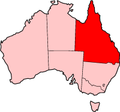
The Capricorn Highway is located in Central Queensland, Australia, and links the city of Rockhampton with western Queensland. The highway is 575 kilometres...
18 KB (1,298 words) - 20:53, 18 May 2024
from the original on 29 April 2022. Retrieved 6 May 2022. "Capricorn Highway and Gregory Highway Intersection Upgrade (Emerald)". Department of Infrastructure...
14 KB (691 words) - 05:47, 20 January 2024
between Flinders Highway and Capricorn Highway apart from Gregory Development Road between Emerald and Charters Towers. The highway services an important...
10 KB (542 words) - 11:07, 27 July 2023
the Cunningham Highway. It runs northward from Goondiwindi for more than 600 kilometres until its termination at the Capricorn Highway near the small...
9 KB (266 words) - 22:59, 27 May 2024
facilitates cross traffic between the Bruce Highway, Capricorn Highway, Fitzroy Developmental Road, and Peak Downs Highway. By 1860 a track from Gladstone to Bowen...
20 KB (1,472 words) - 13:06, 6 October 2024
the Bruce Highway in Midgee to the Capricorn Highway in Gracemere, a distance of 10.8 kilometres (6.7 mi). It crosses the Burnett Highway in Bouldercombe...
15 KB (910 words) - 06:03, 27 April 2024
roads: Capricorn Highway – from Saleyards Road at Gracemere to the Bruce Highway roundabout at Rockhampton (7.7 kilometres (4.8 mi)). Bruce Highway – from...
104 KB (5,363 words) - 21:52, 2 November 2024
4316°S 150.4344°E / -23.4316; 150.4344 (Gracemere Lagoon)). The Capricorn Highway enters the locality from the north (Fairy Bower) and exits to the...
20 KB (2,014 words) - 01:26, 21 October 2024
D'Aguilar Highway New England Highway Isis Highway Scenic Highway (Queensland) Port of Brisbane Motorway Capricorn Highway Centenary Motorway Legacy Way...
5 KB (381 words) - 02:22, 30 July 2024
of houses in the town are located around the railway station. The Capricorn Highway once passed through the town but now bypasses it to the north. The...
8 KB (750 words) - 23:53, 15 June 2024
kilometres (9.1 mi) proposed highway from Fairy Bower on the Capricorn Highway south-west of Rockhampton to Parkhurst on the Bruce Highway to the north-east of...
7 KB (584 words) - 16:48, 30 December 2023
Fitzroy Developmental Road (category Highways in Queensland)
section, as State Route 7, runs from Bauhinia north until it meets the Capricorn Highway about 2 kilometres (1.2 mi) west of Duaringa, and 29 kilometres (18 mi)...
8 KB (435 words) - 03:26, 10 June 2024
roads: Capricorn Highway – from Saleyards Road at Gracemere to the Bruce Highway roundabout at Rochhampton (7.7 kilometres (4.8 mi)). Bruce Highway – from...
107 KB (10,364 words) - 19:01, 5 November 2024
regional significance (LRRS). It runs from the Dawson Highway in Blackwater to the Capricorn Highway in Rolleston, a distance of 120 kilometres (75 mi)....
20 KB (1,285 words) - 20:52, 28 July 2024
locality of Duaringa had a population of 262 people. Duaringa is on the Capricorn Highway, 116 kilometres (72 mi) west of Rockhampton. The Dawson River forms...
71 KB (7,577 words) - 20:02, 6 October 2024
List of A4 roads (redirect from A4 highway (Australia))
Sydney Capricorn Highway, a road connecting Rockhampton with the Landsborough Highway at Barcaldine Esk Highway, a road connecting the Midland Highway with...
4 KB (502 words) - 09:23, 30 May 2023
Ingberry. Reaching Barcaldine it ends at an intersection with the Capricorn Highway. A project to rehabilitate and widen more than 26 kilometres (16 mi)...
14 KB (1,027 words) - 17:14, 25 July 2024
Highway 1 along either coast. Roads that make up the highway are: Great Central Road Gunbarrel Highway Lasseter Highway Stuart Highway Plenty Highway...
9 KB (310 words) - 05:03, 11 February 2024
Highway (State Route 70) Capricorn Highway (A4) Burnett Highway (A3) Dawson Highway (State Route 60) Isis Highway (State Route 52) Wide Bay Highway (State...
9 KB (587 words) - 04:05, 16 May 2024
The Boonal Joint Venture is a coal load out facility located on the Capricorn Highway in Central Queensland of Australia. Coal from Both Yarrabee coal mine...
1 KB (132 words) - 20:46, 14 September 2019
Federal Highway, Kings Highway, Great Western Highway, Mitchell Highway, Mid-Western Highway, Castlereagh Highway, Mulligan Highway, Capricorn Highway, Cunningham...
37 KB (3,142 words) - 16:32, 3 November 2024
The Cunningham Highway is a 327-kilometre (203 mi) national highway located in south-eastern Queensland, Australia. The highway links the Darling Downs...
20 KB (1,363 words) - 22:27, 27 January 2024
James Brian Hellwig Dingo, Queensland, a town in Australia along the Capricorn Highway Dingo Creek, a river in the Mid North Coast region of New South Wales...
3 KB (447 words) - 06:28, 3 October 2024
endpoint of the highway. The entire highway is part of the National Highway system linking Darwin and Brisbane: formerly National Highway 54, Queensland...
30 KB (2,105 words) - 12:42, 9 March 2024
The Moonie Highway is a state highway of Queensland, Australia. Part of State Route 49, it leaves the Warrego Highway at Dalby and runs for over 290 km...
7 KB (549 words) - 10:30, 27 October 2024
Big Things, p. 31-33. "G marks the Industry Park spot along the Capricorn Highway". Rockhampton Morning Bulletin. Archived from the original on 4 June...
143 KB (3,968 words) - 09:31, 28 October 2024
the junction of the Capricorn and Gregory highways. Emerald sits approximately 10 kilometres (6.2 mi) south of the Tropic of Capricorn. Emerald has a hot...
41 KB (3,814 words) - 19:56, 5 November 2024
population of 155 people. The town is located just to the south of the Capricorn Highway, 44 kilometres (27 mi) west of Emerald. The town of Anakie is on the...
17 KB (1,483 words) - 16:29, 25 July 2024
section 10E: Dawson Highway Gladstone–Mount Larcom Road Bajool–Port Alma Road Gavial–Gracemere Road Burnett Highway Capricorn Highway Rockhampton–Yeppoon...
40 KB (3,168 words) - 15:45, 4 April 2024
turns north as Edison Street, and ends at an intersection with the Capricorn Highway (known as Darwin Street). The road is now fully sealed, with the last...
10 KB (793 words) - 16:37, 25 July 2024


