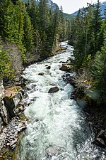
The Cheekye River is a river in southwestern British Columbia, Canada. It flows west into the Cheakamus River and north of Squamish. List of rivers of...
637 bytes (55 words) - 18:34, 3 October 2024
Cheekye is an unincorporated locality on the Cheakamus River just upstream from its confluence with its parent stream, the Squamish, and just north of...
6 KB (198 words) - 01:58, 13 April 2024
the steep western face of Mount Garibaldi is the Cheekye River, a tributary of the Cheakamus River. Opal Cone on the southeastern flank is a small volcanic...
77 KB (9,154 words) - 15:26, 10 July 2024
Alice Ridge (redirect from Cheekye Ridge)
east side of the Cheekye River southwest of Mount Garibaldi in New Westminster Land District. It was originally gazetted as Cheekye Ridge on September...
944 bytes (116 words) - 23:17, 28 October 2024
Squamish River Mamquam River Ring Creek Skookum Creek Cheakamus River Cheekye River Brohm River Rubble Creek Daisy Lake Cheakamus River Brandywine Creek Cheakamus...
32 KB (2,460 words) - 00:54, 16 August 2024
the canyon before joining the Squamish River at Cheekye, a few miles north of the town of Squamish. The river's name is an anglicization of the name of...
6 KB (405 words) - 21:46, 11 October 2024
development. Frequent landslides on its west face drops steeply into the Cheekye River. Atwell Peak is often mistakenly called Mount Garibaldi when viewed...
4 KB (351 words) - 02:58, 11 September 2024
language Cheewat River: from the Nitinaht dialect of Nuu-chah-nulth for "having an island nearby". Cheekye River and the locality of Cheekye near Squamish:...
91 KB (10,413 words) - 17:24, 30 October 2024
River Cheekye River Chehalis River Clendinning Creek Clowhom River Deserted River Elaho River Fitzsimmons Creek Fraser River Gates River Green River Harrison...
2 KB (190 words) - 17:50, 12 April 2024
"Dirty Place" or "Grimy One" in reference to the muddy water of the Cheekye River. The mountain is an important cultural landmark for the Squamish, with...
28 KB (2,917 words) - 17:19, 16 October 2024
the Cheekye River cut a deep valley into the cone's western flank that was later filled with a glacier. After reaching its maximum extent the Cheekye Glacier...
60 KB (7,437 words) - 19:00, 29 February 2024
Shannon Falls) Stawamus Valleycliffe Squamish Brackendale Chiyakmesh Cheekye Paradise Valley Garibaldi (abandoned/condemned) Pinecrest Estates Black...
9 KB (497 words) - 07:06, 24 September 2024
Downtown Squamish Dentville Northyards Garibaldi Highlands Garibaldi Estates Cheekye Paradise Valley Sarah Burke, freestyle skier; resided in Squamish; Ian...
46 KB (2,759 words) - 23:48, 24 October 2024
(west) bank of the Cheakamus River. It begins just below that river's canyon, and continues downstream towards Cheekye, where the road from Brackendale...
5 KB (126 words) - 21:20, 2 October 2024
Landslide, and the Cascade Landslide Complex, Columbia River Gorge, Washington". ColumbiaRiverImages. Archived from the original on 2 March 2018. Retrieved...
157 KB (7,589 words) - 19:54, 21 October 2024
Ceepeecee Chamiss Bay Chapmans Charlotte Lake Chasm Chaumox Cheam View Cheekye Cheslatta Chetarpe Chinook Cove Choate Chopaka Christian Valley Chu Chua...
110 KB (5,935 words) - 02:18, 31 October 2024
factors have lowered demand. A BC Hydro 500 kV powerline known as the Cheekye-Dunsmuir Line was built in 1982 running east to west across the middle...
18 KB (2,210 words) - 17:52, 21 October 2024
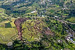
slid and dammed a gorge of Waikaretaheke River, forming a natural reservoir up to 256 metres (840 ft) deep. Cheekye Fan, British Columbia, Canada, about 25 km2...
55 KB (6,399 words) - 07:20, 22 September 2024
sodium hydroxide. The tank car spilled sodium hydroxide into the Cheakamus River, killing most of its fish. Moran is a railway point on the BC Rail line...
45 KB (5,894 words) - 17:55, 21 October 2024
located 5 km (3.1 mi) southeast of Mount Tantalus and 11 km (6.8 mi) west of Cheekye. The Red Tusk gets its name from the reddish metamorphic rock that forms...
1 KB (92 words) - 23:40, 26 October 2024
kilometres (2 mi) south of Garibaldi Lake, 15 kilometres (9 mi) northeast of Cheekye and 5 kilometres (3 mi) north of Mount Garibaldi, British Columbia, Canada...
5 KB (448 words) - 09:19, 2 August 2024


