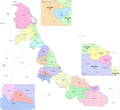
Chiconquiaco is a municipality in the Mexican state of Veracruz. It is located in the Sierra de Chiconquiaco in the middle of the State of Veracruz. It...
10 KB (287 words) - 06:54, 14 July 2024
The Sierra de Chiconquiaco is a coastal mountain range in Veracruz, Eastern Mexico. The Sierra extends generally east-west. It is bounded on the north...
5 KB (280 words) - 01:29, 13 November 2024
Misantla is located in the valley of the Misantla River in the Sierra de Chiconquiaco. Travelwise, Misantla is about 35 km (22 mi) from the beaches of the...
5 KB (570 words) - 19:55, 19 February 2024
Huasteco Plateau, Llanuras y Lomeríos zone, Lagos y Volcanes del Anáhuac, Chiconquiaco, Llanuras y Sierras de Querétaro e Hidalgo, Cordillera Costera del Sur...
141 KB (16,385 words) - 23:48, 30 October 2024
2,400 m) above sea level, more especially about the neighbourhood of Chiconquiaco on the eastern slope of the Cofre de Perote in the state of Veracruz...
3 KB (434 words) - 19:04, 27 January 2024
species of salamander in the family Plethodontidae. It is endemic to the Chiconquiaco region of the Sierra Madre Oriental of Veracruz, Mexico. It has been...
2 KB (101 words) - 18:38, 29 July 2022
de Otontepec, Sierra de Huayacocotla, Sierra de Coxquihui, Sierra de Chiconquiaco, Sierra de Jalacingo, Sierra de Axocuapan, Sierra de Huatusco, Sierra...
120 KB (14,154 words) - 06:33, 14 November 2024
into the Gulf of Mexico. The Bobos River canyon separates the Sierra de Chiconquiaco on the east from the Sierra Madre Oriental and Trans-Mexican Volcanic...
3 KB (260 words) - 00:54, 5 August 2022
Climbs over other plants, and is a vining species. Chusquea simpliciflora Chiconquiaco None Clumper 10 feet (3.0 m) 0.5 inches (13 mm) Has small leaves, and...
66 KB (252 words) - 12:06, 11 October 2024
Xalapa: Acatlán, Actopan, Alto Lucero de Gutiérrez Barrios, Apazapan, Chiconquiaco, Colipa, Emiliano Zapata, Jalcomulco, Juchique de Ferrer, La Antigua...
19 KB (1,108 words) - 00:04, 21 September 2024
Hidalgo Veracruz 279 Chahuapán Veracruz 279 Chavarrillo Veracruz 279 Chiconquiaco Veracruz 279 Chicuasén Veracruz 279 Dos Arroyos Veracruz 279 El Espinal...
30 KB (48 words) - 18:06, 2 November 2024
dry climate is a result of the rain shadow created by the Sierra de Chiconquiaco. The forests receive <1,000 mm (39 in) of annual rainfall, and a long...
4 KB (292 words) - 07:32, 23 April 2021
incorporated as Santiago Huatusco, changing its name on November 29, 1932. Chiconquiaco merged with Acatlán in 1899-1911. Chumatlán merged with Coxquihui in...
82 KB (1,134 words) - 15:41, 16 July 2024
de Perote itself. The Naolinco Volcanic Field lies in the Sierra de Chiconquiaco. It includes the volcanic cones of Cerro Acatlan, which is the largest...
6 KB (740 words) - 10:40, 3 February 2024
covered the municipalities of Acajete, Atzalán, Coacoatzintla, Colipa, Chiconquiaco, Jilotepec, Juchique, Landero y Coss, Miahuatlán, Las Minas, Misantla...
16 KB (965 words) - 03:47, 4 September 2024
Nonoalcos de Zongolíca, crossed Cocolapa, Coscomatepec, Tepeyehualco, Chiconquiaco and for Apazapan they returned to Zongolíca. During the 16th century...
7 KB (300 words) - 06:53, 14 July 2024
ecoregion extends from the Tecolutla River in the north across the Sierra de Chiconquiaco, the eastern Trans-Mexican Volcanic Belt, and the Sierra Madre de Oaxaca...
7 KB (640 words) - 05:57, 16 April 2024
Misantla Totonac include San Marcos Atexquilapan, Landero y Coss, and Chiconquiaco. The distribution of Misantla Totonac speakers is as follows (Secretaría...
19 KB (2,231 words) - 06:20, 13 April 2024
by Tepetlán, to the north-west by Yecuatla and to the south-west by Chiconquiaco. The weather in Juchique de Ferrer is warm all year with rains in summer...
2 KB (183 words) - 19:05, 30 April 2024
by the Naolinco, to the west by the Miahuatlán, and to the north by Chiconquiaco. It is watered by the rivers Actopan and Pájaro Verde. 2020 Acatlán CENSUS...
7 KB (134 words) - 04:52, 14 July 2024
part of the name. The municipality of Tepetlán is delimited by Acatlán, Chiconquiaco, Alto Lucero de Gutiérrez Barrios and Naolinco. The territory of the...
7 KB (292 words) - 20:47, 9 June 2024
of Yecuatla is bordered to the north-east by Colipa, to the south by Chiconquiaco, to the west by Misantla and to the north-west by Colipa. The climate...
5 KB (187 words) - 06:00, 1 September 2023
leeward, and the region lies in the rain shadow of the coastal Sierra de Chiconquiaco, which makes it drier than the rest of Veracruz' coastal lowlands to...
11 KB (227 words) - 22:54, 25 October 2023
Landero y Coss is delimited to the north-east by Misantla to the east by Chiconquiaco, to the south-east by Acatlán, to the south by Miahuatlán and to the...
7 KB (240 words) - 06:58, 14 July 2024


